- Manmanning, Western Australia
-
Manmanning
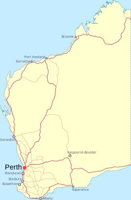
Western AustraliaPopulation: 116 (2006 Census) [1] Established: 1929 Postcode: 6465 Elevation: 375 m (1,230 ft) Location: - 170 km (106 mi) North East of Perth
- 37 km (23 mi) East North East of Wongan Hills
- 39 km (24 mi) North of Dowerin
LGA: Shire of Dowerin State District: Central Wheatbelt Federal Division: Durack Manmanning is a small Wheatbelt town in Western Australia.
The name of the town is an Indigenous Australian word of unknown meaning. The word first appeared on charts drawn in 1907 and was the Indigenous Australian name of a soak located close to the townsite.
The townsite was originally a railway siding on the Ejanding North line and land was set aside for settlers in 1927. The townsite was gazetted in 1929.[2]
References
- ^ Australian Bureau of Statistics (25 October 2007). "Manmanning (State Suburb)". 2006 Census QuickStats. http://www.censusdata.abs.gov.au/ABSNavigation/prenav/LocationSearch?collection=Census&period=2006&areacode=SSC54606&producttype=QuickStats&breadcrumb=PL&action=401. Retrieved 2008-10-09.
- ^ Western Australian Land Information Authority. "History of country town names". http://www.landgate.wa.gov.au/corporate.nsf/web/History+of+country+town+names. Retrieved 2008-10-09.
Categories:- Towns in Western Australia
- Australian Aboriginal placenames
Wikimedia Foundation. 2010.

