- Dattening, Western Australia
-
Dattening
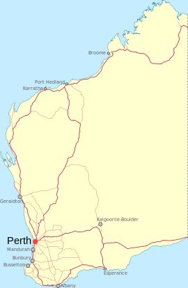
Western AustraliaEstablished: 1908 Postcode: 6308 Elevation: 320 m (1,050 ft) Location: LGA: Shire of Pingelly State District: Wagin Federal Division: O'Connor Dattening is a small town located between Boddington and Pingelly in the Wheatbelt region of Western Australia.
During the 1890s a farmer named Norris Taylor sunk a well in the locality and the area was initially known as Taylor's Well. By 1906 the local progress association petitioned for a townsite to be surveyed and blocks were subdivided in 1907. Blocks were sold in 1908 with 20 Working Men's blocks being put on the market with prices between £8 and £14.[1] The name, Dattening, was suggested as an alternative to Taylor's Well after this name had been rejected since it duplicated the name of a town in South Australia. The Mourambine road board suggested the name Dattening which was the Aboriginal name of a spring which is in the vicinity of the well. The meaning of the name is unknown. The town was gazetted in 1908.[2]
The town residents petitioned for the name of the town to be changed to Taylor's Well in 1925 and 1929 but were unsuccessful on both occasions.
References
- ^ "Working Men's Bolcks". Sunday Times (Perth: National Library of Australia): p. 3. 12 April 1908. http://trove.nla.gov.au/ndp/del/article/57579648?searchTerm=Dattening&searchLimits=. Retrieved 12 April 2011.
- ^ Western Australian Land Information Authority. "History of country town names". http://www.landgate.wa.gov.au/corporate.nsf/web/History+of+country+town+names. Retrieved 2011-04-11.
Categories:- Towns in Western Australia
- Australian Aboriginal placenames
Wikimedia Foundation. 2010.

