- Dandaragan, Western Australia
-
Dandaragan
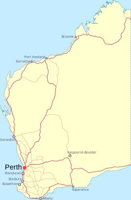
Western AustraliaPopulation: 416 (2006 Census) [1] Established: 1850 gazetted 1958 Postcode: 6507 Elevation: 193 m (633 ft) Location: - 170 km (106 mi) North of Perth
- 29 km (18 mi) West of Moora
- 98 km (61 mi) South East of Jurien Bay
LGA: Shire of Dandaragan State District: Moore Federal Division: Durack
Dandaragan is a small town in the Wheatbelt region of Western Australia. The name of Dandaragan was first recorded in 1850 as the name of a nearby gulley and spring or watering hole known as Dandaraga spring. The word is Indigenous Australian in origin and is thought to mean good kangaroo country.The first recorded land lease was to William Brockman in 1848; he had a 6,000 acres (2,428 ha) land lease at Muchamulla Springs.[2] James Drummond settled in the area in 1850 and established a farm. A police station was built later and the townsite was gazetted in 1958. [3]
References
- ^ Australian Bureau of Statistics (25 October 2007). "Dandaragan (State Suburb)". 2006 Census QuickStats. http://www.censusdata.abs.gov.au/ABSNavigation/prenav/LocationSearch?collection=Census&period=2006&areacode=SSC53666&producttype=QuickStats&breadcrumb=PL&action=401. Retrieved 2008-10-04.
- ^ "Shire of Dandaragan - History". 2008. http://www.dandaragan.wa.gov.au/council/history.html. Retrieved 2008-10-25.
- ^ Western Australian Land Information Authority. "History of country town names". http://www.landgate.wa.gov.au/corporate.nsf/web/History+of+country+town+names. Retrieved 2008-10-24.
Coordinates: 30°41′0″S 115°42′0″E / 30.683333°S 115.7°E
Categories:- Towns in Western Australia
- Wheatbelt (Western Australia)
- Australian Aboriginal placenames
Wikimedia Foundation. 2010.

