- Corrigin, Western Australia
-
Corrigin
Western Australia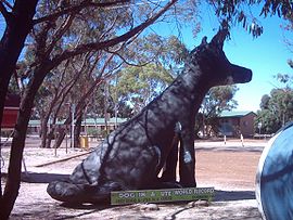
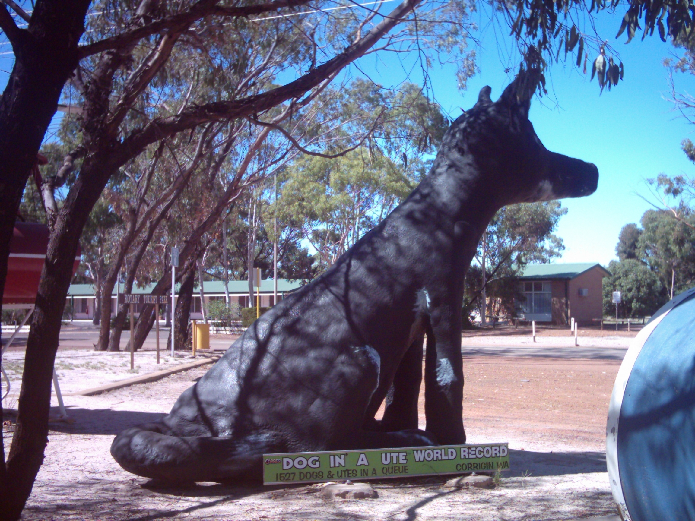
Statue of dog to commemorate world record 1,527 ute convoy 2003.
 Corrigin
Population: 903[1] Established: 1900s Postcode: 6375 Elevation: 295 m (968 ft) Location: 229 km (142 mi) from Perth LGA: Shire of Corrigin Region: Wheatbelt State District: Wagin Federal Division: O'Connor Mean max temp Mean min temp Annual rainfall 23.5 °C
74 °F9.9 °C
50 °F375.5 mm
14.8 inCoordinates: 32°19′37″S 117°52′30″E / 32.327°S 117.875°E
Corrigin is a town located in the central Wheatbelt region of Western Australia, 229 kilometres (142 mi) east-southeast of the state capital, Perth, Western Australia, along State Route 40. It is mostly a farming community focused on crops and sheep, and holds the world record of 'the most dogs in a ute'.[2]
Contents
History
The name "Corrigin", of Noongar indigenous origin, was first recorded in 1877 relating to a well in the area. The meaning of the name is unknown.
In 1909, the Government planned to build a railway from Brookton[3] on the Great Southern Railway to the town of Kunjin, 17 km west of Corrigin. Some time after, a line from Wickepin was also proposed, and the Government decided to locate the crossing point at Corrigin[4].
In 1913, a railway siding was built, and named "Dondakin" by railway authorities due to conflict with the name elsewhere. However, after much local protest, the siding was renamed Corrigin and gazetted on 15 May 1914.[5] The railway line from Wickepin, Western Australia opened a month later, and the main office of the local Road Board moved to the town. In 1915, a school was built.
Present day
Corrigin has a population of 903 and is a key agricultural centre for a district focussed mainly on wheat and sheep farming. It contains a district high school (originally opened 1915 as a primary school), National Australia bank, shopping facilities, accommodation (hotel, motel, caravan park), council offices and a telecentre. Each year, it hosts an agricultural show.
The town is a stop on the Transwa bus service to Esperance via Kulin/Hyden.[6]
A large rocky outcrop just to the east of town is Corrigin Rock.
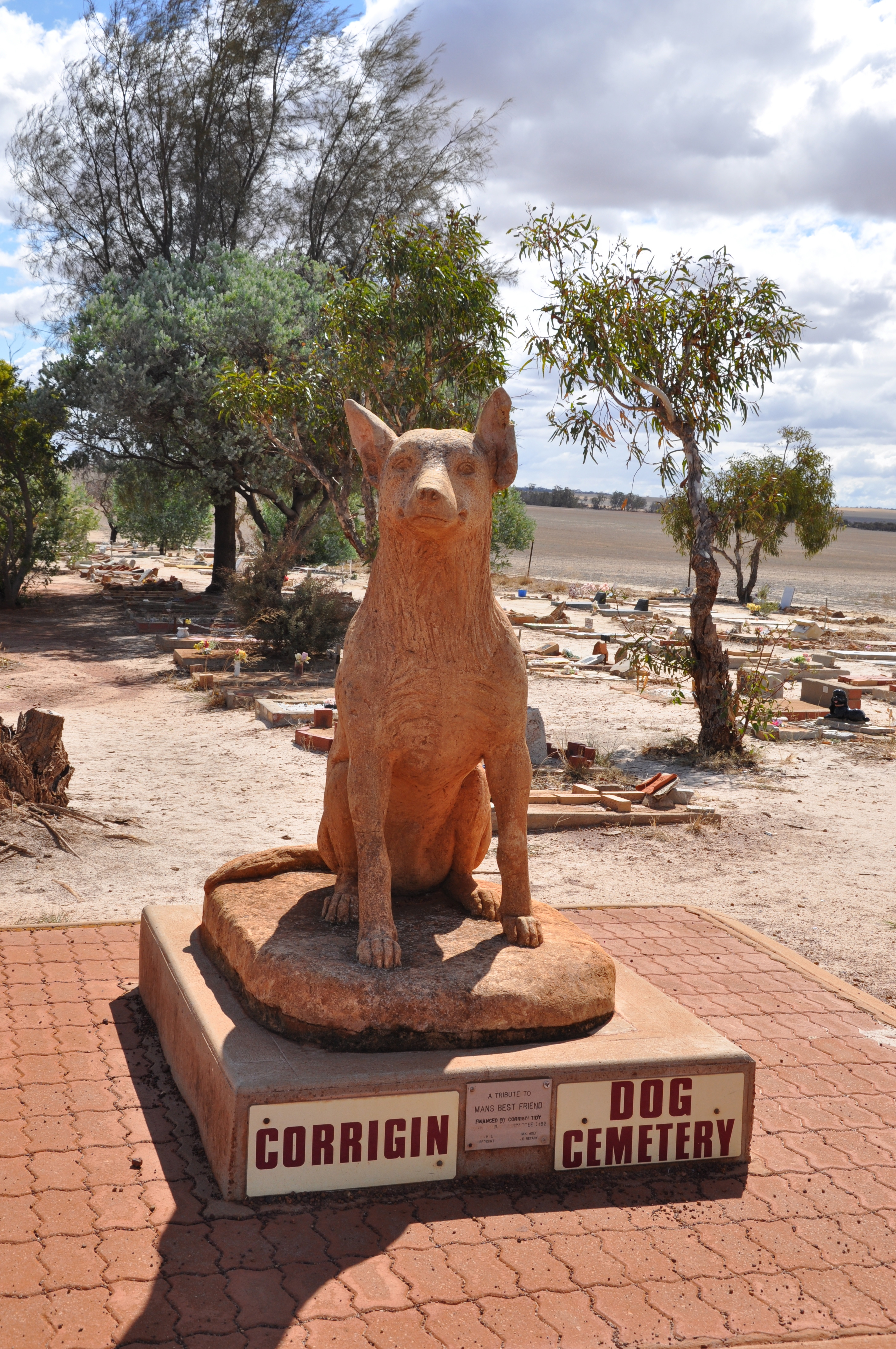
 Dog Cemetery
About 5km west of town is the Corrigin dog cemetery, containing over 80 buried dogs.
References
- ^ Australian Bureau of Statistics (25 October 2007). "Corrigin". 2006 Census QuickStats. http://www.censusdata.abs.gov.au/ABSNavigation/prenav/LocationSearch?collection=Census&period=2006&areacode=SSC53576&producttype=QuickStats&breadcrumb=PL&action=401. Retrieved 13 July 2009.
- ^ Shire of Corrigin (25 October 2005). "Dog In A Ute 2002". http://www.corrigin.wa.gov.au/doginaute. Retrieved 2006-11-15.
- ^ Cross Country to Corrigin Milne, Rod Australian Railway Historical Society Bulletin, April, 1988 pp80-86
- ^ All Change at Corrigin Milne, Rod Australian Railway Historical Society Bulletin, March, 1996 pp67-75
- ^ Western Australian Land Information Authority. "History of country town names". http://www.landgate.wa.gov.au/corporate.nsf/web/History+of+country+town+names. Retrieved 2007-03-25.
- ^ GE2 timetable (1 November 2006). Retrieved on 25 March 2007.
External links
- Shire of Corrigin
- Dog in a Ute - includes photos and history of the event.
- Corrigin dog cemetery
Categories:- Towns in Western Australia
- Australian Aboriginal placenames
- Western Australia geography stubs

Wikimedia Foundation. 2010.