- Toodyay, Western Australia
-
Toodyay
Western Australia
 Toodyay
Population: 1069[1] Established: 1860 Postcode: 6566 Coordinates: 31°33′04″S 116°27′50″E / 31.551°S 116.464°E[2]Coordinates: 31°33′04″S 116°27′50″E / 31.551°S 116.464°E[2] Location: LGA: Shire of Toodyay State District: Moore Federal Division: Pearce Toodyay is a town located in the Wheatbelt[3] region in the Avon Valley, 85 km north-east of Perth, Western Australia. Toodyay is connected to Perth via both rail and road.
Contents
History
 The Old Gaol
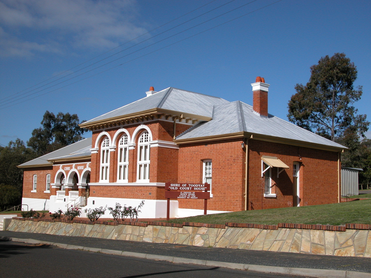
 Old Court House in Fiennes Street, now used as Shire of Toodyay offices (2004)
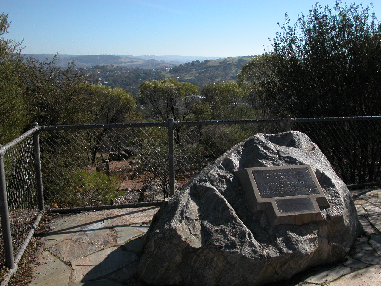
 Memorial to James Drummond, botanist, in Pelham Reserve, overlooking the Toodyay townsite
The original village of Toodyay was one of the earliest inland towns in the State, established along the Avon River in 1836 after settlers including James Drummond, Captain Francis Whitfield and Alexander Anderson explored the area; Drummond established his homestead Hawthornden nearby. However, the location was subject to flooding which led to its abandonment in the 1850s, and a new townsite was established on higher ground 2 km upstream. This was gazetted in 1860 as 'Newcastle' and the original settlement came to be referred to as 'Old Toodyay'. In May 1910 due to confusion with the New South Wales city of Newcastle, Newcastle became known as 'Toodyay', and the original townsite, which had by this time declined substantially, became 'West Toodyay'.[4]
The meaning of the name is uncertain, although it is Noongar Indigenous in origin - maps in 1836 referred to "Duidgee", while some believe it was named for a local woman named Toodyeep who accompanied early explorers in the area.[5] Another source suggests it could mean "place of plenty". The name "Duidgee" is preserved in the riverside recreation area, "Duidgee Park".
In 1861, Western Australia's best known bushranger, Moondyne Joe, was imprisoned in Toodyay for stealing a horse, but escaped. After a series of crimes and jail terms, he was on the run again, returning to Toodyay in 1865 to steal supplies for an attempt to escape overland to South Australia. The annual Moondyne Festival is a light-hearted celebration of this darker side of Toodyay's history.
The Newcastle Gaol, in Clinton Street, was completed in 1864 and in use as a state gaol until 1909. It is now preserved as the Old Gaol Museum; an historic building and tourist attraction.
In 1870, a steam-driven flour mill, Connor's Mill, was built on Stirling Terrace by George Hasell. The mill was also used to generate electricity in the early part of the twentieth century. Saved from demolition in the 1970s, and restored to demonstrate the milling process and machinery, the mill now forms the museum section of the Toodyay Visitors Centre.[6]
The Heritage Council of Western Australia lists well over one hundred places of historical significance in or near Toodyay, including cottages (some of which are now ruins), homesteads, shops, churches, parks and railway constructions.
The State Register of Heritage Buildings includes the Gaol, Connor's Mill, Toodyay Public Library (built 1874), the old Toodyay Post Office (designed by George Temple-Poole, built 1897) and the old Toodyay Fire Station (designed by Ken Duncan, built 1938), as well as several other historic sites in Toodyay.[6] Some of the historic architecture of shops and residences along Stirling Terrace, the main street, form a distinctive frontage described as the Stirling Terrace Streetscape Group.[7]
A number of the above historic buildings are listed on the Australian Heritage Database. Other buildings listed include Freemasons Hotel (built 1861),[8] Victoria Hotel (built late 1890s)[9] and Old Unwins Store[10] on Stirling Terrace, and Butterly's Cottage (built c. 1870)[11] in Harper Road.
Transport
Toodyay, being an historic township and an hour's distance from Perth, is a venue for daytrippers, tourists and motorcyclists. The circuit - Toodyay Road through Gidgegannup / Toodyay / Chittering Valley and Great Northern Highway - is a favourite with motorcyclists. On most weekends, Toodyay's main street is lined with cruisers and sportsbikes of many models, makes and vintages, their riders relaxing in the increasing number of pavement cafes that are springing up to accommodate the burgeoning tourist trade.
Toodyay also serves as a stop on the Avonlink and Prospector passenger trains from Perth to Northam and Kalgoorlie.
Tourist Attractions
Toodyay has a number of tourist attractions, including olive oil farms, lavender farms, holiday retreats, hotels, caravan parks and an archery park.
2009 bushfire
A major bushfire on 29–30 December 2009, which broke out at approximately midday (AWST) on 29 December after temperatures reached 45.4 °C (113.7 °F)[12] and the "catastrophic" fire risk rating had been used for the first time in the state,[13] affected areas to the south, south-west and east of the town of Toodyay, with more than 3,000 hectares (7,410 acres) of forest burnt and 37 homes lost. The main impact of the fire appeared to be in the area of Stirlingia and Adenanthus Drives (31°34′59″S 116°26′46″E / 31.583°S 116.446°E), although warnings had also been issued for the Wicklow Estate to the east of town, and Dumbarton Road to the south-east.[14][15][16][17][18]
References
- ^ Australian Bureau of Statistics (25 October 2007). "Toodyay (Urban Centre/Locality)". 2006 Census QuickStats. http://www.censusdata.abs.gov.au/ABSNavigation/prenav/LocationSearch?collection=Census&period=2006&areacode=UCL526600&producttype=QuickStats&breadcrumb=PL&action=401. Retrieved 30 December 2009.
- ^ "Toodyay". Gazetteer of Australia online. Geoscience Australia, Australian Government. http://www.ga.gov.au/bin/gazd01?rec=282588.Retrieved 30 December 2009.
- ^ "Wheatbelt North Region". Mainroads - Western Australia. August 2008. http://www.mainroads.wa.gov.au/_layouts/getAsset.aspx?URI=2027416&REV=1&RCN=D08. Retrieved 30 December 2009.
- ^ Erickson, R. (1974). Old Toodyay and Newcastle. Toodyay Shire Council. p. 8..
- ^ Western Australian Land Information Authority. "History of country town names". http://www.landgate.wa.gov.au/corporate.nsf/web/History+of+country+town+names. Retrieved 2007-01-17.
- ^ a b "Shire of Toodyay Heritage and Tourism - Connor's Mill". http://www.toodyay.wa.gov.au/heritage_tourism/discovering_our_history/connors_mill.html. Retrieved 2009-05-16.
- ^ "Heritage Council of Western Australia - Stirling Terrace Streetscape Group". http://register.heritage.wa.gov.au/viewplace.html?offset=35&place_seq=24755. Retrieved 2009-05-16.
- ^ "Freemasons Hotel (entry AHD9989)". Australian Heritage Database. Department of Sustainability, Environment, Water, Population and Communities. http://www.environment.gov.au/cgi-bin/ahdb/search.pl?mode=place_detail;place_id=9989. Retrieved 2009-09-14.
- ^ "Victoria Hotel (entry AHD9992)". Australian Heritage Database. Department of Sustainability, Environment, Water, Population and Communities. http://www.environment.gov.au/cgi-bin/ahdb/search.pl?mode=place_detail;place_id=9992. Retrieved 2009-09-14.
- ^ "Old Unwins Store (entry AHD9990)". Australian Heritage Database. Department of Sustainability, Environment, Water, Population and Communities. http://www.environment.gov.au/cgi-bin/ahdb/search.pl?mode=place_detail;place_id=9990. Retrieved 2009-09-14.
- ^ "Butterly's Cottage (entry AHD18096)". Australian Heritage Database. Department of Sustainability, Environment, Water, Population and Communities. http://www.environment.gov.au/cgi-bin/ahdb/search.pl?mode=place_detail;place_id=18096. Retrieved 2009-09-14.
- ^ Bureau of Meteorology (30 December 2009). "Northam, Western Australia — December 2009 Daily Weather Observations". http://www.bom.gov.au/climate/dwo/200912/html/IDCJDW6100.200912.shtml. Retrieved 30 December 2009.
- ^ "WA South on catastrophic fire alert". ABC Online. 29 December 2009. http://www.abc.net.au/news/stories/2009/12/29/2781955.htm. Retrieved 30 December 2009.
- ^ "Up to 20 homes lost in WA bushfire". ABC Online. 30 December 2009. http://www.abc.net.au/news/stories/2009/12/30/2782410.htm. Retrieved 30 December 2009.
- ^ "Bushfire watch and act message for Lloyds Hill area, Wicklow Estate, Dumbarton and Nairn Roads in Toodyay". Fire and Emergency Services Authority (FESA). 30 December 2009. https://internet.fesa.wa.gov.au/mediareleases/Pages/MediaRelease.aspx?ItemId=237. Retrieved 30 December 2009.
- ^ "Up to 20 homes destroyed in WA fire". The West Australian. 30 December 2009. http://au.news.yahoo.com/thewest/a/-/national/6630263/temperatures-ease-spread-of-wa-bushfires/. Retrieved 30 December 2009.
- ^ "Bushfire emergency: homes lost in Toodyay". PerthNow (Sunday Times). 30 December 2009. http://www.perthnow.com.au/news/residents-flee-wall-of-flame-in-badgingarra/story-e6frg12c-1225814480592. Retrieved 30 December 2009.
- ^ "Bushfire tears through Toodyay as homes left gutted". WAtoday. 30 December 2009. http://www.watoday.com.au/wa-news/bushfire-tears-through-toodyay-as-homes-left-gutted-20091230-lj2u.html. Retrieved 30 December 2009.
External links
Preceding station Transwa Trains network Following station TerminusAvonlink Midland - NorthamNorthamTerminustowards East PerthAvonlink East Perth - MerredinNorthamtowards MerredinProspector Northamtowards KalgoorlieCategories:- Towns in Western Australia
- Australian Aboriginal placenames


Wikimedia Foundation. 2010.