- New Zealand State Highway 73
-
State Highway 73
Great Alpine Highway, Christchurch Ring Road Route information Maintained by New Zealand Transport Agency Length: 231 km (144 mi) Major junctions Northwest end: State Highway 6  at Kumara Junction, New Zealand|
Southeast end: Tunnel Road  at Heathcote, New Zealand
Location Primary
destinations:Kumara, Dillmanstown, Jacksons, Otira, Arthur's Pass, Bealey, Cass, Castle Hill Village, Springfield, Sheffield, Waddington, Darfield, Kirwee, Aylesbury, West Melton, Yaldhurst, Christchurch Highway system New Zealand State Highways
Motorways and Expressways • List • Unused←  SH 71
SH 71SH 74 →State Highway 73 is a major east-west South Island State Highway in New Zealand connecting Christchurch on the east coast with Greymouth/Hokitika on the west coast via the Southern Alps. It is mostly two lane, with some single-lane bridges north of Springfield but is mostly dual carriageway in Christchurch with some sections of the road currently being upgraded to motorway status.
Contents
History
The route connecting the West and East coasts of the South Island via the Southern Alps were known for hundreds of years by the Māori people, due to a flourishing pounamu trade. The Europeans were informed of the route by a local chief in the mid-19th century but was not used during his lifetime. In 1864, Arthur Dudley Dobson traversed from the east to the west coast from the Waimakariri River, thereby discovering Arthur's Pass. A route connecting Christchurch to Hokitika was fully completed in 1866, with the first Cobb & Co coach began operating that same year due to the burgeoning gold rush.
 SH 73 through Arthur's Pass
As the railway was progressively built from both sides, the road was the only route that connected both coastlines of the South Island until 1923, when the Otira Tunnel was open, this signalled the end of the Cobb & Co coach in New Zealand.[1][2]
Due to the geography and topography between Springfield and Kumara, the road has bee subjected to several closures and road realignments, with both Porters and Arthur's Pass subjected to frequent closures during the winter months. The road between Arthur's Pass and Otira in particular was amongst the most dangerous in the country, due to the road located on scree slopes which frequently gave way. As a result, numerous studies were conducted into alternative options for fixing the road around Candy's Bend, Starvation Point and the Zig Zag. Construction of the Otira Viaduct and the protective roofs from slips began in 1997 and opened in 1999.[3]
Route
Kumara Junction to Christchurch
As of May 2010, this is the current route of the highway.
State Highway 73 begins 11 km south of Greymouth at Kumara Junction. The highway passes through undulating farmland, scrubland and forest as it passes through the settlements of Kumara and Dillmanstown. The road veers sharply to the left as it approaches the mountains to the front of the road. The road then hugs the Taramakau River as it proceeds down the valley. At Jacksons, the Midland Line crosses the river and begins to run parallel to the road. Just before Aickens at the confuence of the Taramakau and Otira Rivers, the road and rail line veers to the right and runs to the south before reaching Otira.
 The Otira Viaduct
Beyond Otira, the road breaks with the railway line and crosses the river before climbing up towards the Otira Viaduct and Arthur's Pass. At 920 metres, Arthur's Pass is the second highest pass on the road and is one of the three alpine passes connecting the east and west coasts. After peaking, the road descends into Arthur's Pass village with the railway line emerging from the Otira Tunnel nearby.
After the village, the road and rail line runs along the Bealey River valley and crosses the Waimakariri River before veering left and running parallel to both the river and the rail line on the opposite side. Before Cass, the road runs along a bluff and turns right to proceed past some more farmland as well as Lakes Grasmere and Pearson.
 Castle Hill Village
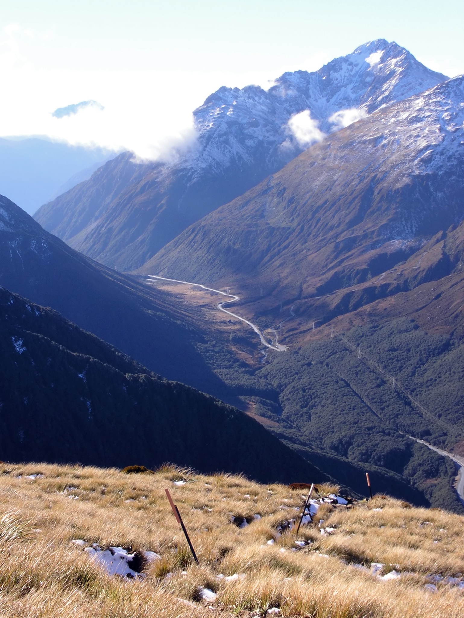
The road then climbs up towards Castle Hill Village and runs through a valley before passing beside Lake Lyndon where it curves left before climbing up towards Porters Pass which, at 939 metres, is the highest point on the road. After cresting, the road descends into the Kowai River valley and runs roughly parallel with the river until it reaches Springfield.
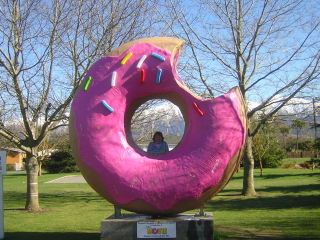
 The former Springfield doughnut with Mount Torlesse in the background
After Springfield, the road emerges onto the Canterbury Plains and runs straight through the settlements of Annat, Sheffield and Waddington before arriving at Darfield. The road then passes through the settlements of Kirwee, Aylesbury and West Melton as well as dairy and lifestyle farms characteristic of the plains. The road passes by Paparua Prison and arrives in Christchurch via Yaldhurst.[4]
Christchurch
As Yaldhurst Road, the proceeds in an easterly direction towards Riccarton. The road widens to four lanes at Avonhead, but by Curletts Road/Peer Street, the highway turns right (while Yaldhurst Road becomes Riccarton Road and heads towards the city centre).
As Curletts Road, the road temporarily reverts back to two lanes divided by a flush median. After Blenheim Road, however the road widens again, crosses over the Main South Line and proceeds towards the future Christchurch Southern Motorway.
As the motorway, the speed limit increases to 100 km/h but the road narrows back to two lanes for about 1.5 km. The road then splits up to form Jerrold Street North and Jerrold Street South where both roads intersects with Barrington Street. The roads then merge to form Brougham Street, a major southern arterial road of the city, where it intersects with all the north-south roads of the CBD except for Manchester Street.
After intersecting with Ensors Road, Brougham Street narrows back to two lanes but turns into a small expressway, which it retains as it merges with Opawa Road just before the Garlands Road intersection. At Port Hills Road/Curries Road intersection the road changes name to Port Hills Road which it retains before the highway designation ends at a parclo interchange with Tunnel Road, though Ports Hills Road still continues beyond this point.
Route changes
Over the past 40 years SH 73 has been subjected to several route changes both in the Christchurch and the Arthur's Pass-Otira areas. In 1999, one of the worst sections of highway in the country (around Candy's Bend) were replaced with the Otira Viaduct. Meanwhile, in Christchurch, since SH 1 was rerouted to bypass the CBD, SH 73 was extended to Brougham Street/Waltham Road intersection, with the rest of the route covered by SH 74. In 2004, with SH 74 being rerouted to run along the Ring Road and the entire length of Tunnel Road instead of through the CBD, SH 73 was extended further to its current terminus.
Major intersections and towns
Kumara Junction to Christchurch
State Highway 73 
Northbound exits Distance to
Greymouth
(km)Distance to
Lyttelton
(km)Southbound exits End Otira Highway 
16.6 240.4 Start Otira Highway Hokitika, Greymouth
Kumara Junction Highway
Taramakau Highway
Greymouth, Hokitika
Taramakau Highway
Kumara Junction HighwayKumara
Name change to Seddon Street through Kumara23.5 233.5 Kumara
Name change to Seddon Street through KumaraDillmanstown 26.2 230.8 Dillmanstown Lake Brunner, Moana
Lake Brunner Road (
( )
)61.5 195.5 Lake Brunner, Moana
Lake Brunner Road ()Jacksons 62.1 194.9 Jacksons MIDLAND LINE 69.4 187.6 MIDLAND LINE MIDLAND LINE 72.2 184.8 MIDLAND LINE Otira 81.5 175.5 Otira MIDLAND LINE 83.2 173.8 MIDLAND LINE OTIRA RIVER 83.3 173.7 OTIRA RIVER OTIRA VIADUCT 87.7 169.3 OTIRA VIADUCT ENTER GREY DISTRICT
Name change to Otira Highway90 167 ARTHUR'S PASS
920 m (3,020 ft)ARTHUR'S PASS
920 m (3,020 ft)ENTER SELWYN DISTRICT
Name change to West Coast RoadArthur's Pass 95 162 Arthur's Pass WAIMAKARIRI RIVER 104 153 WAIMAKARIRI RIVER Bealey 106 151 Bealey Mount White Road 118 139 Mount White Road Cass 121 136 Cass Castle Hill Village 145 112 Castle Hill Village Lake Lyndon, Lake Coleridge
Lyndon Road156 101 Lake Lyndon, Lake Coleridge
Lyndon RoadPORTERS PASS
939 m (3,081 ft)159 98 PORTERS PASS
939 m (3,081 ft)KOWAI RIVER 164.7 92.3 KOWAI RIVER KOWAI RIVER 171.2 84.8 KOWAI RIVER Kowai Bush, Waimakariri Gorge
Pocock Road175.8 80.2 Kowai Bush, Waimakariri Gorge
Pocock RoadSpringfield 177.5 79.5 Springfield Russells Flat
Keens Road
Coxs Road
Junction Road180.1 76.9 Russells Flat
Coxs Road
Junction Road
Keens RoadAnnat 184 73 Annat Sheffield 187 70 Sheffield Waddington 189.5 68.5 Oxford, Rangiora
Waimakariri Gorge Road
Inland Scenic RouteOxford, Rangiora
Waimakariri Gorge Road
Inland Scenic Route189.5 68.5 Waddington Coalgate, Glentunnel
Deans Road
Inland Scenic Route190.5 67.5 Coalgate, Glentunnel
Deans Road
Inland Scenic RouteCoalgate, Glentunnel
Bangor Road
200 57 Coalgate, Glentunnel
Bangor RoadCharing Cross, Dunsandel, Kimberley
Ross Street
McMillan Street200.3 56.7 Kimberley, Charing Cross, Dunsandel
McMillan Street
Ross StreetDarfield
Name change to South Terrace through Darfield200.5 56.5 Darfield
Name change to South Terrace through DarfieldDarfield
Horndon Street202.3 54.7 Darfield
Horndon StreetCharing Cross
Ansons Road206.9 50.1 Charing Cross
Ansons RoadMIDLAND LINE 207 50 MIDLAND LINE Courtenay
Ansons Road207.1 49.9 Courtenay
Ansons RoadCharing Cross, Courtenay
Courtenay Road209 48 Kirwee Kirwee Courtenay, Charing Cross
Courtenay RoadHororata, Burnham, Rolleston
Railway Road
Aylesbury Road
Bealey Road
Station Road214.5 42.5 Aylesbury Aylesbury Rolleston, Burnham, Hororata
Station Road
Railway Road
Aylesbury Road
Bealey RoadRolleston, Kirwee
Hoskyns Road216.6 40.4 Kirwee, Rolleston
Hoskyns RoadBurnham, Weedons
Weedons Ross Road
West Melton Road222.7 34.3 West Melton West Melton Weedons, Burnham
West Melton Road
Weedons Ross RoadSpringston, McLeans Island
Dawsons Road
Chattertons Road227.6 29.4 McLeans Island, Springston
Chattertons Road
Dawsons RoadBroomfield, Sockburn
Buchanans Road231.8 25.2 Broomfield, Sockburn
Buchanans RoadCourtenay, Waddington
Old West Coast Road232.5 24.5 Courtenay, Waddington
Old West Coast RoadYaldhurst 234.2 22.8 Yaldhurst Templeton, McLeans Island
Pound RoadMcLeans Island, Templeton
Pound RoadEnd Yaldhurst Road
continues as West Coast RoadStart Yaldhurst Road
from West Coast RoadChristchurch to Heathcote
State Highway 73 Northbound exits Distance to
Greymouth
(km)Distance to
Lyttelton
(km)Southbound exits End Yaldhurst Road
continues as West Coast Road236.4 20.6 Start Yaldhurst Road
from West Coast RoadTimaru, Masham, Russley, Picton
Masham Road
Russley Road _

Picton, Russley, Masham, Timaru
Russley Road
Masham RoadSockburn, Avonhead
Middlepark Road
Avonhead Road238.5 18.5 Avonhead, Sockburn
Avonhead Road
Middlepark RoadBishopdale, Riccarton
Peer Street
Yaldhurst Road239.4 17.6 Bishopdale, Riccarton
Peer Street
Yaldhurst RoadName change to Yaldhurst Road
End concurrency with Christchurch Ring RoadName change to Curletts Road
Start concurrency with Christchurch Ring RoadHornby, Riccarton
Main South Road239.5 17.5 Riccarton, Hornby
Main South RoadHornby, Christchurch CBD
Blenheim Road
240.3 16.7 Christchurch CBD, Hornby
Blenheim Road MAIN SOUTH LINE 240.5 16.5 MAIN SOUTH LINE Wigram
Parkhouse Road240.8 16.2 Wigram
Parkhouse RoadMiddleton
Lunns Road241.1 15.9 Middleton
Lunns RoadHoon Hay, Halswell, Akaroa
Curletts Road
241.6 15.4 Hoon Hay, Halswell, Akaroa
Curletts Road Name change to Curletts Road Name change to Christchurch Southern Motorway Name change to Christchurch Southern Motorway 244.2 12.8 Name change to Jerrold Street Spreydon, Addington
Barrington StreetAddington, Spreydon
Barrington StreetName change to Jerrold Street 245 12 Name change to Brougham Street Barrington, Addington
Simeon Street
Collins StreetAddington, Barrington
Collins Street
Simeon StreetSydenham, Addington
Selwyn Street245.4 11.6 Addington, Sydenham
Selwyn StreetSydenham, Addington
Strickland Street
Antigua Street245.9 11.1 Addington, Sydenham
Antigua Street
Strickland StreetChristchurch CBD
Montreal Street246.1 10.9 Christchurch CBD
Montreal StreetChristchurch CBD
Durham Street South246.3 10.7 Christchurch CBD
Durham Street SouthBeckenham, Christchurch CBD
Colombo Street246.6 10.4 Christchurch CBD, Beckenham
Colombo StreetSydenham, Christchurch CBD
Burlington Street
Gasson Street247.1 9.9 Christchurch CBD, Sydenham
Gasson Street
Burlington StreetWaltham, Christchurch CBD
Waltham Road247.4 9.6 Christchurch CBD, Waltham
Waltham RoadOpawa, Addington
Opawa Road248.2 8.8 Addington, Opawa
Opawa RoadSt Martins, Linwood
Ensors Road248.5 8.5 Linwood, St Martins
Ensors RoadHEATHCOTE RIVER 249.3 7.7 HEATHCOTE RIVER Name change to Brougham Street 249.5 7.5 Name change to Opawa Road St Martins, Woolston
Garlands Road
249.6 7.4 Woolston, St Martins
Garlands RoadStart concurrency with Christchurch Ring Road End concurrency with Christchurch Ring Road Murray Aynsley, Woolston
Port Hills Road
Curries Road250.5 6.5 Woolston, Murray Aynsley
Curries Road
Port Hills RoadName change to Opawa Road Name change to Port Hills Road Lyttelton, Woolston
Tunnel Road252.1 4.9 Woolston, Lyttelton
Tunnel RoadStart State Highway 73
as Port Hills RoadEnd State Highway 73
Continues as Port Hills RoadSpur sections
State Highway 73A
Location: Hornby–Sockburn Length: 3.6 km (2.2 mi) State Highway 73A is a spur section of SH 73 connecting the suburbs of Hornby, New Zealand and Sockburn, New Zealand via Main South Road and Blenheim Road. Before 2004 it formed part of the old route of SH 73 and further before that SH 1. It is one of the few state highways in New Zealand to be wholly dual carriageway.
Major intersections
State Highway 73A 
Westbound intersections Distance to
Hornby
(km)Distance to
Christchurch CBD
(km)Eastbound intersections End
continues as Main South Road0 10 Start as Main South Road
fromSpringston, Timaru, Hornby, Picton
Shands Road
Carmen Road _ Picton, Hornby, Timaru, Springston
Carmen Road _
Shands RoadPrebbleton, Lincoln
Springs Road1.7 8.3 Prebbleton, Lincoln
Springs RoadWigram, Middleton, Sockburn
Symes Road
Green Lane2.1 7.9 Sockburn, Wigram, Middleton
Green Lane
Symes RoadMAIN SOUTH LINE 2.2 7.8 MAIN SOUTH LINE Broomfield, Yaldhurst
Lowther Street
Racecourse Road2.4 7.6 Broomfield, Yaldhurst
Racecourse Road
Lowther StreetUpper Riccarton, Sockburn
Alloy Street
Epsom Road
Main South Road
SOCKBURN ROUNDABOUT2.6 7.4 Upper Riccarton, Sockburn
Epsom Road
Main South Road
Alloy Street
SOCKBURN ROUNDABOUTName change to Main South Road Name change to Blenheim Road Upper Riccarton, Halswell
Curletts Road _ 3.8 6.2 Upper Riccarton, Halswell
Curletts Road _ End
continues as Blenheim Road to Christchurch CBDSee also
- State Highway 73 at Google Maps
- Great Alpine Highway - a tourist site promoting the road
References
- ^ [1] Arthur's Pass history
- ^ http://www.teara.govt.nz/en/canterbury-places/14 Accessed 29th May 2010
- ^ http://www.nzine.co.nz/views/arthurspass_otira.html The Road from Arthur's Pass to Otira
- ^ http://www.nzine.co.nz/features/arthurs_pass.html From Christchurch to Arthur's Pass By Road
External links
New Zealand highways New Zealand State Highway network · List of New Zealand State Highways National 
North Island SH 10 · SH 11 · SH 12 · SH 14 · SH 15A · SH 16 · SH 17 · SH 18 · SH 20 · SH 21 · SH 22 · SH 23 · SH 24 · SH 25 (incl. SH 25A) · SH 26 · SH 27 · SH 28 · SH 29 · SH 30 (incl. SH 30A) · SH 31 · SH 32 · SH 33 · SH 34 · SH 35 · SH 36 · SH 37 · SH 38 · SH 39 · SH 41 · SH 43 · SH 44 · SH 45 · SH 46 · SH 47 · SH 48 · SH 49 · SH 50 (incl. SH 50A) · SH 53 · SH 54 · SH 56 · SH 57 · SH 58South Island Touring Routes Twin Coast Discovery Highway · Thermal Explorer Highway · Pacific Coast Highway · Classic New Zealand Wine Trail · Alpine Pacific Triangle · Great Alpine Highway · Foothills Scenic Route · Southern Scenic RouteCategories:- State highways in New Zealand


Wikimedia Foundation. 2010.