- Darfield, New Zealand
-
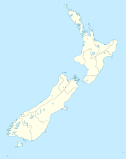
Darfield is a town in the Selwyn District of the South Island of New Zealand. It is located 35 kilometres west from the outskirts of Christchurch, New Zealand on State Highway 73 (The great Alpine highway) and the town is on the Midland railway line, route of the famous TranzAlpine train service. Its population (2001 census) is 1,362.
Darfield is the main town between Christchurch and the West Coast, New Zealand. It is often called "The township under the Nor'west arch", in reference to a characteristic weather phenomenon, which often creates an arch of cloud in an otherwise clear sky to the west of the township. This is caused by the condensation of water particles channelled upwards over the Southern Alps. Darfield has a high school which covers a large area and several shops.
Darfield lies in the Malvern district's arable and pastoral farming area. It is a gateway to the scenic Waimakariri and Rakaia Rivers and the Southern Alps, and is also a popular lift-off place for hot air ballooning.
Fonterra, a multi-national dairy co-operative and the largest company in New Zealand, is planning to build a milk powder factory near the town. Resource consent hearings for factory the will be held in October.[dated info]
A magnitude 7.1 earthquake occurred near Darfield at 4:35 am on 4 September 2010, causing widespread damage to both the town and to surrounding areas including the city of Christchurch.[1]
Notable people from Darfield
- John Wright (5 July 1954), New Zealand cricketer and former coach of the Indian national cricket team.
- Mary Clinton (8 May 1960), New Zealand field hockey player
- James Te-Huna (29 September 1981) - First New Zealander to enter the UFC, 2010 (Ultimate Fighting Championships)
References
- ^ ""Extremely violent" 7.4 quake hits Christchurch". The New Zealand Herald. 4 September 2010. http://www.nzherald.co.nz/nz/news/article.cfm?c_id=1&objectid=10671049.
External links
Coordinates: 43°29′S 172°07′E / 43.483°S 172.117°EThe TranzAlpine passenger train stops (Midland line) Christchurch • Rolleston • Darfield • Springfield • Cass • Arthur's Pass • Otira • Jacksons • Moana • Brunner • GreymouthTowns of the Selwyn District, Canterbury, New Zealand Major towns Other towns Arthur's Pass • Burnham • Coalgate • Doyleston • Dunsandel • Glentunnel • Hororata • Irwell • Kirwee • Rakaia Huts • Sheffield • Southbridge • Springfield • Springston • Tai Tapu • WaddingtonLocalities Annat • Aylesbury • Bealey • Bankside • Broadfield • Brookside • Cass • Castle Hill • Charing Cross • Courtenay • Craigieburn • Ellesmere • Glenroy • Greendale • Greenpark • Greenpark Huts • Halkett • Hawkins • Homebush • Killinchy • Kimberley • Kowai Bush • Ladbrooks • Lake Coleridge • Lakeside • Little Rakaia • Lower Selwyn Huts • Mcleans Island • Mead • Motukarara • Milltown • Norwood • Paparua • Racecourse Hill • Rakaia Gorge • Sandy Knolls • Sedgemere • Selwyn • Selwyn Huts • Springston South • Staircase • Taumutu • Te Pirita • Weedons • Whitecliffs • Windwhistle
Categories:- Selwyn District
- Populated places in New Zealand
Wikimedia Foundation. 2010.

