- Doyleston
-
 Doyleston
Doyleston is a small Canterbury township in the South Island of New Zealand. It was named after Joseph Hastings Doyle, a publican from Christchurch who moved to the locality. Doyleston promised to be one of the main townships in the Ellesmere area, but before long Leeston overtook it and some businesses moved there. Doyleston had a school for many years, but it consolidated with Leeston School in the late 1930s. Doyleston featured a hall on the main street (the second on the site), but partly due to a car crash it was pulled down, making way for new housing. Doyleston's main attraction now is Osborne Park, which has been the centre for junior soccer in Ellesmere for a number of years.
References
External links
- Doyleston at the Selwyn District Council
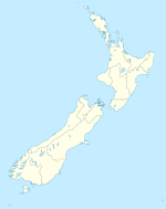
Coordinates: 43°45′S 172°18′E / 43.75°S 172.3°E
Towns of the Selwyn District, Canterbury, New Zealand Major towns Other towns Arthur's Pass • Burnham • Coalgate • Doyleston • Dunsandel • Glentunnel • Hororata • Irwell • Kirwee • Rakaia Huts • Sheffield • Southbridge • Springfield • Springston • Tai Tapu • WaddingtonLocalities Annat • Aylesbury • Bealey • Bankside • Broadfield • Brookside • Cass • Castle Hill • Charing Cross • Courtenay • Craigieburn • Ellesmere • Glenroy • Greendale • Greenpark • Greenpark Huts • Halkett • Hawkins • Homebush • Killinchy • Kimberley • Kowai Bush • Ladbrooks • Lake Coleridge • Lakeside • Little Rakaia • Lower Selwyn Huts • Mcleans Island • Mead • Motukarara • Milltown • Norwood • Paparua • Racecourse Hill • Rakaia Gorge • Sandy Knolls • Sedgemere • Selwyn • Selwyn Huts • Springston South • Staircase • Taumutu • Te Pirita • Weedons • Whitecliffs • Windwhistle
Categories:- Selwyn District
- Populated places in New Zealand

Wikimedia Foundation. 2010.