- Dunsandel
-
Coordinates: 43°40′S 172°11′E / 43.667°S 172.183°E
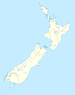
Dunsandel is a small rural township in the Canterbury Region of the South Island, New Zealand. The town is located on the Canterbury Plains just south of the Selwyn River and about 40 km south of Christchurch. Dunsandel is a junction town on SH1, halfway between Christchurch and Ashburton, with roads leading to Leeston, Southbridge and Hororata. The town provides an important refreshment stop for main road travellers with eateries and coffee shops, as well as acting as a support town for the rural hinterland.
Dunsandel had a population of 429 in the 2006 Census, an increase of 27 since 2001.[1] The town was established to serve the local farming community which includes dairy, sheep and cropping and continues providing veterinary, transport and vehicle repair services. It has one primary school for approximately 50 children. The town is the home to the Dunsandel Cricket Club. The club's 'A' team has a reputation as one of the premier teams in the Ellesmere district.
Coordinates: 43°40′S 172°11′E / 43.667°S 172.183°E
Towns of the Selwyn District, Canterbury, New Zealand Major towns Other towns Arthur's Pass • Burnham • Coalgate • Doyleston • Dunsandel • Glentunnel • Hororata • Irwell • Kirwee • Rakaia Huts • Sheffield • Southbridge • Springfield • Springston • Tai Tapu • WaddingtonLocalities Annat • Aylesbury • Bealey • Bankside • Broadfield • Brookside • Cass • Castle Hill • Charing Cross • Courtenay • Craigieburn • Ellesmere • Glenroy • Greendale • Greenpark • Greenpark Huts • Halkett • Hawkins • Homebush • Killinchy • Kimberley • Kowai Bush • Ladbrooks • Lake Coleridge • Lakeside • Little Rakaia • Lower Selwyn Huts • Mcleans Island • Mead • Motukarara • Milltown • Norwood • Paparua • Racecourse Hill • Rakaia Gorge • Sandy Knolls • Sedgemere • Selwyn • Selwyn Huts • Springston South • Staircase • Taumutu • Te Pirita • Weedons • Whitecliffs • Windwhistle
Categories:- Selwyn District
- Populated places in New Zealand
Wikimedia Foundation. 2010.

