- Lake Coleridge
-
Lake Coleridge 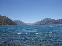
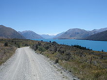
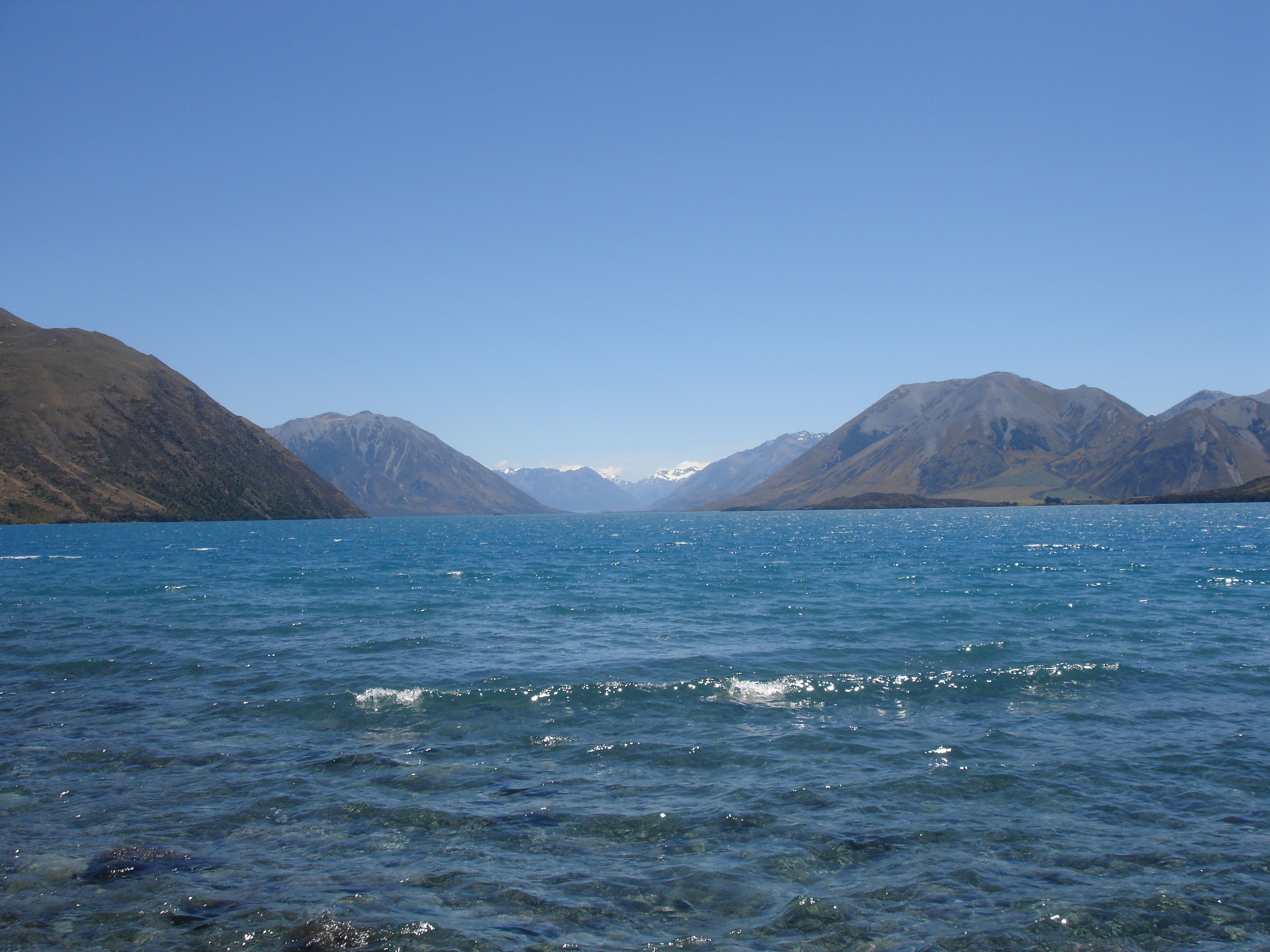
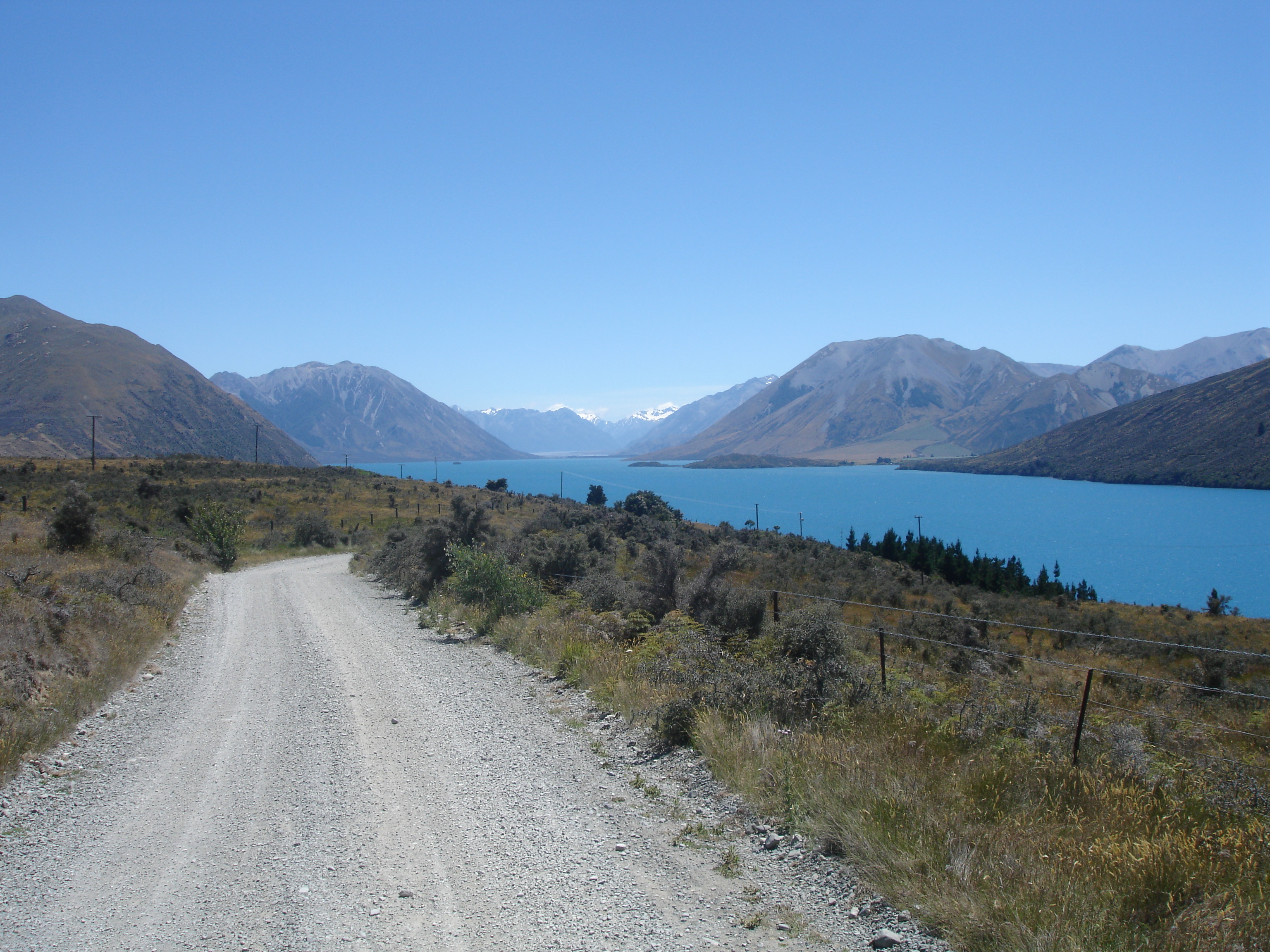
Location Selwyn District, Canterbury Region, South Island Coordinates 43°17′S 171°30′E / 43.283°S 171.5°ECoordinates: 43°17′S 171°30′E / 43.283°S 171.5°E Primary inflows Harper, Wilberforce Basin countries New Zealand Surface area 47 km² Max. depth 200 m [1] References [1] Lake Coleridge is located in inland Canterbury, in New Zealand's South Island. Located 35 kilometres to the northwest of Methven, it has a surface area of 47 km².
The lake is located to the north of the Rakaia River, and is the site of one of the country's earliest hydroelectric schemes, completed in 1914. The project makes use of the difference in altitude between the lake and river (the lake is 150 metres higher). Both the Harper and Wilberforce Rivers have had some of their flow diverted into the lake.

See also
- Lakes of New Zealand
- List of lakes in New Zealand
References
External links
- Details about the Lake Coleridge Power Station
- Map of Lake Coleridge
- Lake Coleridge Selwyn District Council
Towns of the Selwyn District, Canterbury, New Zealand Major towns Other towns Arthur's Pass • Burnham • Coalgate • Doyleston • Dunsandel • Glentunnel • Hororata • Irwell • Kirwee • Rakaia Huts • Sheffield • Southbridge • Springfield • Springston • Tai Tapu • WaddingtonLocalities Annat • Aylesbury • Bealey • Bankside • Broadfield • Brookside • Cass • Castle Hill • Charing Cross • Courtenay • Craigieburn • Ellesmere • Glenroy • Greendale • Greenpark • Greenpark Huts • Halkett • Hawkins • Homebush • Killinchy • Kimberley • Kowai Bush • Ladbrooks • Lake Coleridge • Lakeside • Little Rakaia • Lower Selwyn Huts • Mcleans Island • Mead • Motukarara • Milltown • Norwood • Paparua • Racecourse Hill • Rakaia Gorge • Sandy Knolls • Sedgemere • Selwyn • Selwyn Huts • Springston South • Staircase • Taumutu • Te Pirita • Weedons • Whitecliffs • Windwhistle
Categories:- Geography of the Canterbury Region
- Lakes of New Zealand
- Canterbury Region geography stubs
Wikimedia Foundation. 2010.