- Otira
-
Otira Otira Viaduct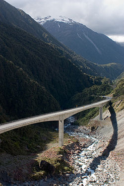
 Otira
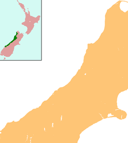
OtiraCoordinates: 42°49′52″S 171°33′39″E / 42.8311°S 171.5608°E Country New Zealand Region West Coast District Westland District Population (2006) - Total 87 Otira is a small township seven kilometres north of Arthur's Pass in the central South Island of New Zealand. It is on the western approach to the pass, a saddle between the Otira and Bealey Rivers high in the Southern Alps. The population of Otira and its surrounds was 87 in the 2006 Census, an increase of 30 from 2001.[1].
It was originally a stop on the Cobb and Co stagecoach from Canterbury to the West Coast. The railway line was then built from Greymouth to Otira, with the pass navigated by coach, until the railway tunnel opened in 1923. During construction of the tunnel, Otira housed about 600 workers and their families. In the 1950s the town had a population of about 350, but this had dropped to 11 in 1988 and recovered to some extent to 44 in 2010.[2]
The township is principally old Railways housing, much of which was constructed in Hamilton and shipped south to be reassembled on site. As well as the railway station, there is a pub, a fire station, and 18 houses, 14 of them tenanted in 2010.[2]
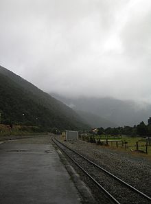 Otira railway station
Close to the town are two major feats of civil engineering: the Otira Tunnel, and the Otira Viaduct.
The town was bought by Bill and Christine Hennah in 1998 for NZ$80,000, and in 2010 was put up for sale with an asking price of NZ$1.5 million.[2]
Otira Viaduct
Above the town is the Otira Viaduct. Completed in 1999, it spans a 440-metre stretch of unstable land, replacing a narrow, winding, dangerous road that was prone to avalanches, slips and closures.
References
- ^ Quickstats about Otira
- ^ a b c "For sale: West Coast town with pub, 44 people". tvnz.co.nz. http://tvnz.co.nz/national-news/sale-west-coast-town-44-people-3610130. Retrieved 2010-06-30.
External links
The TranzAlpine passenger train stops (Midland line) Christchurch • Rolleston • Darfield • Springfield • Cass • Arthur's Pass • Otira • Jacksons • Moana • Brunner • GreymouthCoordinates: 42°49′52″S 171°33′39″E / 42.8311°S 171.5608°E
Categories:- Populated places in New Zealand
- Westland District


Wikimedia Foundation. 2010.