- New Zealand State Highway 4
-
State Highway 4

Route information Maintained by New Zealand Transport Agency Length: 237 km (147 mi) Major junctions North end: Eight Mile Junction (11 km south of Te Kuiti) South end: Wanganui Location Primary
destinations:Taumarunui, National Park, Raetihi Highway system New Zealand State Highways
Motorways and Expressways • List • Unused←  SH 3
SH 3SH 5  →
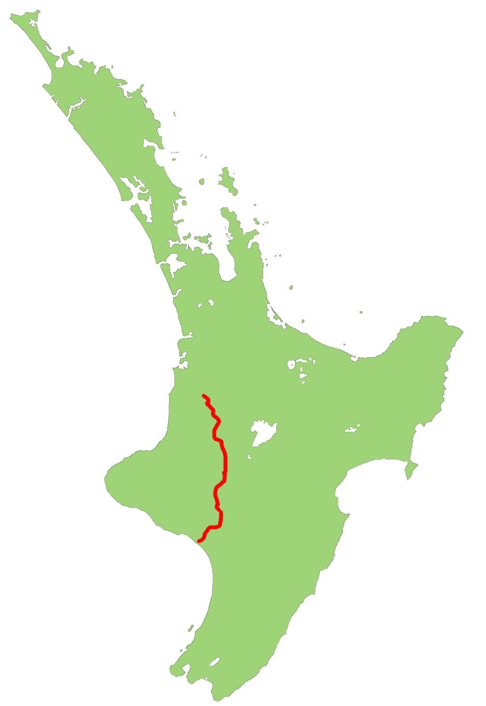
→State Highway 4 is the shortest of New Zealand's eight national highways. It runs north-south across rugged hill country, forming a short cut between two points on State Highway 3 thereby avoiding Taranaki and the coasts of the North and South Taranaki Bights. Distances are measured from north to south.
For most of its length SH4 is a two-lane single carriageway, with at-grade intersections and property accesses, both in rural and urban areas.
Route
This is the route that SH4 takes in 2007.
The highway commences from a junction on SH 3 11 km south of Te Kuiti. It heads south-southeast, climbing initially, then descending along the winding valleys of the Ohura and Ongarue Rivers, two tributaries of the Whanganui. The Ongarue joins the Whanganui close to Taumarunui, and here the highway turns east briefly, ascending the Whanganui's valley before turning south to skirt the North Island Volcanic Plateau. The peaks of the plateau's volcanoes are clearly visible from the highway, especially that of the southernmost, Ruapehu.
At Horopito the highway veers southwest briefly, following a tributary of the Maungawhero River until it joins with this river near Raetihi. The highway continues to descend the Maungawhero's valley to within 40 km of its mouth, then heads west across rolling hill country to the valley of the Whanganui River, which it follows for the last 15 km of its journey into Wanganui.
Major Junctions
Territorial authority Location km Destinations Notes Waitomo District Eight Mile Junction 0 SH 3 north
HamiltonSH 4 begins SH 3 south
New PlymouthRuapehu District Taumarunui 70  SH 43
SH 43
(Kururau Road)
StratfordWhanganui River Manunui 77  SH 41
SH 41
TurangiNational Park 114  SH 47
SH 47
TurangiTohunga Junction 140  SH 49
SH 49
Ohakune, WaiouruWanganui District Putiki 237 SH 3 north
Wanganui, New PlymouthSH 4 ends SH 3 south
Palmerston NorthSee also
- List of New Zealand State Highways
- List of roads and highways, for notable or famous roads worldwide
New Zealand highways New Zealand State Highway network · List of New Zealand State Highways National 
North Island SH 10 · SH 11 · SH 12 · SH 14 · SH 15A · SH 16 · SH 17 · SH 18 · SH 20 · SH 21 · SH 22 · SH 23 · SH 24 · SH 25 (incl. SH 25A) · SH 26 · SH 27 · SH 28 · SH 29 · SH 30 (incl. SH 30A) · SH 31 · SH 32 · SH 33 · SH 34 · SH 35 · SH 36 · SH 37 · SH 38 · SH 39 · SH 41 · SH 43 · SH 44 · SH 45 · SH 46 · SH 47 · SH 48 · SH 49 · SH 50 (incl. SH 50A) · SH 53 · SH 54 · SH 56 · SH 57 · SH 58South Island Touring Routes Twin Coast Discovery Highway · Thermal Explorer Highway · Pacific Coast Highway · Classic New Zealand Wine Trail · Alpine Pacific Triangle · Great Alpine Highway · Foothills Scenic Route · Southern Scenic Route
This New Zealand road or road transport-related article is a stub. You can help Wikipedia by expanding it.