- New Zealand State Highway 63
-
State Highway 63
Route information Maintained by New Zealand Transport Agency Length: 117 km (73 mi) Major junctions Northeast end: Middle Renwick Road/Blenheim Street  at Renwick
Southwest end: Kawatiri Murchison Highway at Kawatiri JunctionLocation Primary
destinations:Hillersden, Tophouse, Saint Arnaud, Lake Rotoiti Highway system New Zealand State Highways
Motorways and Expressways • List • Unused←  SH 62
SH 62SH 65  →
→State Highway 63 is a New Zealand State Highway located in the northern parts of the South Island of New Zealand. It is 117 km long and runs between the settlements of Renwick (in Marlborough) and Kawatiri Junction (in the Tasman region) via Saint Arnaud, providing a bypass of the city of Nelson.
Route
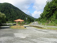 SH 63 beginning at Kawatiri Junction.
SH 63 begins just to the east of Renwick at SH 6, and parallels the course of the Wairau River for 93 kilometres, originally to the south of the river before crossing to the north side about 20 km from the Marlborough/Tasman border, while passing through the settlements of Wairau Valley, Hillersden and Tophouse. Just before reaching Tophouse, the Wairau veers to south while the road arrives in St. Arnaud at the shores of Lake Rotoiti. After St. Arnaud the road swings to the northwest and follows the last 24 km alongside the Buller River. At Kawatiri Junction, it terminates at SH 6 between Murchison and the Hope Saddle.
New Zealand highways New Zealand State Highway network · List of New Zealand State Highways National 
North Island SH 10 · SH 11 · SH 12 · SH 14 · SH 15A · SH 16 · SH 17 · SH 18 · SH 20 · SH 21 · SH 22 · SH 23 · SH 24 · SH 25 (incl. SH 25A) · SH 26 · SH 27 · SH 28 · SH 29 · SH 30 (incl. SH 30A) · SH 31 · SH 32 · SH 33 · SH 34 · SH 35 · SH 36 · SH 37 · SH 38 · SH 39 · SH 41 · SH 43 · SH 44 · SH 45 · SH 46 · SH 47 · SH 48 · SH 49 · SH 50 (incl. SH 50A) · SH 53 · SH 54 · SH 56 · SH 57 · SH 58South Island Touring Routes Twin Coast Discovery Highway · Thermal Explorer Highway · Pacific Coast Highway · Classic New Zealand Wine Trail · Alpine Pacific Triangle · Great Alpine Highway · Foothills Scenic Route · Southern Scenic Route
This New Zealand road or road transport-related article is a stub. You can help Wikipedia by expanding it.

