- New Zealand State Highway 49
-
State Highway 49
Route information Maintained by New Zealand Transport Agency Length: 36.2 km (22.5 mi) Major junctions Northwest end:  SH 4 at Tohunga Junction
Southeast end:  SH 1 at Waiouru
Location Primary
destinations:Ohakune Highway system New Zealand State Highways
Motorways and Expressways • List • Unused←  SH 48
SH 48SH 50  →
→State Highway 49 is a New Zealand State Highway, linking State Highway 4 and State Highway 1, via the tourist town of Ohakune. It forms the southern part of the ring road surrounding Tongariro National Park, and provides access to the southern side of Mount Ruapehu and the Turoa skifield.
State Highway 49, along with State Highways 4, 47, and 46, is used as an alternative route to State Highway 1's Desert Road, and is well used when the Desert Road is closed due to snow.
State Highway 49 lies entirely within the Ruapehu District.
Contents
Route
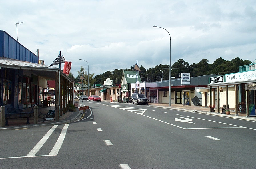
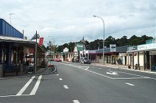 State Highway 49 passing through Ohakune.
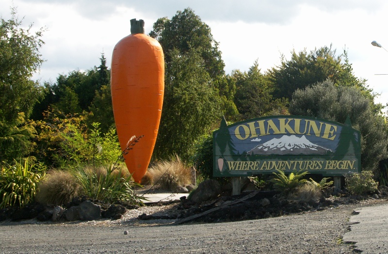
 Ohakune's famous giant carrot lies just off State Highway 49 at the eastern end of the township.
State Highway 49 runs northwest to southeast, and roughly follows the North Island Main Trunk railway. This is the route SH 49 takes in 2008.
State Highway 49 leaves SH 4 at Tohunga Junction, some eight kilometres north of Raetihi, and heads southeast across rolling hills to the tourist town of Ohakune. Following Ohakune's main street, the road continues southeast out of the township, passing Ohakune's famous giant carrot.
State Highway 49 continues southeast across rolling hills, running broadly in the same direction as the North Island Main Trunk. It passes the rural villages of Rangataua and Karioi, before meeting the railway line at the Whangaehu River at Tangiwai. The bridge here has flashing lighs and gates to block off the road in case of a lahar from Mount Ruapehu's crater lake. To the side of the bridge is the Tangiwai memorial, erected to remember the 151 people who died when a Wellington to Auckland express train plunged into the river following a lahar on 24 December 1953.
After crossing the Whangaehu River, and the railway line, SH 49 turns east for several kilometres, before turning south into Waiouru. At Waiouru, SH 49 ends at the intersection with State Highway 1.
History
State Highway 49 used to have one spur - State Highway 49A. It separated from SH 49 at Ohakune, and ran east to Raetihi, where it terminated at State Highway 4. SH 49A has since been revoked.
Future
State Highway 49 has no major projects planned within the next ten years.[1]
Major intersections
Territorial authority Location km Destinations Notes Ruapehu District Tohunga Junction 0 SH 4 north
National ParkSH 49 begins SH 4 south
WanganuiOhakune (Goldfinch Street)
Turoa skifield(Raehiti Ohakune Road)
RaetihiFormer SH 49A junction Tangiwai Whangaehu River Waiouru 36 SH 1 north
(Desert Road)
TaupoSH 49 ends SH 1 south
Palmerston NorthSee also
References
New Zealand highways New Zealand State Highway network · List of New Zealand State Highways National 
North Island SH 10 · SH 11 · SH 12 · SH 14 · SH 15A · SH 16 · SH 17 · SH 18 · SH 20 · SH 21 · SH 22 · SH 23 · SH 24 · SH 25 (incl. SH 25A) · SH 26 · SH 27 · SH 28 · SH 29 · SH 30 (incl. SH 30A) · SH 31 · SH 32 · SH 33 · SH 34 · SH 35 · SH 36 · SH 37 · SH 38 · SH 39 · SH 41 · SH 43 · SH 44 · SH 45 · SH 46 · SH 47 · SH 48 · SH 49 · SH 50 (incl. SH 50A) · SH 53 · SH 54 · SH 56 · SH 57 · SH 58South Island Touring Routes Twin Coast Discovery Highway · Thermal Explorer Highway · Pacific Coast Highway · Classic New Zealand Wine Trail · Alpine Pacific Triangle · Great Alpine Highway · Foothills Scenic Route · Southern Scenic RouteCategories:- State highways in New Zealand


Wikimedia Foundation. 2010.