- Ohakune
-
- "Big Carrot" redirects here. Big Carrot was also a pseudonym used by the band T. Rex.
Ohakune
Ōhākune (Maori)
 Ohakune
Coordinates: 39°25′07″S 175°23′58″E / 39.418491°S 175.399475°ECoordinates: 39°25′07″S 175°23′58″E / 39.418491°S 175.399475°E Country  New Zealand
Region Manawatu-Wanganui Territorial authority Ruapehu District Ward Waimarino-Waiouru Population (2006 Census) - Total 1,101 Time zone NZST (UTC+12) - Summer (DST) NZDT (UTC+13) Postcode 4625 Area code(s) 06 Ohakune is a town in the North Island of New Zealand. It is located at the southern end of the Tongariro National Park, close to the southwestern slopes of the active volcano Mount Ruapehu. Part of the Manawatu-Wanganui region, the town is 70 kilometres northeast of Wanganui, and 25 kilometres west of Waiouru. As of May 2003 the population for Ohakune was 1293.
Contents
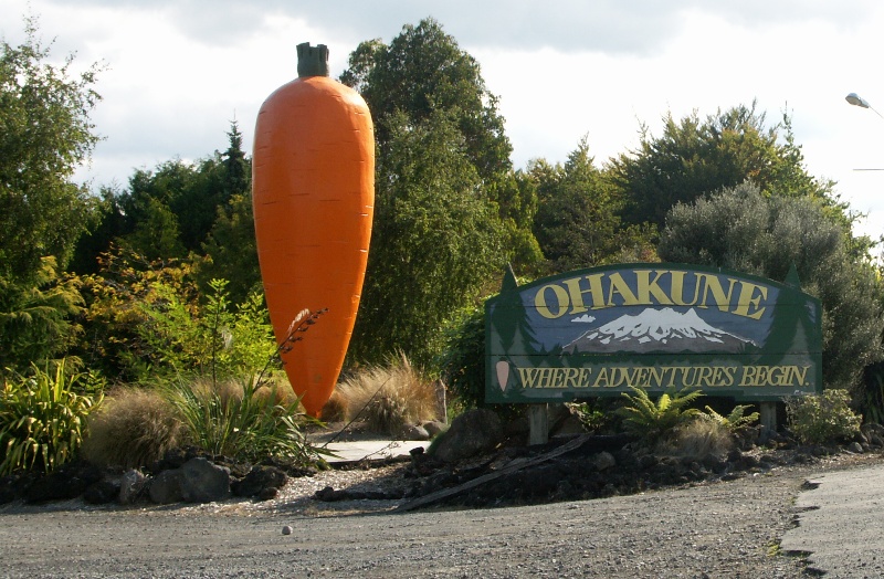
Southern Entrance
On the eastern edge of the town there is a large replica of a carrot, which celebrates the area's reputation as the source of a high proportion of New Zealand's carrots. This is reputedly the world's largest model carrot.
Transportation
State Highway 49 runs through the town, as does the North Island Main Trunk Railway. From 18 December 1917 until 1 January 1968, Ohakune was also the junction for the Raetihi Branch, a branch line railway to Raetihi. A truss bridge formerly used by this branch still stands near the big carrot.
Seventeen kilometres to the east of the town is the Tangiwai bridge, site of New Zealand's worst railway accident, on December 24, 1953.
Town Activities
It is a rural service town and a base for skiers using the Turoa skifield. The town's population is 1101 (2006 census).[1]
- Accommodation
- Snow sports
- Mountain tramping
- Bushwalking
 Ohakune Big Carrot
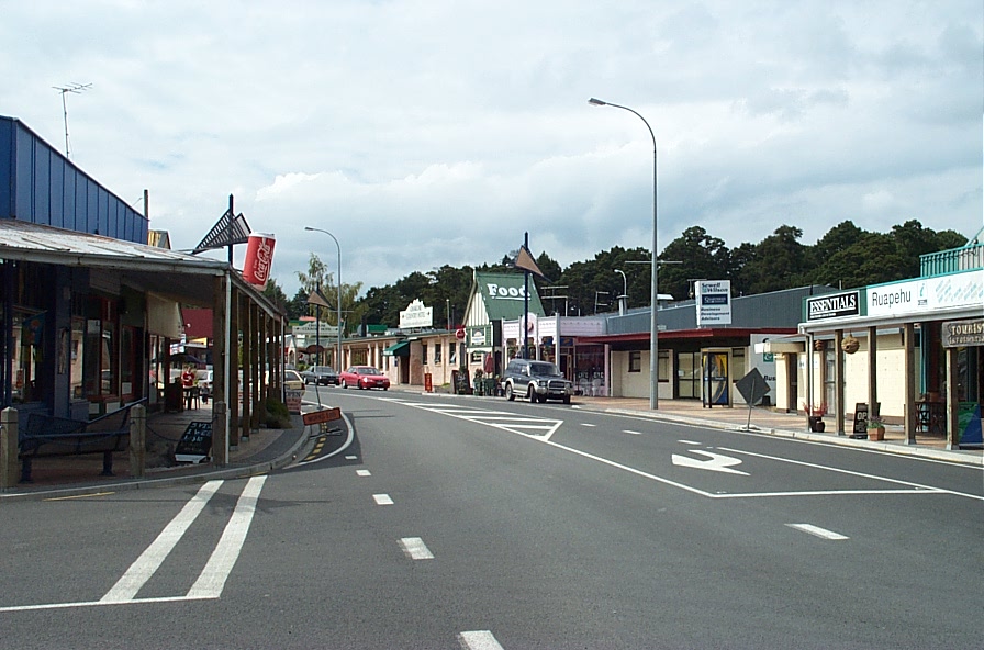
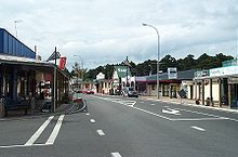 Ohakune main street
Ohakune has hosted the Big Mountain Short Film Festival since 2006. The Ohakune Mountain Mardi Gras is also a major event held each year. It is one of the premier ski parties of the season and is a celebration of winter and the ski season. Ohakune comes alive with this street party as musicians, stalls and rides are set up for the flood of people. It has been running for several years and has had numbers steadily increase, with 2009's event featuring major New Zealand musicians such as band Midnight Youth and DJ General Lee.[2] Ohakune is an essential part of Fallout Festival an annual event that focuses on bringing creative elements into the community to celebrate the snow season.[3]
Ohakune is the home of radio station Zero FM (94.2fm Ohakune)[4]
Trivia
A mock-romantic song from the mid 1960s called September in Ohakune was recorded by Peter Harcourt on an LP called Land of the Long White Shroud
The world's first commercial bungy jumping site was established just outside Ohakune at the old railway viaduct. This was operated during the 1980s until the bridge became too unsafe to continue operations. This bridge is now restored and a highlight of the 'Old Coach Road' walk/bikeway.
See also
References
The Overlander passenger train stops: (North Island Main Trunk Railway) Auckland (Britomart) • Middlemore • Papakura • Pukekohe • Hamilton • Otorohanga • Te Kuiti • Taumarunui • National Park • Ohakune • Marton • Feilding • Palmerston North • Levin • Paraparaumu • Porirua • Wellington (Railway Station)Categories:- Populated places in New Zealand

Wikimedia Foundation. 2010.