- Murray Aynsley
-
 Murray Aynsley
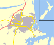
Murray Aynsley is a suburb of Christchurch, New Zealand, located on the fringes of the Port Hills 5 km south-east of the city centre. Situated above the suburb is Glenelg Children's Health Camp. The suburb is named after early Christchurch settler Hugh Murray-Aynsley JP.
Coordinates: 43°33′53″S 172°39′50″E / 43.564676°S 172.663929°E
Suburbs of Christchurch City, Canterbury, New Zealand Main Suburbs Minor Suburbs Addington • Aidanfield • Avondale • Avonhead • Avonside • Balmoral Hill • Barrington • Beckenham • Bexley • Bridgend • Bromley • Brooklands • Broomfield • Burwood • Bryndwr • Casebrook • Chaneys • Clifton • Coutts Island • Cracroft • Dallington • Ferrymead • Harewood • Heathcote Valley • Hei Hei • Hillmorton • Hillsborough • Hoon Hay • Huntsbury • Hyde Park • Ilam • Islington • Kainga • Kennedys Bush • Mairehau • Marshland • Masham • Middleton • Moncks Bay • Moncks Spur • Mount Pleasant • Murray Aynsley • North Linwood • North New Brighton • Northcote • Northwood • Oaklands • Opawa • Ouruhia • Parklands • Phillipstown • Queenspark • Redcliffs • Redwood • Richmond • Richmond Hill • Richmond South • Russley • St Albans • St Andrews Hill • St Martins • Scarborough • Sockburn • Somerfield • South New Brighton • Southshore • Spencerville • Spreydon • Stewarts Gully • Strowan • Styx • Taylors Mistake • Upper Riccarton • Waimairi Beach • Wainoni • Waltham • Westlake • Westmorland • Wigram • YaldhurstSettlements of Banks Peninsula and the Port Hills, Canterbury, New Zealand Settlements Allandale • Ataahua • Akaroa • Barrys Bay • Birdling's Flat • Cass Bay • Charteris Bay • Chorlton • Church Bay • Cooptown • Corsair Bay • Diamond Harbour • Duvauchelle • French Farm • Governors Bay • Gebbies Pass • Gebbies Valley • Hilltop • Kaituna Valley • Kukupa • Lansdowne • Le Bons Bay • Little Akaloa • Little River • Lyttelton • Motukarara • Ohinetahi • Okains Bay • Okuti Valley • Pigeon Bay • Puaha • Puari • Purau • Port Levy • Rapaki • Robinsons Bay • Tai Tapu • Takamatua • Teddington • The Kaik • Wainui •
Port Hills Suburbs Balmoral Hill • Cashmere • Clifton • Cracroft • Ferrymead • Halswell • Heathcote Valley • Hillsborough • Hoon Hay • Huntsbury • Kennedys Bush • Moncks Bay • Moncks Spur • Mt Pleasant • Murray Aynsley • Redcliffs • Richmond Hill • Scarborough • St Andrews Hill • Sumner • Te Onepoto / Taylors Mistake • Westmorland
Categories:- Suburbs of Christchurch
- Canterbury Region geography stubs

Wikimedia Foundation. 2010.