- Opawa
-
- This article is about the suburb of Christchurch, New Zealand. For places in Poland, see Opawa (disambiguation). For the city in the Czech Republic, see Opava.
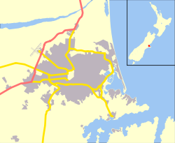
Opawa Coordinates: 43°33′05″S 172°39′43″E / 43.551342°S 172.661937°ECoordinates: 43°33′05″S 172°39′43″E / 43.551342°S 172.661937°E Area - Total 1.9710 km2 (0.8 sq mi) Population (2006) - Total 3,360 - Density 1,704.7/km2 (4,415.2/sq mi) Opawa is an inner suburb of Christchurch, New Zealand, located 2.5 kilometres south-east of the city centre.
The name is a contraction of Opaawaho, which means a place of ('o') an outer pā or outpost ('paawaho') in Māori. Opaawaho or Ōpāwaho is the Māori name for the Heathcote River.[1]
References
Suburbs of Christchurch City, Canterbury, New Zealand Main Suburbs Minor Suburbs Addington • Aidanfield • Avondale • Avonhead • Avonside • Balmoral Hill • Barrington • Beckenham • Bexley • Bridgend • Bromley • Brooklands • Broomfield • Burwood • Bryndwr • Casebrook • Chaneys • Clifton • Coutts Island • Cracroft • Dallington • Ferrymead • Harewood • Heathcote Valley • Hei Hei • Hillmorton • Hillsborough • Hoon Hay • Huntsbury • Hyde Park • Ilam • Islington • Kainga • Kennedys Bush • Mairehau • Marshland • Masham • Middleton • Moncks Bay • Moncks Spur • Mount Pleasant • Murray Aynsley • North Linwood • North New Brighton • Northcote • Northwood • Oaklands • Opawa • Ouruhia • Parklands • Phillipstown • Queenspark • Redcliffs • Redwood • Richmond • Richmond Hill • Richmond South • Russley • St Albans • St Andrews Hill • St Martins • Scarborough • Sockburn • Somerfield • South New Brighton • Southshore • Spencerville • Spreydon • Stewarts Gully • Strowan • Styx • Taylors Mistake • Upper Riccarton • Waimairi Beach • Wainoni • Waltham • Westlake • Westmorland • Wigram • YaldhurstCategories:- Suburbs of Christchurch
- Canterbury Region geography stubs
Wikimedia Foundation. 2010.

