- Chapeltown, South Yorkshire
-
Coordinates: 53°27′43″N 1°27′58″W / 53.461814°N 1.466181°W
Chapeltown 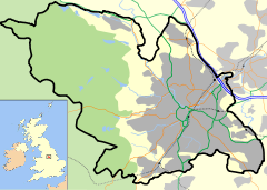
 Chapeltown
Chapeltown shown within SheffieldPopulation 10,043 [1] Parish Ecclesfield Metropolitan borough City of Sheffield Metropolitan county South Yorkshire Region Yorkshire and the Humber Country England Sovereign state United Kingdom Post town SHEFFIELD Postcode district S35 Dialling code 0114 Police South Yorkshire Fire South Yorkshire Ambulance Yorkshire EU Parliament Yorkshire and the Humber UK Parliament Sheffield Hillsborough List of places: UK • England • Yorkshire Chapeltown is in northern Sheffield, in South Yorkshire, England. It forms part of the Ecclesfield civil parish. There is a wide variety of shops, pubs and restaurants as well as a supermarket. Sheffield library also has a branch in Chapeltown.
The town also has a twice-weekly market (Tuesday and Friday).
Like much of Sheffield there is a large amount of greenspace in and around Chapeltown. The town centre has a cricket ground and a wooded park on either side of it. Between Chapeltown and Ecclesfield the land is used for residential purposes on one side of the main road and agricultural on the other. There is also a brownfield site above the park.
It has two railway stations, one being a disused and allegedly haunted passenger station which is very well hidden in nearby overgrown woodlands, plus the railway station next to the Asda supermarket which is on the Penistone Line. Chapeltown is near the M1 motorway. There are two junctions (35 and 35a) serving the town: the latter is mainly used by Thorncliffe industrial estate, which contains the head office of Balfour Beatty Utility Solutions among other companies. There are also regular bus services into Sheffield and additional services to Barnsley and Rotherham town centres.
Most of the industry in the town lies within the Thorncliffe industrial estate, formerly the Thorncliffe Works of Newton, Chambers & Company. This company was first established on this site in 1793 (Jones 1999:148), initially an iron works but which over time expanded into related mining industries and the production of products produced by the fractional distillation of coal. These included the famous 'Izal' disinfectant range. During World War II Churchill tanks were built in the estate. Until recently one of these tanks stood as a memorial on the site of the old factory, but it had fallen into a poor state of repair and has now been removed for restoration, it is unclear if the tank will be replaced when the restoration is complete. The proximity of the M1 has helped the industrial estate's expansion in recent years, especially with companies involved in distribution. The disused railway station can be found by trekking though approximately a mile of dense woodland from the west (J35A), from White Lane. Part of this once- building is still lived in, but it is need of restoration and could be done very easily. The alleged ghosts are said to be WWII soldiers, killed by bomb blast while on the train to the Tank factory.
The old station " Chapeltown & Thorncliffe " can be seen from White Lane.
References
- Jones J 1993 'An Illustrated History of Izal' in Jones M "Aspects of Sheffield Vol 2, Sheffield: Wharncliffe Books
Ceremonial county of South Yorkshire Yorkshire Portal Metropolitan districts Major settlements Askern • Barnsley • Bawtry • Brierley • Conisbrough • Dinnington • Doncaster • Edlington • Hatfield • Hoyland • Maltby • Mexborough • Penistone • Rotherham • Sheffield • South Kirkby and Moorthorpe • Stainforth • Stocksbridge • Swinton • Thorne • Tickhill • Wath upon Dearne • Wombwell
See also: List of civil parishes in South YorkshireRivers Topics Districts of Sheffield Abbeydale · Attercliffe · Batemoor · Beauchief · Beighton · Bradfield (High Bradfield · Low Bradfield) · Brightside · Burngreave · Carbrook · Chapeltown · Crookes · Crosspool · Darnall · Dore · Ecclesall · Ecclesfield · Fulwood · Gleadless · Greenhill · Grenoside · Halfway · Handsworth · Heeley · Hemsworth · Highfield · High Green · Hillsborough · Hyde Park · Longley · Lowfield · Loxley · Malin Bridge · Manor · Meersbrook · Middlewood · Millhouses · Mosborough · Neepsend · Nether Edge · Norton · Owlerton · Oughtibridge · Park Hill · Pitsmoor · Ranmoor · Ringinglow · Sharrow · Stocksbridge · Tinsley · Totley · Wadsley · Wadsley Bridge · Walkley · Wisewood · Woodseats · Woodhouse · Worrall
Categories:- Districts of Sheffield
- South Yorkshire geography stubs

Wikimedia Foundation. 2010.