- National Register of Historic Places listings in Rio Blanco County, Colorado
-
 Location of Rio Blanco County in Colorado
This is a list of the National Register of Historic Places listings in Rio Blanco County, Colorado. It is intended to be a complete list of the properties and districts on the National Register of Historic Places in Rio Blanco County, Colorado, United States. The locations of National Register properties and districts for which the latitude and longitude coordinates are included below, may be seen in a Google map.[1]
There are 10 properties and districts listed on the National Register in the county.
-
- This National Park Service list is complete through NPS recent listings posted November 10, 2011.[2]
Listings county-wide
[3] Landmark name [4] Image Date listed Location City or town Summary 1 Battle of Milk River Site August 22, 1975 Address Restricted Meeker 2 Canon Pintado October 6, 1975 Address Restricted Rangely 3 Carrot Men Pictograph Site August 22, 1975 Address Restricted Rangely 4 Collage Shelter Site August 27, 1980 Address Restricted Rangely 5 Duck Creek Wickiup Village November 20, 1975 Address Restricted Meeker 6 Fremont Lookout Fortification Site November 20, 1974 Address Restricted Rangely 7 Hay's Ranch Bridge February 4, 1985 County Road 127
40°00′48″N 108°05′32″W / 40.013333°N 108.092222°WMeeker 8 Hotel Meeker May 7, 1980 560 Main St.
40°02′14″N 107°54′45″W / 40.037222°N 107.9125°WMeeker 9 Pyramid Guard Station January 10, 2008 County Road 8
40°09′10″N 107°13′26″W / 40.152778°N 107.223889°WYampa 10 St. James Episcopal Church March 30, 1978 368 4th St.
40°02′19″N 107°54′37″W / 40.038611°N 107.910278°WMeeker See also
- List of National Historic Landmarks in Colorado
- National Register of Historic Places listings in Colorado
References
- ^ The latitude and longitude information provided in this table was derived originally from the National Register Information System, which has been found to be fairly accurate for about 99% of listings. For about 1% of NRIS original coordinates, experience has shown that one or both coordinates are typos or otherwise extremely far off; some corrections may have been made. A more subtle problem causes many locations to be off by up to 150 yards, depending on location in the country: most NRIS coordinates were derived from tracing out latitude and longitudes off of USGS topographical quadrant maps created under the North American Datum of 1927, which differs from the current, highly accurate WGS84 GPS system used by Google maps. Chicago is about right, but NRIS longitudes in Washington are higher by about 4.5 seconds, and are lower by about 2.0 seconds in Maine. Latitudes differ by about 1.0 second in Florida. Some locations in this table may have been corrected to current GPS standards.
- ^ "National Register of Historic Places: Weekly List Actions". National Park Service, United States Department of the Interior. Retrieved on November 10, 2011.
- ^ Numbers represent an ordering by significant words. Various colorings, defined here, differentiate National Historic Landmark sites and National Register of Historic Places Districts from other NRHP buildings, structures, sites or objects.
- ^ "National Register Information System". National Register of Historic Places. National Park Service. . http://nrhp.focus.nps.gov/natreg/docs/All_Data.html.
U.S. National Register of Historic Places Topics Lists by states Alabama • Alaska • Arizona • Arkansas • California • Colorado • Connecticut • Delaware • Florida • Georgia • Hawaii • Idaho • Illinois • Indiana • Iowa • Kansas • Kentucky • Louisiana • Maine • Maryland • Massachusetts • Michigan • Minnesota • Mississippi • Missouri • Montana • Nebraska • Nevada • New Hampshire • New Jersey • New Mexico • New York • North Carolina • North Dakota • Ohio • Oklahoma • Oregon • Pennsylvania • Rhode Island • South Carolina • South Dakota • Tennessee • Texas • Utah • Vermont • Virginia • Washington • West Virginia • Wisconsin • WyomingLists by territories Lists by associated states Other Municipalities and communities of Rio Blanco County, Colorado Towns 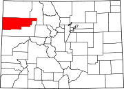 Categories:
- National Register of Historic Places in Colorado by county
- Rio Blanco County, Colorado
-

Wikimedia Foundation. 2010.