- National Register of Historic Places listings in Randolph County, Illinois
-
See also: List of Registered Historic Places in Illinois
Contents: List of Registered Historic Places in Randolph County, Illinois, USA:
-
- This National Park Service list is complete through NPS recent listings posted November 10, 2011.[1]
Landmark name Image Date listed Location City or Town Summary 1 Charter Oak Schoolhouse October 11, 1978 W of Schuline
38°5′21″N 89°47′38″W / 38.08917°N 89.79389°WSchuline 2 Creole House April 3, 1973 Market St.
38°5′10″N 90°5′40″W / 38.08611°N 90.09444°WPrairie du Rocher 3 Fort de Chartres 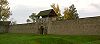
October 15, 1966 Terminus of IL 155, W of Prairie du Rocher, Fort Chartres
38°5′4″N 90°9′28″W / 38.08444°N 90.15778°WPrairie du Rocher 4 French Colonial Historic District April 3, 1974 From Fort Chartres State Park to Kaskasia Island Prairie du Rocher 5 Kolmer Site May 1, 1974 Address Restricted Prairie du Rocher 6 Mary's River Covered Bridge December 31, 1974 About 4 mi. NE of Chester on IL 150
37°56′55″N 89°45′57″W / 37.94861°N 89.76583°WChester 7 Pierre Menard House 
April 15, 1970 Fort Kaskaskia State Park Ellis Grove 8 Modoc Rock Shelter October 15, 1966 Address Restricted Modoc 9 Piney Creek Site May 31, 2001 Address Restricted Campbell Hill 10 Piney Creek South Site May 31, 2001 Address Restricted Campbell Hill 11 Piney Creek West Site May 31, 2001 Address Restricted Campbell Hill 12 Red Bud Historic District December 29, 1979 Irregular pattern along Main and Market Sts.
38°12′33″N 89°59′37″W / 38.20917°N 89.99361°WRed Bud 13 Shiloh College November 15, 2005 13043 Walnut St.
37°55′36″N 89°37′12″W / 37.92667°N 89.62°WShiloh Hill 14 Sparta Historic District June 3, 1982 S. St. Louis, W. 3rd and S. James Sts.
38°7′11″N 89°42′15″W / 38.11972°N 89.70417°WSparta 15 Tegtmeyer Site May 31, 2001 Address Restricted Campbell Hill See also
- List of National Historic Landmarks in Illinois
- National Register of Historic Places listings in Illinois
References
- ^ "National Register of Historic Places: Weekly List Actions". National Park Service, United States Department of the Interior. Retrieved on November 10, 2011.
U.S. National Register of Historic Places Topics Lists by states Alabama • Alaska • Arizona • Arkansas • California • Colorado • Connecticut • Delaware • Florida • Georgia • Hawaii • Idaho • Illinois • Indiana • Iowa • Kansas • Kentucky • Louisiana • Maine • Maryland • Massachusetts • Michigan • Minnesota • Mississippi • Missouri • Montana • Nebraska • Nevada • New Hampshire • New Jersey • New Mexico • New York • North Carolina • North Dakota • Ohio • Oklahoma • Oregon • Pennsylvania • Rhode Island • South Carolina • South Dakota • Tennessee • Texas • Utah • Vermont • Virginia • Washington • West Virginia • Wisconsin • WyomingLists by territories Lists by associated states Other Categories:- Randolph County, Illinois
- National Register of Historic Places in Illinois by county
- National Register of Historic Places in Randolph County, Illinois
-

Wikimedia Foundation. 2010.