- National Register of Historic Places listings in Prowers County, Colorado
-
 Location of Prowers County in Colorado
This is a list of the National Register of Historic Places listings in Prowers County, Colorado.
This is intended to be a complete list of the properties and districts on the National Register of Historic Places in Prowers County, Colorado, United States. The locations of National Register properties and districts for which the latitude and longitude coordinates are included below, may be seen in a Google map.[1]
There are 15 properties and districts listed on the National Register in the county, including 1 National Historic Landmark.
-
- This National Park Service list is complete through NPS recent listings posted November 10, 2011.[2]
Current listings
[3] Landmark name [4] Image Date listed Location City or town Summary 1 Davies Hotel October 19, 1978 122 N. Main
38°05′27″N 102°37′08″W / 38.090833°N 102.618889°WLamar 2 Douglas Crossing Bridge February 4, 1985 County Road 28
37°47′43″N 102°15′20″W / 37.795278°N 102.255556°WGranada 3 Granada Bridge October 15, 2002 U.S. Route 385 at milepost 97.32
38°05′38″N 102°18′37″W / 38.093889°N 102.310278°WGranada 4 Granada Relocation Center 
May 18, 1994 23900 County Road FF, approximately 1 mile southwest of Granada
38°02′58″N 102°19′43″W / 38.049444°N 102.328611°WGranada 5 Holly City Hall October 10, 2003 119 E. Cheyenne St.
38°03′07″N 102°07′17″W / 38.051944°N 102.121389°WHolly 6 Holly Gymnasium April 24, 2007 N. Main St.
38°03′18″N 102°07′19″W / 38.055°N 102.121944°WHolly 7 Holly Santa Fe Depot 
July 28, 1995 302 S. Main St.
38°03′01″N 102°07′24″W / 38.050278°N 102.123333°WHolly 8 Holly SS Ranch Barn February 25, 2004 407 West Vinson
38°02′56″N 102°07′22″W / 38.048889°N 102.122778°WHolly 9 Paulsen Farm December 9, 1999 39035 Road 7
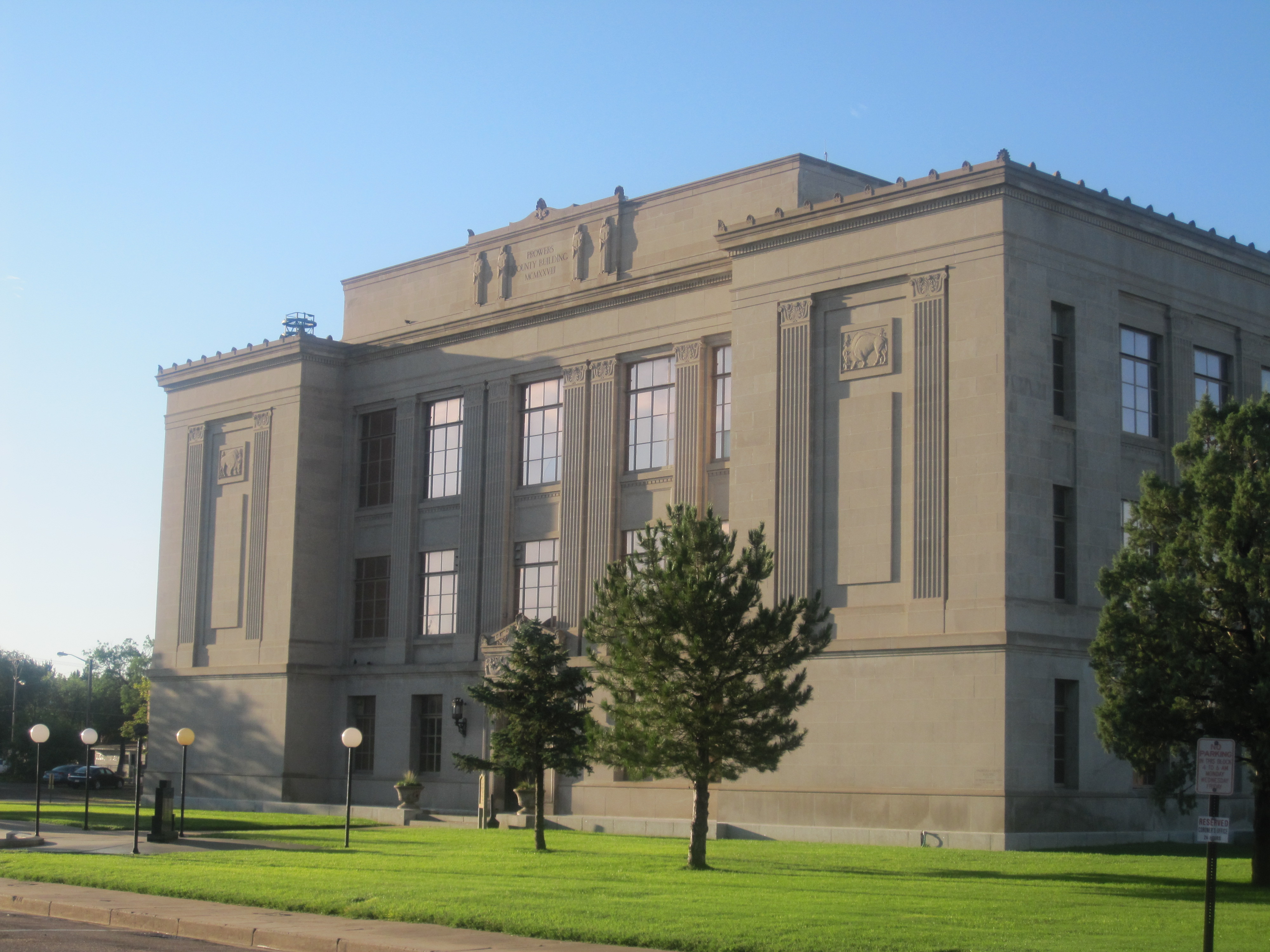
38°12′28″N 102°37′54″W / 38.207778°N 102.631667°WLamar 10 Petticrew Stage Stop August 24, 2000 Address Restricted Lamar 11 Prowers County Building 
September 21, 1981 301 S. Main St.
38°05′12″N 102°37′07″W / 38.08675°N 102.618611°WLamar 12 Prowers County Welfare Housing December 22, 2009 800 E. Maple St.
38°05′33″N 102°36′38″W / 38.092622°N 102.610567°WLamar 13 US Post Office-Lamar Main 
January 22, 1986 300 S. 5th St.
38°05′12″N 102°37′19″W / 38.086667°N 102.621944°WLamar 14 Wiley Rock Schoolhouse February 20, 2004 603 Main St.
38°09′24″N 102°43′11″W / 38.156667°N 102.719722°WWiley 15 Willow Creek Park August 7, 2007 Roughly bounded by Memorial Dr., Parkview Ave., and Willow Valley Rd.
38°04′28″N 102°36′51″W / 38.074331°N 102.614256°WLamar See also
- List of National Historic Landmarks in Colorado
- National Register of Historic Places listings in Colorado
References
- ^ The latitude and longitude information provided in this table was derived originally from the National Register Information System, which has been found to be fairly accurate for about 99% of listings. For about 1% of NRIS original coordinates, experience has shown that one or both coordinates are typos or otherwise extremely far off; some corrections may have been made. A more subtle problem causes many locations to be off by up to 150 yards, depending on location in the country: most NRIS coordinates were derived from tracing out latitude and longitudes off of USGS topographical quadrant maps created under the North American Datum of 1927, which differs from the current, highly accurate WGS84 GPS system used by Google maps. Chicago is about right, but NRIS longitudes in Washington are higher by about 4.5 seconds, and are lower by about 2.0 seconds in Maine. Latitudes differ by about 1.0 second in Florida. Some locations in this table may have been corrected to current GPS standards.
- ^ "National Register of Historic Places: Weekly List Actions". National Park Service, United States Department of the Interior. Retrieved on November 10, 2011.
- ^ Numbers represent an ordering by significant words. Various colorings, defined here, differentiate National Historic Landmark sites and National Register of Historic Places Districts from other NRHP buildings, structures, sites or objects.
- ^ "National Register Information System". National Register of Historic Places. National Park Service. . http://nrhp.focus.nps.gov/natreg/docs/All_Data.html.
U.S. National Register of Historic Places Topics Lists by states Alabama • Alaska • Arizona • Arkansas • California • Colorado • Connecticut • Delaware • Florida • Georgia • Hawaii • Idaho • Illinois • Indiana • Iowa • Kansas • Kentucky • Louisiana • Maine • Maryland • Massachusetts • Michigan • Minnesota • Mississippi • Missouri • Montana • Nebraska • Nevada • New Hampshire • New Jersey • New Mexico • New York • North Carolina • North Dakota • Ohio • Oklahoma • Oregon • Pennsylvania • Rhode Island • South Carolina • South Dakota • Tennessee • Texas • Utah • Vermont • Virginia • Washington • West Virginia • Wisconsin • WyomingLists by territories Lists by associated states Other Municipalities and communities of Prowers County, Colorado City 
Towns Unincorporated
communityCategories:- National Register of Historic Places in Colorado by county
- Prowers County, Colorado
- Buildings and structures in Prowers County, Colorado
-


Wikimedia Foundation. 2010.