- National Register of Historic Places listings in Pope County, Minnesota
-
 Location of Pope County in Minnesota
This is a list of the National Register of Historic Places listings in Pope County, Minnesota. It is intended to be a complete list of the properties and districts on the National Register of Historic Places in Pope County, Minnesota, United States. The locations of National Register properties and districts for which the latitude and longitude coordinates are included below, may be seen in a Google map.[1]
There are 12 properties and districts listed on the National Register in the county.
-
- This National Park Service list is complete through NPS recent listings posted November 10, 2011.[2]
Listings county-wide
[3] Landmark name [4] Image Date listed Location City or town Summary 1 Ann Bickle House March 28, 1997 226 E. Minnesota Ave.
45°38′59″N 95°23′07″W / 45.649722°N 95.385278°WGlenwood 2 Fremad Association Building April 1, 1982 2-22 S. Franklin
45°38′58″N 95°23′24″W / 45.649444°N 95.39°WGlenwood 3 Glenwood Public Library April 1, 1982 108 1st Ave.
45°38′56″N 95°23′16″W / 45.648889°N 95.387778°WGlenwood 4 Urjans Iverson House February 11, 1982 Off Minnesota Highway 104
45°27′14″N 95°15′18″W / 45.453889°N 95.255°WSedan 5 Little Falls and Dakota Depot May 24, 2006 Depot Ln.
45°36′43″N 95°31′48″W / 45.611944°N 95.53°WStarbuck 6 Minnewaska Hospital April 1, 1982 Wollan and 5th Sts.
45°36′44″N 95°31′58″W / 45.612222°N 95.532778°WStarbuck 7 Northern Pacific Depot October 6, 1983 Off Washington Ave.
45°42′56″N 95°16′09″W / 45.715556°N 95.269167°WVillard 8 Daniel Pennie House April 1, 1982 County Highway 27
45°43′56″N 95°16′35″W / 45.732222°N 95.276389°WVillard 9 Pope County Courthouse April 1, 1982 130 E. Minnesota Ave.
45°38′59″N 95°23′15″W / 45.649722°N 95.3875°WGlenwood 10 Sunset Beach Hotel February 11, 1982 County Highway 17
45°36′51″N 95°24′38″W / 45.614167°N 95.410556°WGlenwood 11 Terrace Historic District April 1, 1982 Off Minnesota Highway 104
45°30′40″N 95°19′08″W / 45.511111°N 95.318889°WSedan 12 Terrace Mill Historic District July 17, 1979 Off Minnesota Highway 104
45°30′38″N 95°19′14″W / 45.510556°N 95.320556°WSedan See also
- List of National Historic Landmarks in Minnesota
- National Register of Historic Places listings in Minnesota
References
- ^ The latitude and longitude information provided in this table was derived originally from the National Register Information System, which has been found to be fairly accurate for about 99% of listings. For about 1% of NRIS original coordinates, experience has shown that one or both coordinates are typos or otherwise extremely far off; some corrections may have been made. A more subtle problem causes many locations to be off by up to 150 yards, depending on location in the country: most NRIS coordinates were derived from tracing out latitude and longitudes off of USGS topographical quadrant maps created under the North American Datum of 1927, which differs from the current, highly accurate WGS84 GPS system used by Google maps. Chicago is about right, but NRIS longitudes in Washington are higher by about 4.5 seconds, and are lower by about 2.0 seconds in Maine. Latitudes differ by about 1.0 second in Florida. Some locations in this table may have been corrected to current GPS standards.
- ^ "National Register of Historic Places: Weekly List Actions". National Park Service, United States Department of the Interior. Retrieved on November 10, 2011.
- ^ Numbers represent an ordering by significant words. Various colorings, defined here, differentiate National Historic Landmark sites and National Register of Historic Places Districts from other NRHP buildings, structures, sites or objects.
- ^ "National Register Information System". National Register of Historic Places. National Park Service. . http://nrhp.focus.nps.gov/natreg/docs/All_Data.html.
U.S. National Register of Historic Places Topics Lists by states Alabama • Alaska • Arizona • Arkansas • California • Colorado • Connecticut • Delaware • Florida • Georgia • Hawaii • Idaho • Illinois • Indiana • Iowa • Kansas • Kentucky • Louisiana • Maine • Maryland • Massachusetts • Michigan • Minnesota • Mississippi • Missouri • Montana • Nebraska • Nevada • New Hampshire • New Jersey • New Mexico • New York • North Carolina • North Dakota • Ohio • Oklahoma • Oregon • Pennsylvania • Rhode Island • South Carolina • South Dakota • Tennessee • Texas • Utah • Vermont • Virginia • Washington • West Virginia • Wisconsin • WyomingLists by territories Lists by associated states Other Municipalities and communities of Pope County, Minnesota Cities 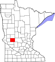
Townships Bangor | Barsness | Ben Wade | Blue Mounds | Chippewa Falls | Gilchrist | Glenwood | Grove Lake | Hoff | Lake Johanna | Langhei | Leven | Minnewaska | New Prairie | Nora | Reno | Rolling Forks | Walden | Westport | White Bear Lake
Ghost town Footnotes ‡This populated place also has portions in an adjacent county or counties
Categories:- National Register of Historic Places in Minnesota by county
- Pope County, Minnesota
- Buildings and structures in Pope County, Minnesota
-

Wikimedia Foundation. 2010.