- National Register of Historic Places listings in Lake County, South Dakota
-
 Location of Lake County in South Dakota
This is a list of the National Register of Historic Places listings in Lake County, South Dakota.
This is intended to be a complete list of the properties and districts on the National Register of Historic Places in Lake County, South Dakota, United States. The locations of National Register properties and districts for which the latitude and longitude coordinates are included below, may be seen in a Google map.[1]
There are 15 properties and districts listed on the National Register in the county.
-
- This National Park Service list is complete through NPS recent listings posted November 10, 2011.[2]
Current listings
[3] Landmark name [4] Image Date listed Location City or town Summary 1 Chapel Emmanuel Railroad Car September 8, 1976 West of Madison on U.S. Route 81 in Prairie Village
44°00′26″N 97°09′57″W / 44.007222°N 97.165833°WMadison 2 Chicago, Milwaukee, St. Paul, and Pacific Railroad Depot October 19, 1989 315 S. Egan
44°00′10″N 97°06′52″W / 44.002778°N 97.114444°WMadison 3 Matthew W. Daly House July 13, 1988 102 NE. 9th St.
44°00′55″N 97°06′47″W / 44.015278°N 97.113056°WMadison 4 J. Whitney Goff Round Barn May 19, 2004 44520 236th St.
43°57′52″N 97°22′13″W / 43.964444°N 97.370278°WWinfred 5 Abraham Hegdahl Farm January 28, 2004 22808 U.S. Route 81
44°04′43″N 97°07′37″W / 44.078611°N 97.126944°WMadison 6 Lake Badus Rural Agricultural Historic District June 24, 2003 Roughly bounded by U.S. Route 81 and County Roads 16, 37, and 20
44°09′17″N 97°06′00″W / 44.154722°N 97.1°WNunda 7 Lake County Courthouse February 10, 1993 Center St. between Harth and Lee Aves.
44°00′20″N 97°06′41″W / 44.005556°N 97.111389°WMadison 8 Lake Madison Lutheran Church October 12, 2000 5.5 miles southeast of Madison
44°04′51″N 97°02′37″W / 44.080833°N 97.043611°WMadison 9 Herman Luce Cabin January 30, 1978 Lake Herman State Park
43°59′29″N 97°09′57″W / 43.991389°N 97.165833°WMadison 10 William A. Mackay House June 3, 1976 304 NE. 4th St.
44°00′34″N 97°06′37″W / 44.009444°N 97.110278°WMadison 11 Madison Historic District May 11, 1976 Bounded roughly by both sides of Egan Ave., Washington, and 4th and 7th Sts.
44°00′39″N 97°06′43″W / 44.010833°N 97.111944°WMadison 12 Madison Masonic Temple January 26, 1990 229 N. Egan Ave.
44°00′25″N 97°06′48″W / 44.006944°N 97.113333°WMadison 13 St. Ann's Catholic Church of Badus August 7, 1979 Northeast of Ramona
44°08′51″N 97°08′28″W / 44.1475°N 97.141111°WRamona 14 St. William's Catholic Church February 12, 1999 3rd St.
44°07′07″N 97°13′01″W / 44.118611°N 97.216944°WRamona 15 Washington School June 28, 2010 514 North Washington
44°07′07″N 97°13′01″W / 44.118611°N 97.216944°WMadison 1924 building representative of school design of 1920s South Dakota[5] See also
- List of National Historic Landmarks in South Dakota
- National Register of Historic Places listings in South Dakota
References
- ^ The latitude and longitude information provided in this table was derived originally from the National Register Information System, which has been found to be fairly accurate for about 99% of listings. For about 1% of NRIS original coordinates, experience has shown that one or both coordinates are typos or otherwise extremely far off; some corrections may have been made. A more subtle problem causes many locations to be off by up to 150 yards, depending on location in the country: most NRIS coordinates were derived from tracing out latitude and longitudes off of USGS topographical quadrant maps created under the North American Datum of 1927, which differs from the current, highly accurate WGS84 GPS system used by Google maps. Chicago is about right, but NRIS longitudes in Washington are higher by about 4.5 seconds, and are lower by about 2.0 seconds in Maine. Latitudes differ by about 1.0 second in Florida. Some locations in this table may have been corrected to current GPS standards.
- ^ "National Register of Historic Places: Weekly List Actions". National Park Service, United States Department of the Interior. Retrieved on November 10, 2011.
- ^ Numbers represent an ordering by significant words. Various colorings, defined here, differentiate National Historic Landmark sites and National Register of Historic Places Districts from other NRHP buildings, structures, sites or objects.
- ^ "National Register Information System". National Register of Historic Places. National Park Service. . http://nrhp.focus.nps.gov/natreg/docs/All_Data.html.
- ^ "Washington School on National Register". Daily Leader. Associated Press (Madison, South Dakota). August 30, 2010. http://www.zwire.com/site/news.cfm?newsid=20445512&BRD=1302&PAG=461&dept_id=181987&rfi=6. Retrieved September 2, 2010.
U.S. National Register of Historic Places Topics Lists by states Alabama • Alaska • Arizona • Arkansas • California • Colorado • Connecticut • Delaware • Florida • Georgia • Hawaii • Idaho • Illinois • Indiana • Iowa • Kansas • Kentucky • Louisiana • Maine • Maryland • Massachusetts • Michigan • Minnesota • Mississippi • Missouri • Montana • Nebraska • Nevada • New Hampshire • New Jersey • New Mexico • New York • North Carolina • North Dakota • Ohio • Oklahoma • Oregon • Pennsylvania • Rhode Island • South Carolina • South Dakota • Tennessee • Texas • Utah • Vermont • Virginia • Washington • West Virginia • Wisconsin • WyomingLists by territories Lists by associated states Other Municipalities and communities of Lake County, South Dakota City 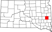
Towns Village Unincorporated
communitiesCategories:- Lake County, South Dakota
- National Register of Historic Places in South Dakota by county
- Buildings and structures in Lake County, South Dakota
-

Wikimedia Foundation. 2010.