- Maryland Route 948
-
Maryland Route 948
Route information Maintained by MDSHA Location Counties: Garrett, Allegany Highway system Maryland highway system
Interstate • US • State • Minor • Former • Turnpikes←  MD 946
MD 949  →
→Maryland Route 948 (MD 948) is a collection of unsigned state highways in the U.S. state of Maryland. These highways are service roads, state-maintained portions of county highways, and connectors in the vicinity of Interstate 68 in Garrett County and Allegany County. MD 948B, 948H, and 948K are located in Garrett County. The remaining nine sections of MD 948 are in Allegany County between Cumberland and the Washington County line.
- MD 948AD is the designation for a 0.20-mile (0.32 km) section of Pleasant Valley Road between MD 144 (National Pike) and the entrance to Rocky Gap State Park west of Flintstone. The state highway meets I-68 at Exit 50.[1][2]
- MD 948AE is the designation for a 0.18-mile (0.29 km) section of Rocky Gap Road at its overpass of I-68 and its eastern terminus at MD 144 east of Cumberland.[1][3]
- MD 948AF is the designation for a 0.29-mile (0.47 km) section of Jeffries Road at its overpass of I-68 east of Cumberland.[1][4]
- MD 948AL is the designation for a 0.49-mile (0.79 km) section of M.V. Smith Road around its interchange with I-68 east of Flintstone within Green Ridge State Forest. M.V. Smith Road meets I-68 at Exit 64.[1][5]
- MD 948AM is the designation for Flintstone Drive, a 0.61-mile (0.98 km) service road in Flintstone between a private driveway and the intersection of Flintstone Creek Road and Black Valley Road, which heads south from the four-way intersection as MD 948AO. MD 948AM provides access to the Exit 56 ramps to and from westbound I-68.[1][6]
- MD 948AO is the designation for a 0.31-mile (0.50 km) section of Black Valley Road between MD 144 (Old National Pike) and MD 948AM (Flintstone Drive) in Flintstone.[1][7]
- MD 948B is the designation for a 0.24-mile (0.39 km) section of Old Frostburg Road at its overpass of I-68 west of Finzel.[8][9]
- MD 948C is the designation for Sunset Orchard Road, a 0.39-mile (0.63 km) highway that leads to a group of communications towers west of Flintstone. The state highway begins at MD 144 just west of I-68 Exit 52 and spins off a long, two-way spur that leads to an entrance ramp to westbound I-68.[1][10]
- MD 948H is the designation for Diesel School Road, a 0.62-mile (1.00 km) service road east from US 219 just south of I-68 Exit 14 in Keyser's Ridge.[8][11]
- MD 948K is the designation for an unnamed 0.40-mile (0.64 km) service road that heads west from Pigs Ear Road west of Keyser's Ridge.[8][12]
- MD 948M is the designation for a 0.44-mile (0.71 km) section of West Wilson Road between Street Road and MD 144 west of Flintstone.[1][13]
- MD 948Y is the designation for a 0.37-mile (0.60 km) section of High Germany Road from U.S. Route 40 Scenic north to the Washington County line at Sideling Hill Creek near Little Orleans. MD 948Y meets I-68 at Exit 72.[1][14]
References
- ^ a b c d e f g h i "Highway Location Reference: Allegany County" (PDF). Maryland State Highway Administration. 2009. http://www.marylandroads.com/Location/2009_ALLEGANY.pdf. Retrieved 2010-11-09.
- ^ Google, Inc. Google Maps – Maryland Route 948AD (Map). Cartography by Google, Inc. http://maps.google.com/maps?f=d&source=s_d&saddr=Pleasant+Valley+Rd&daddr=Pleasant+Valley+Rd+NE&hl=en&geocode=FUSsXQId4OhP-w%3BFTq2XQIdbuJP-w&mra=ls&sll=39.696637,-78.650415&sspn=0.007578,0.01929&ie=UTF8&ll=39.694177,-78.650994&spn=0.007579,0.01929&t=h&z=16. Retrieved 2010-11-09.
- ^ Google, Inc. Google Maps – Maryland Route 948AE (Map). Cartography by Google, Inc. http://maps.google.com/maps?f=d&source=s_d&saddr=Rocky+Gap+Rd&daddr=Rocky+Gap+Rd&hl=en&geocode=FUyIXQId1ZRP-w%3BFc6BXQIdgJ5P-w&mra=ls&sll=39.68304,-78.667957&sspn=0.00379,0.009645&ie=UTF8&ll=39.683098,-78.669802&spn=0.00379,0.009645&t=h&z=17. Retrieved 2010-11-09.
- ^ Google, Inc. Google Maps – Maryland Route 948AF (Map). Cartography by Google, Inc. http://maps.google.com/maps?f=d&source=s_d&saddr=Jeffries+Rd+NE&daddr=Jeffries+Rd+NE&hl=en&geocode=FVRJXQId3ApP-w%3BFeVYXQIdxg5P-w&mra=ls&sll=39.672008,-78.705053&sspn=0.000474,0.001206&ie=UTF8&t=h&z=16. Retrieved 2010-11-09.
- ^ Google, Inc. Google Maps – Maryland Route 948AL (Map). Cartography by Google, Inc. http://maps.google.com/maps?f=d&source=s_d&saddr=M+V+Smith+Rd+NE&daddr=Mv+Smith+Rd+NE&hl=en&geocode=Fa8_XQId1CBT-w%3BFbVVXQId_hRT-w&mra=ls&sll=39.665405,-78.437222&sspn=0.001895,0.004823&ie=UTF8&t=h&z=16. Retrieved 2010-11-09.
- ^ Google, Inc. Google Maps – Maryland Route 948AM (Map). Cartography by Google, Inc. http://maps.google.com/maps?f=d&source=s_d&saddr=Flintstone+Dr+NE&daddr=Flintstone+Dr+NE&hl=en&geocode=FdniXQIdbgBR-w%3BFdrjXQIdICpR-w&mra=ls&sll=39.706427,-78.570528&sspn=0.001894,0.004823&ie=UTF8&t=h&z=16. Retrieved 2010-11-09.
- ^ Google, Inc. Google Maps – Maryland Route 948AO (Map). Cartography by Google, Inc. http://maps.google.com/maps?f=d&source=s_d&saddr=Flintstone+Creek+Rd&daddr=Flintstone+Dr+NE&hl=en&geocode=FSzTXQIdoiVR-w%3BFdrjXQIdICpR-w&mra=ls&sll=39.705965,-78.569283&sspn=0.007577,0.01929&ie=UTF8&ll=39.70547,-78.56746&spn=0.007577,0.01929&t=h&z=16. Retrieved 2010-11-09.
- ^ a b c "Highway Location Reference: Garrett County" (PDF). Maryland State Highway Administration. 2009. http://www.marylandroads.com/Location/2009_GARRETT.pdf. Retrieved 2010-11-09.
- ^ Google, Inc. Google Maps – Maryland Route 948B (Map). Cartography by Google, Inc. http://maps.google.com/maps?f=d&source=s_d&saddr=Old+Frostburg+Rd&daddr=Old+Frostburg+Rd&hl=en&geocode=Fdh-XQIdDIZK-w%3BFR-MXQIdg4pK-w&mra=ls&sll=39.68247,-79.001902&sspn=0.00379,0.009645&ie=UTF8&ll=39.683453,-79.001527&spn=0.00379,0.009645&t=h&z=17. Retrieved 2010-11-09.
- ^ Google, Inc. Google Maps – Maryland Route 948C (Map). Cartography by Google, Inc. http://maps.google.com/maps?f=d&source=s_d&saddr=MD-144+E%2FBaltimore+Pike%2FNational+Pike+NE&daddr=Sunset+Orchard+Rd+NE&hl=en&geocode=FbjYXQIdXjNQ-w%3BFWHoXQIduUFQ-w&mra=ls&sll=39.708821,-78.626093&sspn=0.000947,0.002411&ie=UTF8&t=h&z=16. Retrieved 2010-11-09.
- ^ Google, Inc. Google Maps – Maryland Route 948H (Map). Cartography by Google, Inc. http://maps.google.com/maps?f=d&source=s_d&saddr=US-219+N%2FGarrett+Hwy&daddr=Dia+School+Rd%2FDiesel+School+Rd&hl=en&geocode=FSyIXQIdFq1G-w%3BFSaOXQIdQtFG-w&mra=ls&sll=39.685548,-79.245079&sspn=0.000947,0.002411&ie=UTF8&ll=39.684485,-79.250114&spn=0.00758,0.01929&t=h&z=16. Retrieved 2010-11-09.
- ^ Google, Inc. Google Maps – Maryland Route 948K (Map). Cartography by Google, Inc. http://maps.google.com/maps?f=d&source=s_d&saddr=Old+Pigs+Ear+Rd&daddr=Pigs+Ear+Rd&hl=en&geocode=FX3JXQIdS8VF-w%3BFTrPXQIdXOBF-w&mra=ls&sll=39.701165,-79.313784&sspn=0.007578,0.01929&ie=UTF8&ll=39.702152,-79.311032&spn=0.007578,0.01929&t=h&z=16. Retrieved 2010-11-09.
- ^ Google, Inc. Google Maps – Maryland Route 948M (Map). Cartography by Google, Inc. http://maps.google.com/maps?f=d&source=s_d&saddr=Street+Rd+NE&daddr=Unknown+road&hl=en&geocode=FYDjXQIdqIRQ-w%3BFcPmXQIdcaNQ-w&mra=ls&sll=39.708738,-78.602543&sspn=0.007577,0.01929&ie=UTF8&t=h&z=17. Retrieved 2010-11-09.
- ^ Google, Inc. Google Maps – Maryland Route 948Y (Map). Cartography by Google, Inc. http://maps.google.com/maps?f=d&source=s_d&saddr=Unknown+road&daddr=High+Germany+Rd&hl=en&geocode=FfjZXQId7stU-w%3BFYHnXQIdEMJU-w&mra=ls&sll=39.708623,-78.32752&sspn=0.007577,0.01929&ie=UTF8&ll=39.706444,-78.330846&spn=0.007577,0.01929&t=h&z=16. Retrieved 2010-11-09.
External links
Roads in Allegany County, Maryland State highways 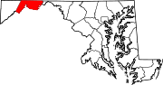
U.S. Highways Interstate Highways Roads in Garrett County, Maryland State highways 
U.S. Highways Interstate Highways Categories:- State highways in Maryland
- Roads in Allegany County, Maryland
- Roads in Garrett County, Maryland


Wikimedia Foundation. 2010.