- Roads and freeways in metropolitan Phoenix
-
 All freeways within the Metropolitan Phoenix region
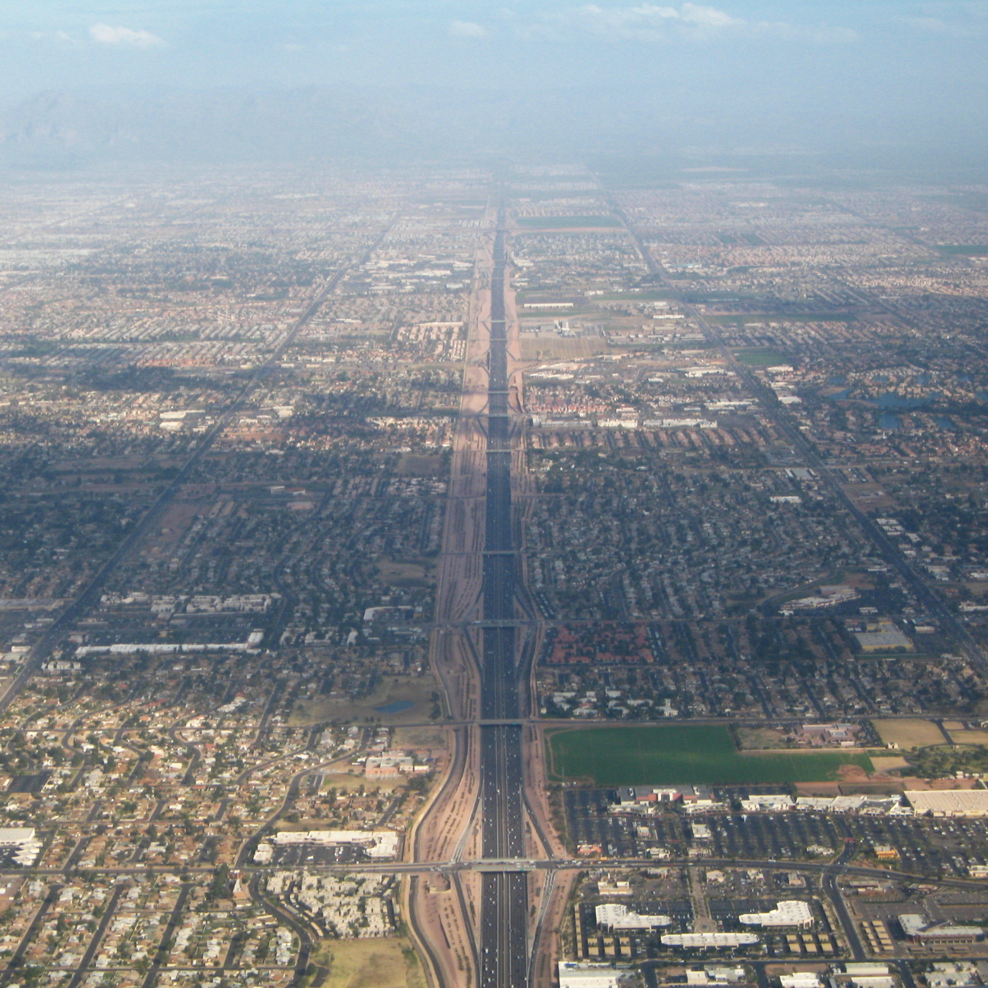
The metropolitan area of Phoenix in the U.S. state of Arizona contains one of the nation's largest and fastest growing freeway systems, boasting over 1,405 lane miles as of 2005.[1]
Due to the lack of any form of mass transit besides bus prior to 2008, the Phoenix Metropolitan Area has remained a very automobile-dependent city, with its first freeway opening in 1958—a year preceding most cities' first freeway openings. Coupled with the explosive growth of the region and adequate funding, the result is one of the nation's most expansive freeway networks.
The backbone of Phoenix's freeway system is composed of three major freeways—Interstate 10, Interstate 17, and U.S. Route 60. Interstate 10, being a transcontinental route between California and Florida, is the most heavily traveled freeway in the Valley of the Sun. Interstate 17 runs down the center of Arizona, connecting Phoenix with Sedona, Prescott, Flagstaff and the Grand Canyon. U.S. Route 60 spans most of the country, but is only a controlled-access highway for a few short stints, one of them being in the Valley. It shuttles travelers to cities such as Wickenburg, Las Vegas (by way of a connection in Wickenburg with U.S. Route 93), and Globe. In addition to these three freeways, two beltways, Routes 101 and 202, loop around Phoenix and Mesa respectively. State Route 51 connects Downtown with the northern reaches of the city, and Arizona State Route 143 is a distributor for Phoenix Sky Harbor International Airport.
Phoenix freeways are funded primarily by local sales tax dollars rather than federal money, so newer freeways were, and are, given state route designation as opposed to interstate designation. Primarily due to this, Phoenix is the largest city in the United States to have two Interstate Highways and no 3-digit interstates.[2]
Contents
Existing freeways
Interstate 10
 I-10 west at The Split interchange with I-17 north
Papago Freeway
This is Arizona's widest and most congested freeway,[3] entering the metropolitan area on its western edge in the city of Buckeye as the Papago Freeway. It continues eastward through the cities of Goodyear, Avondale, and Tolleson; where it has an interchange with northbound Loop 101. Following Tolleson, I-10 reaches Phoenix's western city limits, and as it approaches downtown, there is a four-level symmetrical stack interchange with Interstate 17 known by locals as The Stack. The freeway proceeds eastward through a tunnel constructed under a city park before it reaches the Mini Stack interchange with Loop 202 and SR 51. Turning southward at this interchange, I-10 runs adjacent to Sky Harbor International Airport before an interchange with the southern terminus of I-17. There are numerous construction projects along Interstate 10 spanning both east and westbound from around Dysart Road in Avondale, to Verrado Way in Buckeye. The projects are expected to convert the current 4 lane divided freeway into a 10 lane divided freeway. The final phase of the project is anticipated to be complete around late 2011. During construction drivers can expect weekly delays, closed stretches of roadway, closed exits, and a slowed speed limit. When completed (along with the anticipation of the completion of state route 801) Traffic coming in and out of Phoenix is anticipated to be less congestive, and easier to manage.[4]Maricopa Freeway
After this second I-17 interchange, I-10 is known as the Maricopa Freeway, presumably after the Native American tribe. It regains its primary eastward direction as it crosses the Salt River, but after meeting SR 143 it turns south again via what is dubbed by locals as the Broadway Curve.[5] I-10 is now in the city of Tempe, where an interchange with US 60 is located. The freeway enters its final city in the Valley of the Sun, Chandler. In Chandler, Loop 202 intersects I-10 at another four-level symmetrical stack interchange before the freeway enters the Gila River Indian Community and continues on through the undeveloped stretch of desert between Phoenix and the fast-growing town of Casa Grande before making its way towards the Tucson metropolitan area.[6]Interstate 17
Black Canyon Freeway
I-17 enters the valley from the north as the Black Canyon Freeway, in the New River and Anthem area before a four-level interchange with Loop 101. It then continues directly southward on the 27th and 25th Avenue alignments in northern Phoenix, passing Metrocenter Mall as it heads directly for downtown. Another four-level stack awaits I-17 when it meets Interstate 10 immediately northwest of downtown at The Stack.Maricopa Freeway
At Durango Street, in the segment of freeway known as the Durango Curve, the highway turns eastward, becoming the Maricopa Freeway, and provides a southerly bypass of downtown before meeting I-10 again near Sky Harbor and terminating. Interstate 17 was the Valley's first freeway, with maps showing a road built to Interstate Highway standards route by 1961 in some segments.[7]Arizona State Route 51
Piestewa Freeway
The Piestewa Freeway begins at the Mini Stack interchange with I-10 and Loop 202, and proceeds north through Phoenix towards Piestewa Peak (formerly known as Squaw Peak). After passing near Paradise Valley, Route 51 reaches its northern terminus at Loop 101.This freeway was formerly known as the Squaw Peak Parkway, but since "Squaw" is regarded as a derogatory term for Native American women, the Arizona Board of Geographic and Historic Names rechristened the route "Piestewa" Freeway after Lori Piestewa, a Native American woman who died in the 2003 invasion of Iraq. The name change was controversial, with most residents still referring to both the freeway and the landmark peak as Squaw Peak.[8]
U.S. Route 60
 View east along US 60, Mesa
Superstition Freeway
US 60 enters the Valley of the Sun within Pinal County borders in Apache Junction. After crossing into Maricopa County and into east Mesa, a four-level interchange dubbed the SuperRedTan awaits motorists. This interchange, completed in 2007, provides access to the Red Mountain and Santan Freeway segments of Loop 202. Continuing westward past the interchange, the freeway passes through the heart of Mesa before meeting Loop 101 and eventually duplexing with westbound I-10 near Tempe.[9]Arizona State Route 143
Hohokam Expressway
Originally signed as Business I-10, the Hohokam Expressway is a relatively short north–south freeway that runs east of Sky Harbor International Airport, between Loop 202 and Interstate 10. Its primary purpose is to distribute east side airport traffic onto Loop 202 and I-10 without utilizing stop-and-go surface streets. There are no current plans to upgrade or reconstruct any portions of the nearly four-mile expressway.[10]Loop 101
Agua Fria Freeway
Loop 101 begins in the city of Tolleson as the Agua Fria Freeway at a junction with Interstate 10. Proceeding northward through the West Valley cities of Glendale and Peoria, Loop 101 turns eastward along the Beardsley Road alignment. In the northern section of Phoenix, there is an interchange with Interstate 17, which is where the Pima Freeway segment begins.[11]Pima Freeway
Remaining eastbound, the freeway meets the northern terminus of Route 51, continues eastbound, and then turns southward, passing through the northern part of Scottsdale. It then continues south along the relatively undeveloped border between Scottsdale and the Salt River Pima-Maricopa Indian Community.[12] Loop 101 meets no freeways again until the Loop 202 four-level stack, which is located partially over the Salt River to create the state's longest bridge, at more than one mile in total length over water.[13]Price Freeway
Proceeding southward as the Price Freeway, Loop 101 enters Tempe and encounters a junction with US 60 before entering Chandler and terminating at Loop 202.[14]Loop 202
Red Mountain Freeway
The Red Mountain Freeway begins at the Mini Stack junction with Route 51 and Interstate 10 before heading east into Tempe. Route 143 and Loop 101 intersect the Red Mountain Freeway at various points in the city prior to the road entering the northern reaches of Mesa, where it had temporarily ended at Power Road. The final segment of the Red Mountain Freeway from Power Road to University Drive is open as of July 21, 2008.[15] The freeway then continues due southward towards US 60, until it bisects it at the SuperRedTan Interchange. Loop 202 then becomes the Santan Freeway.Santan Freeway
The Santan Freeway segment comprises the southern half of the Loop 202 partial beltway and begins at US 60, heading south into the town of Gilbert. Turning westward near Phoenix-Mesa Gateway Airport, the freeway passes through Chandler with an interchange at the southern terminus of Loop 101. Loop 202 proceeds westward, following the Pecos Road alignment until meeting its current terminus at I-10—where an interchange was built with Loop 202 expansion westward in mind.[16]Former freeway
Arizona State Route 153
Sky Harbor Expressway
The Sky Harbor Expressway was a small remnant of the old northern alignment of Route 143. Beginning at Washington St., the former expressway heads south, under the Union Pacific Railroad, to an interchange with the airport entrance, before a bridge over the Salt River parallel to and just a few hundred feet away from the bridge on Route 143. The former expressway then ends at University Avenue with no further planned extension to Interstate 10.Route 153 was deleted from the Regional Transportation Plan starting in May 2007,[17] and much of the western half of the original alignment was re-used as right-of-way for the Sky Train people mover at Phoenix Sky Harbor International Airport.
Cancelled freeway
Arizona State Route 50
State Route 50
Location: Phoenix–Glendale Paradise Parkway
Route 50 was part of Proposition 300 in 1985, but was removed from the system in December 1994, when then Arizona governor Fife Symington made some funding cuts that included removal of the Paradise Parkway and Estrella Freeway from the system entirely. (The Estrella Freeway was re-added to the system when Proposition 400 was passed ten years later in 2004.) Route 50 will not be re-added to the system, because in February 1996 the ADOT auctioned off all the right-of-way it had purchased for the freeway, which was to be located between Loop 101 and Route 51 in the Central Valley.[18]Browse numbered routes ←  SR 48
SR 48AZ SR 51  →
→Proposed and future freeways
Interstate 11
Hassayampa Freeway
Interstate 11 is a proposed Interstate Highway in the United States to run from Tonopah, Arizona northwest to Las Vegas, Nevada by way of Kingman, Arizona. The highway would parallel existing U.S. 93 north of Wickenburg, Arizona; south of Wickenburg, it would follow a new freeway near the Hassayampa River and is part of a long-range vision for the Valley's future transportation needs, as defined by the Maricopa Association of Governments and ADOT.[19] There is no identified funding for this facility and no formal studies have been initiated.
Arizona State Route 24
Gateway Freeway
This is a proposed freeway in the Southeast Valley that would connect the Santan Freeway segment of Loop 202 near Phoenix-Mesa Gateway Airport to US 60 or another highway alignment in western Pinal County. Route 24 (former SR 802) is currently under study; a public hearing on the draft environmental assessment was held in Fall 2010.[20]
Arizona State Route 30
I-10 Reliever
This proposed east–west freeway would hopefully remove some West Valley I-10 motorists in an attempt decrease traffic along the frequently congested Interstate. Its western beginning would be at Route 85, and it would run east to encounter proposed Loop 303, and continue through to end at Loop 202's proposed South Mountain Freeway segment. Construction of the proposed Route 30 (former SR 801), would, if the freeway is approved, begin sometime in the early 2020s, based on funding and planning by the Maricopa Association of Governments.[21]
Arizona State Route 85
State Route 85
Route 85 is an existing two-lane road, with one lane for northbound traffic and one lane for southbound traffic. This setup continues for the road's entire length, which is between Interstate 10 and Interstate 8. However some sections are being expanded to a four lane divided highway, because of traffic counts on Route 85 that are projecting to double by twenty years, a long range goal of transforming this rural two-lane highway into a full-fledged freeway was implemented. This will be done by twelve individual projects, each which will add two lanes of interim roadway aside the existing two-lane roadway with the goal of a freeway-style upgrade in mind.[22]
Loop 202
South Mountain Freeway
The South Mountain Freeway is a proposed southerly bypass of Downtown Phoenix which would do so by cutting through South Mountain Park and abutting the southern edge of the Ahwatukee neighborhood of Phoenix. It would begin at the already complete traffic interchange of the Santan Freeway and Interstate 10. Heading west along the Pecos Road alignment through Ahwatukee, the freeway would straddle the border with the Gila River Indian Reservation. Turning northwest and eventually north, the South Mountain Freeway would follow the 55th Avenue alignment north to its terminus with Interstate 10 in west Phoenix. This freeway has long considered to be the missing link by the region's planners because of the need to better move regional traffic, in addition to a better option for vehicles to avoid metro Phoenix. [23]
ADOT revealed in a press release in the Arizona Republic on March 9, 2009, that the fate of the South Mountain Freeway will not be decided until at least 2011 due to a need for the Maricopa Association of Governments to first balance a $5.3 billion budget shortfall in the region's 20-Year Transportation Plan.[24]
Until then, the proposed final segment of Loop 202 is under a Design Concept Report and Environmental Impact Statement analysis, which when completed around 2011 would allow the construction of this freeway to begin sometime between then and 2015, if at all. Community opposition, mainly from residents of Ahwatukee. While the Maricopa Association of Governments had considered building a limited access parkway or arterials along the South Mountain Freeway's proposed route, the eight-lane freeway concept ultimately was pushed by the region's planners to meet the traffic needs at close to the same cost. For most of 2010, the Gila River Indian Community, Maricopa Association of Governments, City of Phoenix, ADOT and others have been discussing movement of the alignment to tribal land, but no agreements have yet been reached.[25] [26] [27]
Loop 303
Bob Stump Memorial Freeway (Estrella Freeway)
The Bob Stump Memorial Freeway will begin at a stack interchange with I-17 south of the Route 74 exit. Continuing west, Loop 303 will be in northern Phoenix until the proposed interchange with Lake Pleasant Parkway when it turns southwest into Peoria. The section between Happy Valley Road to the Route 74 area opened to traffic May 13, 2011 as a controlled access freeway. The freeway will then have a full interchange with US 60 as it enters Surprise, heading exactly south. Passing through Glendale into Goodyear, it will end at a stack interchange with I-10.[28]
South of the proposed junction with Interstate 10, Loop 303 is currently under study to see if it is feasible to build an extension of the route to proposed Route 30. The final design concept report for the new freeway is due in late 2009/early 2010.[28]
Named interchanges and features
The table below lists commonly used colloquialisms and nicknames for several interchanges and portions within the freeway system.
Name[29] Feature Type Freeway(s) Involved Location AADT[30] Year[31] Aerial Broadway Curve Direction change  I-10 (Maricopa Freeway)
Tempe 294,000 1968 [1] Dreamy Draw Mountain pass SR 51 (Piestewa Freeway)Phoenix 134,000 1995 [2] Durango Curve Direction change  I-17 (Black Canyon Freeway)
Phoenix 119,000 1963 [3] Mini Stack 4-level Interchange  I-10 / SR 51 / SR 202
Phoenix 303,000 1990 [4] North Stack 4-level Interchange  I-17 / SR 101
Phoenix 210,000 2001 [5] Papago Freeway Tunnel Vehicular tunnel I-10 (Papago Freeway)Phoenix 275,000 1990 [6] SuperRedTan 4-level Interchange  SR 202 / US 60
Mesa 198,000 2007 [7] Superstition Transition 3-level Interchange I-10 / US 60Tempe 257,000 1970 [8] The Split 3-level Interchange I-10 / I-17Phoenix 200,000 1988 [9] The Stack 4-level Interchange I-10 / I-17Phoenix 230,000 1990 [10] Funding
Phoenix has been expanding its highway system since 1985, when voters passed Proposition 300, which established a half-cent general sales tax to fund new urban freeways that were currently in the Regional Transportation Plan. At the time, this included the unbuilt or partially unbuilt: Sky Harbor Expressway, I-10, Route 51, Route 143, Loop 101, and Loop 202. Most of these were completed by 2005, with Loop 202 being in the final stage of construction.[32]
In 1994, voters in Maricopa County voted against Proposition 400, which would have extended the half-cent sales tax extension from 2006 through 2016 had it been passed. Half of this additional funding would have been used for improvements in mass transit as well as new freeways. But because of the defeat, there was no funding beyond fiscal year 2006, regardless of if the Regional Transportation Plan was completed or not.[32]
In 1996, the Maricopa Association of Governments Regional Council passed a series of bills provided funding for a Long Range Plan between fiscal years 2007 and 2015. The Red Mountain Freeway, Santan Freeway, and Sky Harbor Expressway segments, all of which were previously unfunded, became prioritized with construction commencing almost immediately.[32]
In 1999, even more funding was given to accelerate construction of the Regional Transportation Plan by the State Legislature, which passed a bill called the "2007 Acceleration Plan". This bill forced the State Infrastructure Bank to assist in funds, which assisted in pushing the completion of Regional Transportation Plan forward to the end of 2007.[32]
With the transportation tax set to expire in 2006, a revived Proposition 400 was put before the voters of Maricopa County in 2004, ten years after the original vote ended in failure. Proposing an identical half-cent extension of the sales tax, the new proposition would extend the tax a full twenty years as opposed to the original ten.[33] Unlike its predecessor, the proposition passed by a wide 58-42% margin and established funding for several future projects including highways and mass transit. A similar but much more wide-reaching proposal to enact a full one-cent sales tax increase over a thirty-year period on a statewide level, much of which would have gone to funding Phoenix area projects, failed to qualify for the 2008 general election ballot due to issues with the petition.[34]
However, the 1985 plan was not fully completed by 2007 due to the lingering unfinished segment of Loop 202 between University Avenue and Power Road in Mesa, where work wrapped up on July 21, 2008.[15]
Ramp metering
The Phoenix freeway system heavily utilizes ramp meters, with 121 currently operational in the metropolitan area. Since their implementation in the 1980s, the goal of these has remained to "break up platoons" of cars by limiting the number that can enter a freeway at a time. The Arizona Department of Transportation (ADOT) states that this has been "tremendously successful".[35]
Travel times program
On January 22, 2008, a test program was begun by ADOT which involved the placement of travel times to popular commuter destinations on variable message signs along inbound freeway routes during the morning peak hours and outbound routes in the evening. These signs will only be activated on weekdays during peak travel hours (6am to 9am and 3pm to 7pm) and will not appear if there is a more urgent message to display; such as an Amber Alert or other emergency. If these signs gain motorist approval within their trial, then they might be expanded to include all Valley freeways and continued for years thereafter.[36]
See also
- Transportation in Arizona
- Arizona Department of Transportation
- Valley Metro (Phoenix)
- Maricopa Association of Governments
References
- ^ Artibise, Yuri; Gammage Jr., Grady; Welch, Nancy (2008-09-07). "Transformation into Big City has Benefits, Burdens". Arizona Republic. http://www.azcentral.com/arizonarepublic/viewpoints/articles/2008/09/07/20080907vip-lavsphx0907.html. Retrieved 2008-10-12.
- ^ "Freeways and Expressways". National Association of Realtors. http://neighborhoods.realtor.com/AZ/Phoenix/Phoenix/442624/Transportation. Retrieved 2008-09-12.
- ^ "Arizona AADT" (Excel). Arizona Department of Transportation. http://mpd.azdot.gov/data/documents/SHSAADT060808.xls. Retrieved 2009-01-31.[dead link]
- ^ "Interstate 10 (Papago Freeway)". Arizona Department of Transportation. http://www.dot.state.az.us/Highways/Valley_Freeways/I10/Papago/index.asp. Retrieved 2008-10-12.
- ^ Golfen, Bob (2007-02-16). "Tempe Pushes for 24 Lanes on Broadway Curve". Arizona Republic. http://www.azcentral.com/arizonarepublic/local/articles/021624lane0216.html. Retrieved 2008-10-12.
- ^ "Interstate 10 (Maricopa Freeway)". Arizona Department of Transportation. http://www.dot.state.az.us/Highways/Valley_Freeways/I10/Maricopa/index.asp. Retrieved 2008-10-12.
- ^ Arizona State Highway Department (1961). Arizona Road Map (Map). Cartography by Rand McNally. http://www.arizonaroads.com/maps/index.html. Retrieved 2008-09-12.
- ^ Legon, Jeordan (2005). "Mom, Soldier and Hopi Indian: 'She Fought and Died Valiantly'". CNN. http://edition.cnn.com/SPECIALS/2003/iraq/heroes/piestewa.html. Retrieved 2008-09-12.
- ^ "US 60 (Superstition Freeway)". Arizona Department of Transportation. http://www.dot.state.az.us/Highways/Valley_Freeways/US60/Superstition/index.asp. Retrieved 2008-10-12.
- ^ "State Route 143 (Hohokam Expressway)". Arizona Department of Transportation. http://www.valleyfreeways.com/Highways/Valley_Freeways/SR143/index.asp. Retrieved 2008-09-12.
- ^ "Loop 101 (Agua Fria Freeway)". Arizona Department of Transportation. http://www.dot.state.az.us/Highways/Valley_Freeways/Loop_101/Agua_Fria/index.asp. Retrieved 2008-10-12.
- ^ SRPMIC Community Map
- ^ "Loop 101 (Pima Freeway)". Arizona Department of Transportation. http://www.dot.state.az.us/Highways/Valley_Freeways/Loop_101/Pima/index.asp. Retrieved 2008-10-12.
- ^ "Loop 101 (Price Freeway)". Arizona Department of Transportation. http://www.dot.state.az.us/Highways/Valley_Freeways/Loop_101/Price/index.asp. Retrieved 2008-10-12.
- ^ a b Thomason, Art (2008-07-08). "Freeway Opening Scheduled for July 21". Arizona Republic. http://www.azcentral.com/news/articles/2008/07/08/20080708mr-freeway0709.html. Retrieved 2008-07-10.
- ^ "Loop 202 (Santan Freeway)". Arizona Department of Transportation. http://www.dot.state.az.us/Highways/Valley_Freeways/Loop_202/Santan/index.asp. Retrieved 2009-01-30.
- ^ "Major Amendment to Regional Transportation Plan Approved". Maricopa Association of Governments. http://www.mag.maricopa.gov/detail.cms?item=7482. Retrieved 2008-09-12.
- ^ Waters, Mark. "Valley Freeway System" (Flash). Arizona Republic. http://www.azcentral.com/flash/loop101/freeways.html. Retrieved 2008-09-12.
- ^ Clancy, Michael (2010-05-04). "Phoenix Committee to Discuss Interstate 11 Proposal". Arizona Republic. http://www.azcentral.com/community/phoenix/articles/2010/05/04/20100504phoenix-interstate-11-proposal.html. Retrieved 2010-06-26.
- ^ "State Route 802 (Williams Gateway Freeway)". Arizona Department of Transportation. http://www.azdot.gov/Highways/Valley_Freeways/SR802/index.asp. Retrieved 2008-01-21.
- ^ "State Route 801". Arizona Department of Transportation. Archived from the original on December 11, 2007. http://web.archive.org/web/20071211005000/http://www.azdot.gov/Highways/Valley_Freeways/SR801/index.asp. Retrieved 2008-01-21.
- ^ "State Route 85 - Fact Sheet". Arizona Department of Transportation. Archived from the original on January 10, 2008. http://web.archive.org/web/20080110230606/http://www.azdot.gov/Highways/Projects/SR85/FactSheet.asp. Retrieved 2008-01-21.
- ^ "Loop 202 (South Mountain Freeway)". Arizona Department of Transportation. http://www.azdot.gov/Highways/Valley_Freeways/Loop_202/South_Mountain/project_planning.asp. Retrieved 2010-12-11.
- ^ Creno, Cathryn (2009-03-09). "Freeway Decision Put Off Until 2011". Arizona Republic. http://www.azcentral.com/arizonarepublic/local/articles/2009/03/09/20090309phxsmfreeway0309.html. Retrieved 2008-03-09.
- ^ "Loop 202 (South Mountain Freeway)". Arizona Department of Transportation. http://www.azdot.gov/Highways/Valley_Freeways/Loop_202/South_Mountain/project_planning.asp. Retrieved 2008-01-21.
- ^ Sparks, Colleen (2008-04-18). "Environmental Impact of South Mountain Freeway Debated". Arizona Republic. http://www.azcentral.com/news/articles/2008/04/18/20080418ar-freeway0418.html. Retrieved 2009-01-20.
- ^ Maricopa Association of Governments Transportation Policy Committee Presentation 2009-01-23
- ^ a b "Loop 303 North of I-10". Arizona Department of Transportation. http://www.azdot.gov/Highways/Valley_Freeways/Loop_303/North/index.asp. Retrieved 2008-01-21.
- ^ "Traffic Terms". KJZZ. http://kjzz.org/news/traffic/terms. Retrieved 2008-03-17.
- ^ "Arizona AADT" (Excel). Arizona Department of Transportation. http://tpd.azdot.gov/data/documents/SHSAADT0707.xls. Retrieved 2008-10-15.[dead link]
- ^ "About Valley Freeways". Arizona Department of Transportation. http://www.valleyfreeways.com/Highways/Valley_Freeways/About.asp. Retrieved 2008-10-15.
- ^ a b c d "Introduction to the Phoenix Urban Area Regional Freeway System". Arizona Department of Transportation. http://www.azdot.gov/Highways/RFS/History.asp. Retrieved 2008-01-21.
- ^ "2005 Annual Report on the Status of the Implementation of Proposition 400" (PDF). Maricopa Association of Governments. http://www.mag.maricopa.gov/pdf/cms.resource/ANNUALREPORT89292.pdf. Retrieved 2008-08-27.
- ^ "Ruling Keeps Roads, Land Measures off Ariz. Ballot". Arizona Republic. http://www.azcentral.com/news/articles/2008/08/26/20080826ballot-measures0826-ON.html. Retrieved 2008-08-27.
- ^ Cambridge Systematics, Inc. (2002-05-13). "8.0: Secondary Research" (PDF). Twin Cities Ramp Meter Evaluation – Final Report. Minnesota Department of Transportation. pp. 8.5–8.6. http://www.dot.state.mn.us/rampmeterstudy/pdf/finalreport/8.pdf. Retrieved 2008-01-21.
- ^ "ADOT now provides freeway travel...". Arizona Department of Transportation. Archived from the original on 2008-02-02. http://web.archive.org/web/20080202104215/http://www.az511.com/dtt/index.php. Retrieved 2008-01-24.
External links
- Urban Freeways - Arizona Roads
- Phoenix Highway Guide
- Valley Freeways
- Metro Phoenix Freeways Interactive Map
- AARoads
Roads and freeways in metropolitan Phoenix Radial Papago/Maricopa (I-10) • Black Canyon (I-17) • Piestewa (AZ 51) • Superstition (US 60) • Williams Gateway (AZ 24) • I-10 Reliever (AZ 30) • Sky Harbor (Former AZ 153)Circumferential Interchanges and other Categories:- Freeways in the Phoenix metropolitan area
- Transportation in Phoenix, Arizona


Wikimedia Foundation. 2010.