- Quinnipiac River Historic District
-
Quinnipiac River Historic District
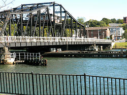 Grand Avenue Bridge (1896).
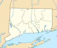

Location: Roughly bounded by Quinnipiac Ave., Lexington, Chapel, Ferry, Pine, Front, and Lombard Sts., New Haven, Connecticut Coordinates: 41°18′35″N 72°52′59″W / 41.30972°N 72.88306°WCoordinates: 41°18′35″N 72°52′59″W / 41.30972°N 72.88306°W Area: 313 acres (127 ha) Architectural style: Greek Revival, Italianate, Queen Anne Governing body: Local NRHP Reference#: 84001139[1] Added to NRHP: June 28, 1984 Quinnipiac River Historic District is a 313-acre (127 ha) historic district straddling the Quinnipiac River in the Fair Haven and Fair Haven Heights neighborhoods of New Haven, Connecticut.
It was listed on the U.S. National Register of Historic Places in 1984. At that time it included 524 contributing buildings, an inland wetland at the mouth of Hemingway Creek on the northeast corner of the district, and the Grand Avenue Swing Bridge over the Quinnipiac River connecting Fair Haven with Fair Haven Heights at the center of the district and previously identified as being NRHP-eligible.[1][2]
Gallery
-

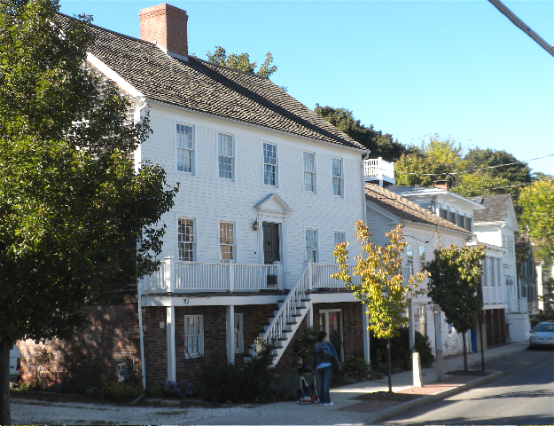
Original Stephen Rowe’s tavern and store (1804), 182 Front St., and other houses of the early 19th century oystering village on Front St. north of the Grand Ave. Bridge.
-

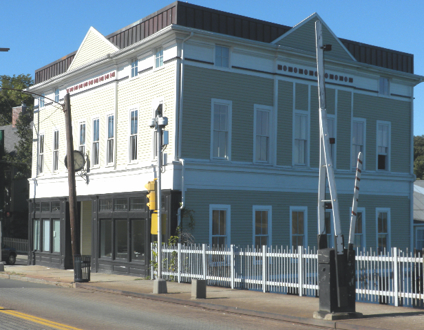
King's Block (1816), 20 Grand Ave.
-
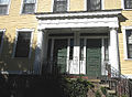
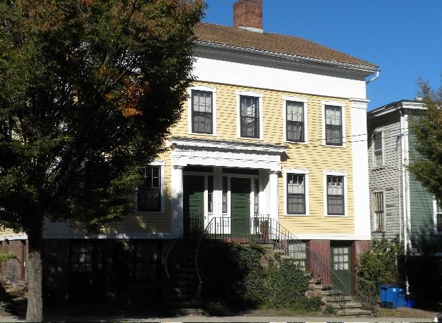
Recessed Doric porch of double Greek revival house, 37-39 Grand Avenue, Fair Haven.
-
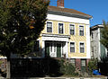
Double Greek revival house, 37-39 Grand Avenue.
-

One Grand Ave. (1890s)
References
- ^ a b "National Register Information System". National Register of Historic Places. National Park Service. 2009-03-13. http://nrhp.focus.nps.gov/natreg/docs/All_Data.html.
- ^ Kate Ohno and John Herzan (1983). "National Register of Historic Places Inventory-Nomination: Quinnipia River Historic District". National Park Service. http://pdfhost.focus.nps.gov/docs/NRHP/Text/84001139.pdf. and Accompanying 37 photos, from 1983 and historic
External links
- New Haven Preservation Trust: Quinnipiac River Historic District, with text adapted from NRHP application document plus gallery of 8 photos
- Quinnipiac River Village
U.S. National Register of Historic Places Topics Lists by states Alabama • Alaska • Arizona • Arkansas • California • Colorado • Connecticut • Delaware • Florida • Georgia • Hawaii • Idaho • Illinois • Indiana • Iowa • Kansas • Kentucky • Louisiana • Maine • Maryland • Massachusetts • Michigan • Minnesota • Mississippi • Missouri • Montana • Nebraska • Nevada • New Hampshire • New Jersey • New Mexico • New York • North Carolina • North Dakota • Ohio • Oklahoma • Oregon • Pennsylvania • Rhode Island • South Carolina • South Dakota • Tennessee • Texas • Utah • Vermont • Virginia • Washington • West Virginia • Wisconsin • WyomingLists by territories Lists by associated states Other Categories:- Historic districts in Connecticut
- National Register of Historic Places in Connecticut
- Italianate architecture in Connecticut
- Greek Revival architecture in Connecticut
- Queen Anne architecture in Connecticut
- Fair Haven (New Haven)
- Historic districts in New Haven, Connecticut
- Connecticut Registered Historic Place stubs
-


Wikimedia Foundation. 2010.