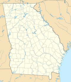
- Downtown Athens Historic District
-
Downtown Athens Historic District
Location: Roughly bounded by Hancock Ave., Foundry, Mitchell (original); Roughly bounded by Hancock Ave., Foundry, Mitchell, Broad, and Lumpkin sts. (increase); Roughly bounded by Dougherty St., Thomas St., Hickory St., Broad St. South St. and Pulaski St. (increase II)
Athens, GeorgiaCoordinates: 33°57′30″N 83°22′25″W / 33.95833°N 83.37361°WCoordinates: 33°57′30″N 83°22′25″W / 33.95833°N 83.37361°W Area: 40 acres (16 ha), 1 acre (0.40 ha), and 24 acres (9.7 ha) Built: 1833, 1841, other Architect: Brown, A. Ten Eyck (revision 2) Architectural style: Early Commercial, Renaissance, Greek Revival (original); Federal, Greek Revival (revision 2) Governing body: Local, Private, and U.S. POSTAL SERVICE NRHP Reference#: 78000974, 84000965, and 06000737[1] Added to NRHP: August 10, 1978 (original)
May 31, 1984 (increase)
August 18, 2006 (revision 2)The Downtown Athens Historic District is a historic area in Athens, Georgia, United States. It was listed on the National Register of Historic Places in 1978. Its boundaries were revised twice, in 1984 and 2006, and additional documentation was filed in 2006.[1] It is in the Downtown Athens, Georgia neighborhood.
The original listing includes Early Commercial architecture, Renaissance architecture, and Greek Revival architecture in 82 contributing buildings and 2 contributing buildings in a 40-acre (16 ha) area roughly bounded by Hancock Ave., Foundry, and Mitchell. It includes work dating back to 1833. It includes the Franklin House and the Clarke County Courthouse which are separately listed on the National Register. Historic functions served include rail transportation, dwelling, and commerce/trade.
The boundary increase of 1984 added seven contributing buildings in a 1-acre (0.40 ha) area roughly bounded by Hancock Ave., Foundry, Mitchell, Broad, and Lumpkin Sts. Historic function includes commerce/trade, and a current or former specialty store is included.
The revision in 2006 added new area, removed some area, and added additional documentation. The increased area, roughly bounded by Dougherty St., Thomas St., Hickory St., Broad St. South St. and Pulaski St., was 24 acres, with 25 contributing buildings and 1 other contributing structure. It includes Federal and Greek Revival architecture, and some work of architect A. Ten Eyck Brown and some property controlled by the U.S. Postal Service.
Historic function: domestic; commerce/trade; government; religion; recreation and culture; industry/processing/extraction; health care Historic subfunction: single dwelling; business; city hall; religious structure; theater; communications facility; clinic Building is listed for architectural criteria
References
- ^ a b "National Register Information System". National Register of Historic Places. National Park Service. 2009-03-13. http://nrhp.focus.nps.gov/natreg/docs/All_Data.html.
U.S. National Register of Historic Places Topics Lists by states Alabama • Alaska • Arizona • Arkansas • California • Colorado • Connecticut • Delaware • Florida • Georgia • Hawaii • Idaho • Illinois • Indiana • Iowa • Kansas • Kentucky • Louisiana • Maine • Maryland • Massachusetts • Michigan • Minnesota • Mississippi • Missouri • Montana • Nebraska • Nevada • New Hampshire • New Jersey • New Mexico • New York • North Carolina • North Dakota • Ohio • Oklahoma • Oregon • Pennsylvania • Rhode Island • South Carolina • South Dakota • Tennessee • Texas • Utah • Vermont • Virginia • Washington • West Virginia • Wisconsin • WyomingLists by territories Lists by associated states Other Categories:- Historic districts in Georgia (U.S. state)
- Renaissance Revival architecture in the United States
- Federal architecture in Georgia (U.S. state)
- Greek Revival architecture in Georgia (U.S. state)
- Early Commercial architecture in the United States
- Geography of Clarke County, Georgia
- Historic districts in the United States
- A. Ten Eyck Brown buildings
Wikimedia Foundation. 2010.

