- Dekwaneh
-
Dekwaneh
ضهر الحصين— City — Location within Lebanon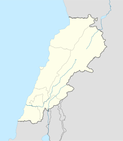
 Dekwaneh
Coordinates: 33°52′45″N 35°32′37″E / 33.87917°N 35.54361°ECoordinates: 33°52′45″N 35°32′37″E / 33.87917°N 35.54361°E Country  Lebanon
Governorate Mount Lebanon Governorate District Matn District Government - Time Zone GMT +2 (UTC) - - Summer (DST) +3 (UTC) - Area Code(s) (+961) 1 - Zip Code Time zone EET (UTC+2) - Summer (DST) EEST (UTC+3) Postal code Dialing code +961 Dekwaneh (Arabic: ضهر الحصين translit. Dikwene) (also Dekweneh) is a suburb north of Beirut in the Matn District of the Mount Lebanon Governorate, Lebanon. The population is predominantly Marionite Christian.[1] It used to be the location of an UNRWA administered Palestinian Refugee camp housing approximately 50,000-60,000 refugees at called Tel al-Zaatar, site of the Tel al-Zaatar massacre.[2]
Archaeology
Dekwaneh I is about 700 metres (2,300 ft) northwest of Mar Roucos monastery, in the gullies of (now deforested) pinewood slopes on the west side of a ridge. Material was found by Raoul Describes, who mentioned rock-shelters in the area that were destroyed by quarrying for quicklime.[3] Further collections by Auguste Bergy and Peter Wescombe. Some of the flint tools recovered were determined to be Acheulean as well as a large amount of waste and bifaces from the Middle Paleolithic that suggested it was a factory site at that time.[4]
Dekwaneh II material comes from various locations around the area, most notably the ravine below the monastery. Flint tools were also found here by Bergy and Describes which included the Qaraoun culture's Heavy Neolithic forms such as massive axes, picks, scrapers and rabots. Other early Neolithic tools were found along with some Middle Palelithic material including an Emireh point and tortoise cores. Along with material from Dekwaneh I, finds from the locations are stored in the Museum of Lebanese Prehistory.[4]
References and footnotes
- ^ Samir Khalaf (2002). Civil and uncivil violence in Lebanon: a history of the internationalization of communal conflict. Columbia University Press. pp. 222–. ISBN 978-0-231-12477-5. http://books.google.com/books?id=Mue9eoWJAPwC&pg=PA222. Retrieved 13 August 2011.
- ^ P. Edward Haley; Lewis W. Snider; M. Graeme Bannerman (1979). Lebanon in crisis: participants and issues. Syracuse University Press. pp. 26–. ISBN 978-0-8156-2210-9. http://books.google.com/books?id=mdrqhFpLkC8C&pg=PA26. Retrieved 13 August 2011.
- ^ Describes, Raoul., Quelques ateliers paléolithiques des environs de Beyrouth, Mélanges de l'Université Saint-Joseph: Volume VII, 1921.
- ^ a b Lorraine Copeland; P. Wescombe (1965). Inventory of Stone-Age sites in Lebanon, p. 85. Imprimerie Catholique. http://books.google.com/books?id=6YsRRwAACAAJ. Retrieved 21 July 2011.
 Matn District, Mount Lebanon Governorate
Capital: Jdeideh Towns and villages Ain Aar · Ain el Safssaf · Ain el Sendianeh · Ain Saadeh · Aintoura · Amaret Chalhoub · Antelias · Aoukar · Ayroun · Baabdat · Baskinta · Bauchrieh · Beit Chabab · Beit el Chaar · Beit el Kekko · Beit Mery · Bhersaf · Biakout · Bikfaya · Bkenneya · Bourj Hammoud · Broummana · Bsalim · Bteghrine · Chaouiyeh · Choueir · Daher al Hosein · Dahr el Sawan · Daychounieh · Dbayeh · Dekwaneh · Dik El Mehdi · Dhour El Choueir · Dora · Douar · Fanar · Ghabeh · Ghabet Bologna · Hadirah · Haret al Ballaneh · Hbous · Jal el Dib · Jdeideh · Jouar · Kaakour · Kfarakab · Kfartay · Khenchara · Majdel Tarchich · Majzoub · Mansourieh · Mar Chaaya · Mar Michael Bnabil · Mar Moussa · Mar Roukouz · Marjaba · Mazraat Yachouh · Mchikha · Mezher · Mhaydseh · Mkalles · Mrouj · Mtaileb · Mtein · Mzekkeh · Nabay · Naccache · Ouyoun · Qonaytrah · Qonnabat Broummana · Qornet Shehwan · Rabieh · Roumieh · Sakiyat al Mesek · Sed el Bauchrieh · Sin el Fil · Wata el Mrouj · Zalka · Zarooun · Zekrite · Zouk al Khrab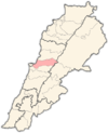
Notable landmarks Notable touristic sites Archaeological sites in LebanonAadloun • Aaiha • Aammiq • Ain Harcha • Akbiyeh • Amioun • Anjar, Lebanon • Antelias cave • Ard Tlaili • Arqa • Baalbek • Batroumine • Batroun • Beirut • Beit Mery • Byblos • Dahr El Ahmar • Dakoue • Deir El Aachayer • Deir el Ahmar • Dekwaneh • Douris (Baalbek) • Elaea (Lebanon) • Hadeth south • Haret ech Cheikh • Hashbai • Hermel plains • Iaat • Jabal es Saaïdé • Jbaa • Jdeideh • Jebel Aabeby • Jeita Grotto • Joub Jannine • Jieh • Kamid al lawz • Kaukaba • Kefraya • Kfar Qouq • Kfarhata • Ksar Akil • Labweh • Lake Qaraoun (Ain Jaouze) • Lion Tower • Majdal Anjar • Mansourieh • Maronite mummies • Mayrouba • Moukhtara · Mtaileb · Nabi Zair • Nachcharini • Neba'a Faour • Niha Bekaa • Qaraoun • Ras Baalbek I • Ras Beirut • Ras El Kelb • Sands of Beirut • Sidon • Sin el Fil • Sarepta • Stone of the Pregnant Woman • Tahun ben Aissa • Tell Ain Nfaikh • Tell Ain Saouda • Tell Deir • Tell el-Burak • Tell Khardane • Tell Jisr • Tell Mureibit • Tell Neba'a Litani • Tell Zenoub • Tell Zeitoun • Temple of Bacchus • Temple of Eshmun • Toron • Tripolis (region of Phoenicia) • Tyre Necropolis • Tyre, Lebanon • Yanta • Ain W Zain • Zahlé •Categories:- Populated places in the Mount Lebanon Governorate
- Matn District
- Lebanon geography stubs
- Fertile Crescent
- Archaeological sites in Lebanon
- Populated places in Lebanon
- Paleolithic
- Heavy Neolithic sites


Wikimedia Foundation. 2010.