- Aadloun
-
Aadloun
عدلونLocation in Lebanon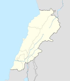
 Aadloun
Coordinates: 33°24′14″N 35°16′26″E / 33.40389°N 35.27389°ECoordinates: 33°24′14″N 35°16′26″E / 33.40389°N 35.27389°E Country  Lebanon
Governorate South Governorate District Sidon District Time zone EET (UTC+2) – Summer (DST) +3 (UTC) Aadloun I, II, III & IV Alternate name Abri Zumoffen (Aadloun I), Bezez Cave, Mugharet el Bzaz (Aadloun II) History Periods Early Yarbrudian (Acheulio-Yarbrudian), Levalloiso-Mousterian, Upper Paleolithic, Heavy Neolithic Cultures Paleolithic, Neolithic, Phoenician Site notes Excavation dates 1898, 1900, 1908, 1958, 1963 Archaeologists Godefroy Zumoffen,
Dorothy Garrod,
Diana KirkbrideCondition Ruins Management Directorate General of Antiquities Public access No Aadloun, Adloun or Adlun (Arabic: عدلون) is a coastal town in South Lebanon, 17 kilometres (11 mi) south of Sidon famous for its cultivation of watermelons. It is also the site of a Phoenician necropolis and prehistoric caves where four archaeological sites have been discovered and dated to the Stone Age.[1]
Contents
Aadloun I
Aadloun I or Abri Zumoffen is a low cave and terrace at the foot of a cliff near a beach. It was discovered and sounded by Godefroy Zumoffen in 1898, 1900 and 1908 who found material thought to be either Acheulean or Mousterian. Dorothy Garrod suggested similarities existed to a final Acheulean (or Yarbrudian) industry of Tabun E. Along with Diana Kirkbride, she re-opened excavations in 1958 with another season in 1963 and found a pre-Aurignacian (Garrod's Amudian) blade industry in the deposits.[2][3] D. A. Hooijer discussed the fauna of the site suggesting it included game animals and rhino.[4] Materials from the site are now in collections of the Saint Joseph University, Beirut and the Museum of Archaeology and Anthropology, University of Cambridge, Cambridge. The site is now owned by the Directorate General of Antiquities but the previous land owner carried out private digging that has spread deposits from the Aadloun II cave site over the area creating a false layer.[1]
Aadloun II
Aadloun II, Bezez Cave or Mugharet el Bzaz is a cave on the east of the road heading to Tyre set into a cliff at an altitude of approximately 17 metres (56 ft) above sea level. It was first sounded with little result in 1898 by Godefroy Zumoffen. A major excavation was undertaken in 1963 by Diana Kirkbride and Dorothy Garrod who determined a sequence stretching through the Yarbrudian, Levalloiso-Mousterian, Upper Paleolithic and on into the Heavy Neolithic. Materials from the excavations were to be held by Saint Joseph University and the American University of Beirut. The site is owned by the Directorate General of Antiquities and a gate was fixed over the mouth of the cave for protection.[1]
Aadloun III
Aadloun III is a site approximately 1 kilometre (0.62 mi) south of Aadloun with a Chalcolithic (Enéolithique) industry that was found by P. E. Gigues.[1]
Aadloun IV
Aadloun IV was found by P. E. Gigues on the terraces below the village near the caves that have been damaged by quarrying. Local farmers have recovered several fine Neolithic and Chalcolithic tools from this area that are held by Saint Joseph University. Dr. Gigues collection was held in Beirut by a relative who charged a fee for showing it after his retirement to Morocco.[1]
Materials recovered
Lorraine Copeland made a collection of mostly Heavy Neolithic flints from the site in 1966. Amongst the finds were massive trapezoidal axes, chisels, a chopper, points, a pick, rough scrapers, blades, cores and hammerstones. The finds led Andrew Moore to suggest that Bezez cave was a factory site for such tools.[5]
References
- ^ a b c d e Lorraine Copeland; P. Wescombe (1965). Inventory of Stone-Age sites in Lebanon, pp. 63-64. Imprimerie Catholique. http://books.google.com/books?id=6YsRRwAACAAJ. Retrieved 21 July 2011.
- ^ Garrod, Dorothy & Kirkbride, Diana., Excavation of a Paleolithic Rock-shelter at Adlun, Lebanon, Acts of the 5th C.I.S.P.P., Hamburg, 1958.
- ^ Garrod, Dorothy & Kirkbride, Diana., Excavation of Abri Zumoffen, a Paleolithic Rock-shelter near Adloun, in southern Lebanon, 1958, Bulletin du Musée de Beyrouth, volume 16, 1961
- ^ Hooijer, D.A., The Fossil Vertebrates of Ksar Akil, a Palaeolithic Rock-Shelter in the Lebanon, Zoloögische Verhandelgingen, 49, 1, 1961.
- ^ Moore, A.M.T. (1978). The Neolithic of the Levant. Oxford University, Unpublished Ph.D. Thesis. pp. 447–448. http://ancientneareast.tripod.com/187.html.
Archaeological sites in LebanonAadloun • Aaiha • Aammiq • Ain Harcha • Akbiyeh • Amioun • Anjar, Lebanon • Antelias cave • Ard Tlaili • Arqa • Baalbek • Batroumine • Batroun • Beirut • Beit Mery • Byblos • Dahr El Ahmar • Dakoue • Deir El Aachayer • Deir el Ahmar • Dekwaneh • Douris (Baalbek) • Elaea (Lebanon) • Hadeth south • Haret ech Cheikh • Hashbai • Hermel plains • Iaat • Jabal es Saaïdé • Jbaa • Jdeideh • Jebel Aabeby • Jeita Grotto • Joub Jannine • Jieh • Kamid al lawz • Kaukaba • Kefraya • Kfar Qouq • Kfarhata • Ksar Akil • Labweh • Lake Qaraoun (Ain Jaouze) • Lion Tower • Majdal Anjar • Mansourieh • Maronite mummies • Mayrouba • Moukhtara · Mtaileb · Nabi Zair • Nachcharini • Neba'a Faour • Niha Bekaa • Qaraoun • Ras Baalbek I • Ras Beirut • Ras El Kelb • Sands of Beirut • Sidon • Sin el Fil • Sarepta • Stone of the Pregnant Woman • Tahun ben Aissa • Tell Ain Nfaikh • Tell Ain Saouda • Tell Deir • Tell el-Burak • Tell Khardane • Tell Jisr • Tell Mureibit • Tell Neba'a Litani • Tell Zenoub • Tell Zeitoun • Temple of Bacchus • Temple of Eshmun • Toron • Tripolis (region of Phoenicia) • Tyre Necropolis • Tyre, Lebanon • Yanta • Ain W Zain • Zahlé •Categories:- Paleolithic
- Neolithic settlements
- Chalcolithic sites
- Archaeological sites in Lebanon
- Fertile Crescent
- Populated places in the South Governorate
- Sidon District
- Heavy Neolithic sites

Wikimedia Foundation. 2010.