- Kefraya
-
Kefraya
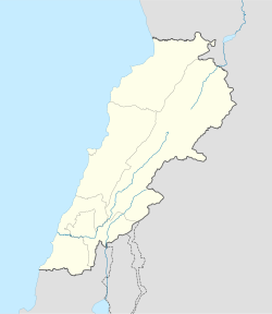
كفريا— Town — Location within Lebanon Coordinates: 33°40′15″N 35°44′11″E / 33.67083°N 35.73639°ECoordinates: 33°40′15″N 35°44′11″E / 33.67083°N 35.73639°E Country  Lebanon
Governorate Beqaa Governorate District Western Beqaa District Government – Time Zone GMT +2 (UTC) – - Summer (DST) +3 (UTC) – Area Code(s) (+961) 1 – Zip Code Time zone EET (UTC+2) – Summer (DST) EEST (UTC+3) Postal code Dialing code +961 Kefraya (Arabic: كفريا translit. Kafraiya) is a village in the Western Beqaa District of the Beqaa Governorate in the Republic of Lebanon, approximately 2 kilometres (1.2 mi) northwest of Joub Jannine.[1]
It is known for its vineyards and Château Kefraya wines. Château Kefraya is the second biggest winery in the Beqaa Valley with land that extends up to 300 acres (1.2 km2) amongst the foothills of Mount Barouk, 20 kilometres (12 mi) south of the town of Chtaura. The majority of the shares of the winery were bought by Druze politician Walid Jumblat from the De Bustros family in the late 1980s.[2]
Archaeology
Kefraya was also once home to the Qaraoun culture with a Heavy Neolithic archaeological industry prior to the Neolithic Revolution.[3][4] A very large archaeological site was discovered in the area running along both sides of the road. Good quality flint nodules were found amongst Eocene conglomerates where a Heavy Neolithic factory site was detected with a massive abundance of Levallois cores, debitage and waste littering the surface of the site. Large numbers of flint tools were collected by workers that included a variety of scrapers on flakes, kinves, axes, adzes and a segmented sickle blade.[5] The type of flint found in the area was termed Kefraya flint.[6][7]
References
- ^ Université Saint-Joseph (Beirut, Lebanon) (1966). Mélanges de l'Université Saint-Joseph. Impr. catholique. http://books.google.com/books?id=_SQOAAAAYAAJ. Retrieved 26 August 2011.
- ^ Robert Joseph (1 December 2006). Wine Travel Guide to the World. Footprint Travel Guides. pp. 346–. ISBN 978-1-904777-85-4. http://books.google.com/books?id=8G5aWddvUh4C&pg=PA346. Retrieved 26 August 2011.
- ^ Fred Wendorf; Anthony E. Marks (1975). Problems in prehistory: North Africa and the Levant. SMU Press. ISBN 978-0-87074-146-3. http://books.google.com/books?id=2krJIQ1fwcEC. Retrieved 26 August 2011.
- ^ Raymond Vaufrey (1968). La Préhistoire: problèmes et tendances. Éditions du Centre national de la recherche scientifique. http://books.google.com/books?id=1KaBAAAAMAAJ. Retrieved 26 August 2011.
- ^ Moore, A.M.T. (1978). The Neolithic of the Levant. Oxford University, Unpublished Ph.D. Thesis. pp. 446–447. http://ancientneareast.tripod.com/186.html.
- ^ Dorothy Anne Elizabeth Garrod; L. Copeland (1983). Adlun in the Stone Age: the excavations of D.A.E. Garrod in the Lebanon, 1958-1963. B.A.R.. ISBN 978-0-86054-203-2. http://books.google.com/books?id=OVITAQAAMAAJ. Retrieved 26 August 2011.
- ^ Francis Hours (1994). Atlas des sites du proche orient (14000-5700 BP). Maison de l'Orient méditerranéen. ISBN 978-2-903264-53-6. http://books.google.com/books?id=KlZtAAAAMAAJ. Retrieved 26 August 2011.
External links
- Wikimapia - Chateau Kefraya
- Chateau Kefraya Website
- kifraya.com Kefraya Wine Making
- marcopolis.com The Story of Chateau Kefraya
- discoverlebanon.com Chateau Kefraya
 Archaeological sites in LebanonAadloun • Aaiha • Aammiq • Ain Harcha • Akbiyeh • Amioun • Anjar, Lebanon • Antelias cave • Ard Tlaili • Arqa • Baalbek • Batroumine • Batroun • Beirut • Beit Mery • Byblos • Dahr El Ahmar • Dakoue • Deir El Aachayer • Deir el Ahmar • Dekwaneh • Douris (Baalbek) • Elaea (Lebanon) • Hadeth south • Haret ech Cheikh • Hashbai • Hermel plains • Iaat • Jabal es Saaïdé • Jbaa • Jdeideh • Jebel Aabeby • Jeita Grotto • Joub Jannine • Jieh • Kamid al lawz • Kaukaba • Kefraya • Kfar Qouq • Kfarhata • Ksar Akil • Labweh • Lake Qaraoun (Ain Jaouze) • Lion Tower • Majdal Anjar • Mansourieh • Maronite mummies • Mayrouba • Moukhtara · Mtaileb · Nabi Zair • Nachcharini • Neba'a Faour • Niha Bekaa • Qaraoun • Ras Baalbek I • Ras Beirut • Ras El Kelb • Sands of Beirut • Sidon • Sin el Fil • Sarepta • Stone of the Pregnant Woman • Tahun ben Aissa • Tell Ain Nfaikh • Tell Ain Saouda • Tell Deir • Tell el-Burak • Tell Khardane • Tell Jisr • Tell Mureibit • Tell Neba'a Litani • Tell Zenoub • Tell Zeitoun • Temple of Bacchus • Temple of Eshmun • Toron • Tripolis (region of Phoenicia) • Tyre Necropolis • Tyre, Lebanon • Yanta • Ain W Zain • Zahlé •Categories:
- Western Beqaa District
- Fertile Crescent
- Archaeological sites in Lebanon
- Populated places in Lebanon
- Neolithic settlements
- Heavy Neolithic sites
- Great Rift Valley
- Lebanon geography stubs
Wikimedia Foundation. 2010.

