- Mayrouba
-
Mayrouba
Arabic : ميروبا Mayrouba
MeyroubaLocation in Lebanon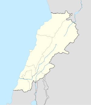
 Mayrouba
Coordinates: 34°00′04″N 35°46′10″E / 34.00111°N 35.76944°ECoordinates: 34°00′04″N 35°46′10″E / 34.00111°N 35.76944°E Country  Lebanon
Governorate Mount Lebanon Governorate District Keserwan District Elevation 1,300 m (4,265 ft) Time zone EET (UTC+2) - Summer (DST) EEST (UTC+3) Mayrouba I, II, III, IV, V, VI Alternate name Ain-bou-Grasse (Mayrouba III), Ain Berdet (Mayrouba V), "Site Tixier" (Mayrouba VI) History Periods Upper Paleolithic Cultures Mayroubian Site notes Excavation dates 1962 Archaeologists Paulist Fathers, Nasrallah, P. H. Gigues, Burkhalter, Fattal, Auguste Bergy, Maurice Tallon, Henri Fleisch, Francis Hours Condition Ruins Public access Yes Mayrouba (Arabic: ميروبا) is a village in Keserwan District, Mount Lebanon Governorate, Lebanon.[1] It sits at an altitude of 1,300 metres (4,300 ft). The population of Mayrouba is almost exclusively Maronite Catholic, part of the Eastern Catholic Churches. There are several Stone age archaeological sites in the vicinity that have defined the location as the type site of the Mayroubian culture.[2][3]
Contents
Mayrouba I
Mayrouba I is 14 kilometres (8.7 mi) east northeast of Junie by the way to Faraya. It is a large site on top of a plateau to the north of the village situated in sandstone at an altitude of approximately 1,400 metres (4,600 ft). It was discovered by Paulist Fathers from Harissa. Collections were made from the site by P.R. Gigues and various Jesuits including Maurice Tallon, Auguste Bergy, Francis Hours and Henri Fleisch. Fleisch admitted that it was not the best choice for a type site due to the possibility of mixed industries however he published it as a transitional site with successive occupations between peoples of the Middle Paleolithic and Upper Paleolithic.[4]
Finds of predominantly blue-grey Upper Jurassic flints included an emphasized Upper Paleolithic element with finds of two Emireh points by Lorraine Copeland and R. Khawam in 1965. Artefacts included numerous burins, end scrapers, thick blades, steep scrapers, bladelet cores, tortoise cores, discoid cores, point cores and miniature flake cores. Collections from the site have been dispersed but a large number have been retained by Saint Joseph University.[3]
Mayrouba II
Mayrouba II is 2 kilometres (1.2 mi) north of Mayrouba found by Francis Hours and determined as a Mayroubian site in a wooded, uncultivated area on sandstone at an altitude of approximately 1,460 metres (4,790 ft).[3]
Mayrouba III
Mayrouba III (Ain-bou-Grasse) is on the other side of the crest of a hill from Mayrouba I in a wooded area at an altitude of approximately 1,460 metres (4,790 ft). It was found by Francis Hours in 1964 and determined as a Mayroubian site and lies undisturbed amongst pines.[3]
Mayrouba IV
 Emireh Point. From Meyrouba VI, Lebanon. Greyish-blue Jurassic flint, patinated to white. Upper Paleolithic.
Mayrouba IV is on a small plateau north of the road between Jebel Mazloum and Mayrouba, east of a track leading to Ain-bou-Grasse, 100 metres (330 ft) west of Mayrouba I. It was found by Francis Hours in 1964 and determined as a Mayroubian site. A collection was made by Hours, Jacques Tixier and Lorraine Copeland in 1965 of mostly cores and burins but including an Emireh point. It lies undisturbed amongst screes.[3]
Mayrouba V
Mayrouba V (Ain Berdet) is about 2 kilometres (1.2 mi) northwest of Mayrouba at an altitude of approximately 1,293 metres (4,242 ft) on the slopes of a wooded hill. It was found by Francis Hours in 1964, determined as a Mayroubian site and lies undisturbed.[3]
Mayrouba VI
Mayrouba VI ("Site Tixier") is 100 metres (330 ft) south of Mayrouba I in a wood sloping towards the road to Mayrouba. It was found undisturbed in 1965 by Francis Hours, Jacques Tixier and Lorraine Copeland. The tools found indicated it to be a Mayroubian site and included an Emireh point, they are held by the Museum of Lebanese Prehistory.[3]
References
- ^ Owen's commerce & travel and international register. Owen's Commerce & Travel Ltd.. 1964. http://books.google.com/books?id=EkYjAQAAMAAJ. Retrieved 21 July 2011.
- ^ Henry Field (1956). Ancient and modern man in Southwestern Asia. University of Miami Press. http://books.google.com/books?id=WN1AAQAAIAAJ. Retrieved 21 July 2011.
- ^ a b c d e f g Lorraine Copeland; P. Wescombe (1965). Inventory of Stone-Age sites in Lebanon, pp. 40-42 & 106-107. Imprimerie Catholique. http://books.google.com/books?id=6YsRRwAACAAJ. Retrieved 21 July 2011.
- ^ Fleisch, Henri., Les stations préhistoriques de montagne au Liban, VI' Congrès de l'UlSPP (Rome, 1962)
External Links
Archaeological sites in LebanonAadloun • Aaiha • Aammiq • Ain Harcha • Akbiyeh • Amioun • Anjar, Lebanon • Antelias cave • Ard Tlaili • Arqa • Baalbek • Batroumine • Batroun • Beirut • Beit Mery • Byblos • Dahr El Ahmar • Dakoue • Deir El Aachayer • Deir el Ahmar • Dekwaneh • Douris (Baalbek) • Elaea (Lebanon) • Hadeth south • Haret ech Cheikh • Hashbai • Hermel plains • Iaat • Jabal es Saaïdé • Jbaa • Jdeideh • Jebel Aabeby • Jeita Grotto • Joub Jannine • Jieh • Kamid al lawz • Kaukaba • Kefraya • Kfar Qouq • Kfarhata • Ksar Akil • Labweh • Lake Qaraoun (Ain Jaouze) • Lion Tower • Majdal Anjar • Mansourieh • Maronite mummies • Mayrouba • Moukhtara · Mtaileb · Nabi Zair • Nachcharini • Neba'a Faour • Niha Bekaa • Qaraoun • Ras Baalbek I • Ras Beirut • Ras El Kelb • Sands of Beirut • Sidon • Sin el Fil • Sarepta • Stone of the Pregnant Woman • Tahun ben Aissa • Tell Ain Nfaikh • Tell Ain Saouda • Tell Deir • Tell el-Burak • Tell Khardane • Tell Jisr • Tell Mureibit • Tell Neba'a Litani • Tell Zenoub • Tell Zeitoun • Temple of Bacchus • Temple of Eshmun • Toron • Tripolis (region of Phoenicia) • Tyre Necropolis • Tyre, Lebanon • Yanta • Ain W Zain • Zahlé •Categories:- Lebanon geography stubs
- Paleolithic
- Archaeological sites in Lebanon
- Type sites
- Fertile Crescent
- Keserwan District
- Mayroubian sites
- Populated places in the Mount Lebanon Governorate


Wikimedia Foundation. 2010.