- Mtaileb
-
Mtaileb — Village — Country  Lebanon
Governorate Mount Lebanon Governorate District Matn District Mtaileb I, Mtaileb II 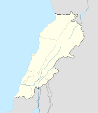
 Shown within Lebanon
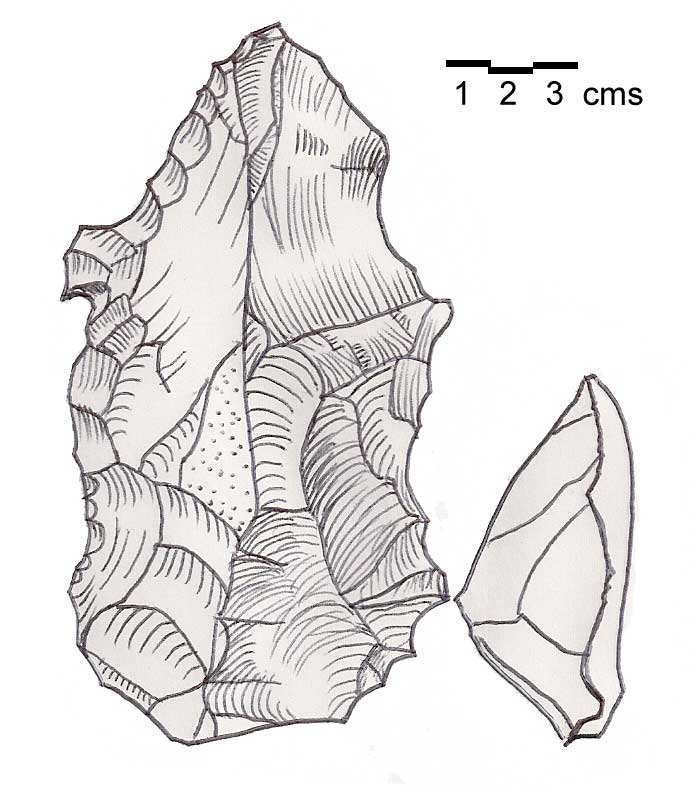
Location 1.5 kilometres (0.93 mi) east northeast of Antelias (Mtaileb I) Region Mount Lebanon Governorate Coordinates 33°55′25″N 35°36′41″E / 33.923611°N 35.611389°E History Periods Heavy Neolithic, Neolithic Cultures Qaraoun culture Site notes Condition Ruins Public access Yes 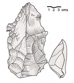 Heavy Neolithic flint tools of the Qaraoun culture found at Mtaileb I - Massive nosed scraper on a flake with irregular jagged edges, notches and "noses".
Mtaileb or Mtayleb is a suburb north of Beirut in the Matn District of Mount Lebanon Governorate in Lebanon.[1]
Mtaileb I
Mtaileb I or Rabiya is an archaeological site located 1.5 kilometres (0.93 mi) east northeast of Antelias in a wooded ravine next to a road that zig-zags upwards to the Rabiya Club.[2] The site was discovered by Auguste Bergy in 1941 and a Heavy Neolithic assemblage of the Qaraoun culture consisting of enormous flint tools was collected and now held in the Museum of Lebanese Prehistory marked "1,500 m - 1,800m E.N.E. Antelias". The tools were studied by Jacques Cauvin and said to be made of impure Upper Jurassic flint. The area is now well built up with widely spaced villas and contains flint outcrops under the soil.[2]
Mtaileb II
Mtaileb II is located 900 metres (3,000 ft) west northwest of Mtaileb on the north facing, wooded, sandstone slopes, in a junction of two ravines beneath the main Bikfaya road. A small Neolithic assemblage of tools was collected in beige and grey flint with small axes and picks. One slightly polished trapezoidal axe was found. The material is stored in the Museum of Lebanese Prehistory marked "1500 m S.W. Mazraat-ech-Chaar".[2]
References
- ^ Université Saint-Esprit (1992). Encyclopédie maronite, p. 124. Université Saint Esprit. http://books.google.com/books?id=yKIqAQAAIAAJ. Retrieved 6 August 2011.
- ^ a b c Lorraine Copeland; P. Wescombe (1965). Inventory of Stone-Age sites in Lebanon, p. 109-110, also see fig. XIII for drawings of Heavy Neolithic tools from Mtaileb I. Imprimerie Catholique. http://books.google.com/books?id=6YsRRwAACAAJ. Retrieved 21 July 2011.
Archaeological sites in LebanonAadloun • Aaiha • Aammiq • Ain Harcha • Akbiyeh • Amioun • Anjar, Lebanon • Antelias cave • Ard Tlaili • Arqa • Baalbek • Batroumine • Batroun • Beirut • Beit Mery • Byblos • Dahr El Ahmar • Dakoue • Deir El Aachayer • Deir el Ahmar • Dekwaneh • Douris (Baalbek) • Elaea (Lebanon) • Hadeth south • Haret ech Cheikh • Hashbai • Hermel plains • Iaat • Jabal es Saaïdé • Jbaa • Jdeideh • Jebel Aabeby • Jeita Grotto • Joub Jannine • Jieh • Kamid al lawz • Kaukaba • Kefraya • Kfar Qouq • Kfarhata • Ksar Akil • Labweh • Lake Qaraoun (Ain Jaouze) • Lion Tower • Majdal Anjar • Mansourieh • Maronite mummies • Mayrouba • Moukhtara · Mtaileb · Nabi Zair • Nachcharini • Neba'a Faour • Niha Bekaa • Qaraoun • Ras Baalbek I • Ras Beirut • Ras El Kelb • Sands of Beirut • Sidon • Sin el Fil • Sarepta • Stone of the Pregnant Woman • Tahun ben Aissa • Tell Ain Nfaikh • Tell Ain Saouda • Tell Deir • Tell el-Burak • Tell Khardane • Tell Jisr • Tell Mureibit • Tell Neba'a Litani • Tell Zenoub • Tell Zeitoun • Temple of Bacchus • Temple of Eshmun • Toron • Tripolis (region of Phoenicia) • Tyre Necropolis • Tyre, Lebanon • Yanta • Ain W Zain • Zahlé • Matn District, Mount Lebanon Governorate
Capital: Jdeideh Towns and villages Ain Aar · Ain el Safssaf · Ain el Sendianeh · Ain Saadeh · Aintoura · Amaret Chalhoub · Antelias · Aoukar · Ayroun · Baabdat · Baskinta · Bauchrieh · Beit Chabab · Beit el Chaar · Beit el Kekko · Beit Mery · Bhersaf · Biakout · Bikfaya · Bkenneya · Bourj Hammoud · Broummana · Bsalim · Bteghrine · Chaouiyeh · Choueir · Daher al Hosein · Dahr el Sawan · Daychounieh · Dbayeh · Dekwaneh · Dik El Mehdi · Dhour El Choueir · Dora · Douar · Fanar · Ghabeh · Ghabet Bologna · Hadirah · Haret al Ballaneh · Hbous · Jal el Dib · Jdeideh · Jouar · Kaakour · Kfarakab · Kfartay · Khenchara · Majdel Tarchich · Majzoub · Mansourieh · Mar Chaaya · Mar Michael Bnabil · Mar Moussa · Mar Roukouz · Marjaba · Mazraat Yachouh · Mchikha · Mezher · Mhaydseh · Mkalles · Mrouj · Mtaileb · Mtein · Mzekkeh · Nabay · Naccache · Ouyoun · Qonaytrah · Qonnabat Broummana · Qornet Shehwan · Rabieh · Roumieh · Sakiyat al Mesek · Sed el Bauchrieh · Sin el Fil · Wata el Mrouj · Zalka · Zarooun · Zekrite · Zouk al Khrab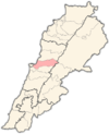
Notable landmarks Notable touristic sites Categories:- Matn District
- Populated places in the Mount Lebanon Governorate
- Archaeological sites in Lebanon
- Heavy Neolithic sites
- Fertile Crescent
- Ancient Levant
- Neolithic settlements


Wikimedia Foundation. 2010.