- Mkalles
-
Mkalles
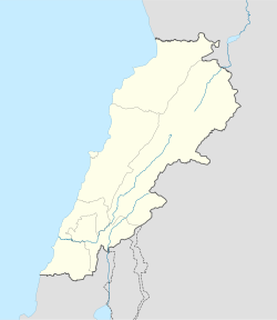
المكلس— City — Location within Lebanon Coordinates: 33°52′N 35°33′E / 33.867°N 35.55°ECoordinates: 33°52′N 35°33′E / 33.867°N 35.55°E Country  Lebanon
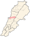
Governorate Mount Lebanon Governorate District Matn District Government – Time Zone GMT +2 (UTC) – - Summer (DST) +3 (UTC) – Area Code(s) (+961) 1 – Zip Code Area – Total 1.32 km2 (0.5 sq mi) Time zone EET (UTC+2) – Summer (DST) EEST (UTC+3) Postal code Dialing code +961 Mkalles (Arabic: المكلس translit. al-Mkalles) is a town in the Matn District of the Mount Lebanon Governorate, Lebanon. Mkalles is administered by Mansourieh municipality.
References and footnotes
External links
 Matn District, Mount Lebanon GovernorateCapital: Jdeideh
Towns and villages Ain Aar · Ain el Safssaf · Ain el Sendianeh · Ain Saadeh · Aintoura · Amaret Chalhoub · Antelias · Aoukar · Ayroun · Baabdat · Baskinta · Bauchrieh · Beit Chabab · Beit el Chaar · Beit el Kekko · Beit Mery · Bhersaf · Biakout · Bikfaya · Bkenneya · Bourj Hammoud · Broummana · Bsalim · Bteghrine · Chaouiyeh · Choueir · Daher al Hosein · Dahr el Sawan · Daychounieh · Dbayeh · Dekwaneh · Dik El Mehdi · Dhour El Choueir · Dora · Douar · Fanar · Ghabeh · Ghabet Bologna · Hadirah · Haret al Ballaneh · Hbous · Jal el Dib · Jdeideh · Jouar · Kaakour · Kfarakab · Kfartay · Khenchara · Majdel Tarchich · Majzoub · Mansourieh · Mar Chaaya · Mar Michael Bnabil · Mar Moussa · Mar Roukouz · Marjaba · Mazraat Yachouh · Mchikha · Mezher · Mhaydseh · Mkalles · Mrouj · Mtaileb · Mtein · Mzekkeh · Nabay · Naccache · Ouyoun · Qonaytrah · Qonnabat Broummana · Qornet Shehwan · Rabieh · Roumieh · Sakiyat al Mesek · Sed el Bauchrieh · Sin el Fil · Wata el Mrouj · Zalka · Zarooun · Zekrite · Zouk al KhrabNotable landmarks Notable touristic sites Categories:- Populated places in the Mount Lebanon Governorate
- Matn District
- Lebanon geography stubs
Wikimedia Foundation. 2010.


