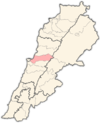
- Dik El Mehdi
-
Dik El Mehdi is a village, at 325 meters elevation, in the Matn District governorate of Mount Lebanon.[1] Its population has been estimated at 2,096 by Aayroun. The village is 18 km. from Beirut. The majority of it inhabitants derives from the Ashkar family known for their pro-syrian pertinence. However, many of its inhabitants come from various regions in Lebanon covering diverse political beliefs.
Dick el Mehdi is famous for its best in class elementary, high and secondary school "Champville".
References
 Matn District, Mount Lebanon Governorate
Capital: Jdeideh Towns and villages Ain Aar · Ain el Safssaf · Ain el Sendianeh · Ain Saadeh · Aintoura · Amaret Chalhoub · Antelias · Aoukar · Ayroun · Baabdat · Baskinta · Bauchrieh · Beit Chabab · Beit el Chaar · Beit el Kekko · Beit Mery · Bhersaf · Biakout · Bikfaya · Bkenneya · Bourj Hammoud · Broummana · Bsalim · Bteghrine · Chaouiyeh · Choueir · Daher al Hosein · Dahr el Sawan · Daychounieh · Dbayeh · Dekwaneh · Dik El Mehdi · Dhour El Choueir · Dora · Douar · Fanar · Ghabeh · Ghabet Bologna · Hadirah · Haret al Ballaneh · Hbous · Jal el Dib · Jdeideh · Jouar · Kaakour · Kfarakab · Kfartay · Khenchara · Majdel Tarchich · Majzoub · Mansourieh · Mar Chaaya · Mar Michael Bnabil · Mar Moussa · Mar Roukouz · Marjaba · Mazraat Yachouh · Mchikha · Mezher · Mhaydseh · Mkalles · Mrouj · Mtaileb · Mtein · Mzekkeh · Nabay · Naccache · Ouyoun · Qonaytrah · Qonnabat Broummana · Qornet Shehwan · Rabieh · Roumieh · Sakiyat al Mesek · Sed el Bauchrieh · Sin el Fil · Wata el Mrouj · Zalka · Zarooun · Zekrite · Zouk al KhrabNotable landmarks Notable touristic sites Categories:- Matn District
- Lebanon geography stubs
Wikimedia Foundation. 2010.

