- Daychounieh
-
Daychounieh
الديشونية— City — Location within Lebanon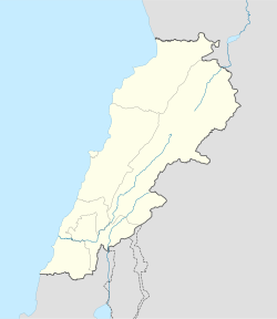
 Daychounieh
Coordinates: 33°51′N 35°34′E / 33.85°N 35.567°ECoordinates: 33°51′N 35°34′E / 33.85°N 35.567°E Country  Lebanon
Governorate Mount Lebanon Governorate District Matn District Government - Time Zone GMT +2 (UTC) - - Summer (DST) +3 (UTC) - Area Code(s) (+961) 4 - Zip Code 22415 Area - Total 1.33 km2 (0.5 sq mi) Highest elevation 250 m (820 ft) Lowest elevation 200 m (656 ft) Time zone EET (UTC+2) - Summer (DST) EEST (UTC+3) Postal code Dialing code +961 Daychounieh (Arabic: الديشونية translit. al-Dayšūniyat) (also Al-Daychounieh) is a village in the Matn District of the Mount Lebanon Governorate, Lebanon. Daychounieh is administered by Mansourieh municipality.
Contents
Overview
Etymology
Geography
Daychounieh is 21 km to the Capital (Beirut), 26 km to the Province Administrative Center (Baabda) and 15 km to the Caza Administrative Center (Jdeideh).
Daychounieh is accessible from Mansourieh main road.
Beirut River flows east to west from Lebanon’s mountains passing through Daychounieh to the Mediterranean Sea.
Demographics
As of 2009, Daychounieh houses a population of approx. 800, of which 98 constitute the electorate and 153 are native residents. The number of residences is approx. 250. [1]
References and footnotes
- ^ "Daychounieh E-Community". http://www.baldati.com/networks/community.php?networkid=941. Retrieved June 24, 2009.
External links
 Matn District, Mount Lebanon GovernorateCapital: Jdeideh
Towns and villages Ain Aar · Ain el Safssaf · Ain el Sendianeh · Ain Saadeh · Aintoura · Amaret Chalhoub · Antelias · Aoukar · Ayroun · Baabdat · Baskinta · Bauchrieh · Beit Chabab · Beit el Chaar · Beit el Kekko · Beit Mery · Bhersaf · Biakout · Bikfaya · Bkenneya · Bourj Hammoud · Broummana · Bsalim · Bteghrine · Chaouiyeh · Choueir · Daher al Hosein · Dahr el Sawan · Daychounieh · Dbayeh · Dekwaneh · Dik El Mehdi · Dhour El Choueir · Dora · Douar · Fanar · Ghabeh · Ghabet Bologna · Hadirah · Haret al Ballaneh · Hbous · Jal el Dib · Jdeideh · Jouar · Kaakour · Kfarakab · Kfartay · Khenchara · Majdel Tarchich · Majzoub · Mansourieh · Mar Chaaya · Mar Michael Bnabil · Mar Moussa · Mar Roukouz · Marjaba · Mazraat Yachouh · Mchikha · Mezher · Mhaydseh · Mkalles · Mrouj · Mtaileb · Mtein · Mzekkeh · Nabay · Naccache · Ouyoun · Qonaytrah · Qonnabat Broummana · Qornet Shehwan · Rabieh · Roumieh · Sakiyat al Mesek · Sed el Bauchrieh · Sin el Fil · Wata el Mrouj · Zalka · Zarooun · Zekrite · Zouk al Khrab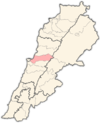
Notable landmarks Notable touristic sites Categories:- Populated places in the Mount Lebanon Governorate
- Matn District
- Lebanon geography stubs


Wikimedia Foundation. 2010.