- Dahr El Ahmar
-
Dahr El Ahmar
ضهر إل أحمر— Village — Location in Lebanon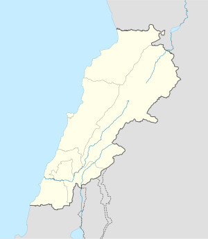
 Dahr El Ahmar
Coordinates: 33°31′45″N 35°50′55″E / 33.52917°N 35.84861°ECoordinates: 33°31′45″N 35°50′55″E / 33.52917°N 35.84861°E Country  Lebanon
Governorate Beqaa Governorate District Rashaya District Area - Total 3.9 sq mi (10.14 km2) Elevation 3,543 ft (1,080 m) Dahr El Ahmar is a village in Lebanon, situated in the Rashaya District and south of the Beqaa Governorate. It is located near the Syrian border, approximately 6 km from Rashaya and south of Kfar Danis.[1] The population of the village is predominantly Druze.[2] There is a shrine in the village to an important woman in Druze history, Sitt Sarah, the niece of one of the authors of the Epistles of Wisdom, Baha'u d-Dīn as-Samuqī ("al-Muqtana Baha’ud-Dīn").[3] She is remembered for being a great peacemaker.[4]
Archaeological site
Some flints were found 500 metres north of the village in the hills including large axes, scrapers and sickle blades with fine denticulation. This was suggested by Jacques Cauvin and Marie-Claire Cauvin to been a site contemporary with the earliest neolithic levels at Byblos.[5]
References
- ^ Ivan Mannheim (1 July 2001). Syria & Lebanon handbook: the travel guide. Footprint Travel Guides. pp. 603–. ISBN 9781900949903. http://books.google.com/books?id=t9LHVdWLc7gC&pg=PA603. Retrieved 23 April 2011.
- ^ British Druze Society - Druze communities in the Middle East
- ^ Fuad I. Khuri (2004). Being a Druze. Druze Heritage Foundation. ISBN 9781904850014. http://books.google.com/books?id=l4LXAAAAMAAJ. Retrieved 23 April 2011.
- ^ Intisar J. Azzam (2007). Gender and religion: Druze women. Druze Heritage Foundation. ISBN 9781904850120. http://books.google.com/books?id=gVEMAQAAMAAJ. Retrieved 23 April 2011.
- ^ Moore, A.M.T. (1978). The Neolithic of the Levant. Oxford University, Unpublished Ph.D. Thesis. pp. 436–442. http://ancientneareast.tripod.com/182.html.
External Links
Archaeological sites in LebanonAadloun • Aaiha • Aammiq • Ain Harcha • Akbiyeh • Amioun • Anjar, Lebanon • Antelias cave • Ard Tlaili • Arqa • Baalbek • Batroumine • Batroun • Beirut • Beit Mery • Byblos • Dahr El Ahmar • Dakoue • Deir El Aachayer • Deir el Ahmar • Dekwaneh • Douris (Baalbek) • Elaea (Lebanon) • Hadeth south • Haret ech Cheikh • Hashbai • Hermel plains • Iaat • Jabal es Saaïdé • Jbaa • Jdeideh • Jebel Aabeby • Jeita Grotto • Joub Jannine • Jieh • Kamid al lawz • Kaukaba • Kefraya • Kfar Qouq • Kfarhata • Ksar Akil • Labweh • Lake Qaraoun (Ain Jaouze) • Lion Tower • Majdal Anjar • Mansourieh • Maronite mummies • Mayrouba • Moukhtara · Mtaileb · Nabi Zair • Nachcharini • Neba'a Faour • Niha Bekaa • Qaraoun • Ras Baalbek I • Ras Beirut • Ras El Kelb • Sands of Beirut • Sidon • Sin el Fil • Sarepta • Stone of the Pregnant Woman • Tahun ben Aissa • Tell Ain Nfaikh • Tell Ain Saouda • Tell Deir • Tell el-Burak • Tell Khardane • Tell Jisr • Tell Mureibit • Tell Neba'a Litani • Tell Zenoub • Tell Zeitoun • Temple of Bacchus • Temple of Eshmun • Toron • Tripolis (region of Phoenicia) • Tyre Necropolis • Tyre, Lebanon • Yanta • Ain W Zain • Zahlé •Categories:- Archaeological sites in Lebanon
- Populated places in the Beqaa Governorate
- Lebanon geography stubs

Wikimedia Foundation. 2010.