- Cloughleigh
-
Cloghleagh
an Chloch Liath— Populated place — Location in Ireland
 Cloghleagh
Coordinates: 52°50′37″N 8°59′33″W / 52.84361°N 8.9925°WCoordinates: 52°50′37″N 8°59′33″W / 52.84361°N 8.9925°W Country Ireland Province Munster County Clare Government - Dáil Éireann Clare - EU Parliament North–West Population (2006) - Urban 825 Time zone WET (UTC+0) - Summer (DST) IST (WEST) (UTC-1) Irish Grid Reference Cloughleigh, officially Cloghleagh (Irish: an Chloch Liath),[1] is a townland and residential area of Ennis, County Clare, Ireland.
It is mostly made up of bungalows, semi-detached houses and terraced houses. There is a community centre, playing fields and a playground in the estate, as well as a national school, which is financed directly by the State, but administered jointly by the State, a patron body, and local representatives. Nearby estates include Hermitage and Waterpark View.
Cloughleigh falls within Ennis parish, and benefits from the local Church of Christ the King. Opened in 1978, it is one of the smallest churches in the parish. The current minister is Father Tom O'Gorman.[2]
The community centre now houses Cloughleigh Youth Club, which meets on Thursday evenings. The club was founded in 1986 and originally met in a prefab for a number of years before moving to the community centre. The club promotes a 'contract' that everyone is respected regardless of race, colour or creed. Activities on offer include football, hockey and dodgeball, arts and crafts, dancing, debates and quizzes. Over the years, the club has reached national finals in debating, freestyle, hip hop and quiz competitions. Members also participate in overseas exchanges, and staffing of a summer camp for twenty-five children between the ages of seven and ten.[3]
The RAPID Project in Cloughleigh, part of the Irish Government's drive for regeneration of deprived areas,[4] was named one of the principal winners in Co-operation Ireland's annual Pride of Place Competition 2007.[5]
In June 2009, a hand grenade was thrown through the front door of a house on Childers Road in the estate. The Army Bomb Disposal Unit was called and Gardaí evacuated eight other houses, although the grenade did not explode.[6][7]
Most primary school students attend Cloughleigh National School, which is located on the estate. Other students attend Ennis National School or the other primary schools throughout Ennis. Most secondary pupils attend nearby Ennis Community College (The Tech), but others attend the various other secondary schools in Ennis.
See also
- Roslevan
References
- ^ Placenames Database of Ireland
- ^ Ennis Parish - Church of Christ the King
- ^ Cloughleigh Youth Club - teenspace ireland
- ^ Eur28k For Cloughleigh School Library
- ^ National Pride Of Place Award For RAPID Project In Cloughleigh
- ^ http://www.clareherald.com/2009/06/grenade-fails-to-explode-in-ennis.html
- ^ http://www.rte.ie/news/2009/0613/ennis.html
Places in County Clare County town: Ennis Towns 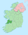
Villages Ardnacrusha · Aughinish · Ballynacally · Ballyvaughan · Barefield · Bodyke · Bridgetown · Broadford · Cahiracon · Carrigaholt · Clarecastle · Clonlara · Cloonanaha · Connolly · Cooraclare · Coore · Corofin · Cratloe · Cree · Cross · Crusheen · Doolin · Doonaha · Doonbeg · Ennistymon · Fanore · Feakle · Hurlers Cross · Inagh · Ivarstown · Kilbaha · Kildysart · Kilfenora · Kilkishen · Killaloe · Killimer · Kilmihil · Kilnamona · Knock · Labasheeda · Lahinch · Liscannor · Lisdoonvarna · Lisseycasey · Meelick · Milltown Malbay · Mountshannon · Mullagh · Murroogh · Newmarket-on-Fergus · O'Brien's Bridge · O'Callaghans Mills · Parteen · Quilty · Quin · Ruan · Scarriff · Sixmilebridge · Spancill Hill · Spanish Point · Tuamgraney · Tulla · WhitegateTownlands Ardsallis · Ballaghline · Burren · Coolmeen · Deer Island · Drumcliff · Inis Cathaig (or Scattery Island) · Ogonnelloe · TulligList of townlands in County Clare · Category:Mountains and hills of County Clare · Category:Rivers of County Clare · Category:Geography of County Clare Categories:- Untranslated Irish place names
- Ennis


Wikimedia Foundation. 2010.