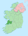
- Drumcliff, County Clare
-
Drumcliff is a townland and parish located in County Clare, Ireland to the west of Ennis. The area is noted for its old cemetery, which contains the Republican plot, for members of the Irish Republican Army killed in the Irish War of Independence and the Irish Civil War. [1]
There are also ruins of an old church with round tower.
References
Places in County Clare Towns Villages - Ardnacrusha
- Aughinish
- Ballynacally
- Ballyvaughan
- Barefield
- Bodyke
- Bridgetown
- Broadford
- Cahiracon
- Carrigaholt
- Clarecastle
- Clonlara
- Cloonanaha
- Connolly
- Cooraclare
- Coore
- Corofin
- Cratloe
- Cree
- Cross
- Crusheen
- Doolin
- Doonaha
- Doonbeg
- Ennistymon
- Fanore
- Feakle
- Hurlers Cross
- Inagh
- Ivarstown
- Kilbaha
- Kildysart
- Kilfenora
- Kilkishen
- Killaloe
- Killimer
- Kilmihil
- Kilnamona
- Knock
- Labasheeda
- Lahinch
- Liscannor
- Lisdoonvarna
- Lisseycasey
- Meelick
- Milltown Malbay
- Mountshannon
- Mullagh
- Murroogh
- Newmarket-on-Fergus
- O'Brien's Bridge
- O'Callaghans Mills
- Parteen
- Quilty
- Quin
- Ruan
- Scarriff
- Sixmilebridge
- Spancill Hill
- Spanish Point
- Tuamgraney
- Tulla
- Whitegate
Townlands - Ardsallis
- Ballaghline
- Burren
- Coolmeen
- Deer Island
- Drumcliff
- Inis Cathaig (or Scattery Island)
- Ogonnelloe
- Tullig
- List of townlands in County Clare
- Category:Mountains and hills of County Clare
- Category:Rivers of County Clare
- Category:Geography of County Clare
Coordinates: 52°52′3.25″N 8°59′45.57″W / 52.8675694°N 8.9959917°W
Categories:- Towns and villages in County Clare
Wikimedia Foundation. 2010.

