- Cree (Ireland)
-
Cree
An Chríoch— Town — Location in Ireland
 Cree
CreeCoordinates: 52°44′45.36″N 9°25′51.76″W / 52.7459333°N 9.4310444°WCoordinates: 52°44′45.36″N 9°25′51.76″W / 52.7459333°N 9.4310444°W Country Ireland Province Munster County County Clare Population (2006) - Urban 457 Time zone WET (UTC+0) - Summer (DST) IST (WEST) (UTC-1) Irish Grid Reference Cree or Creegh (Irish: An Chríoch, meaning "The End") is a small village in West County Clare in Ireland. It is situated at a crossroads near the towns of Doonbeg and Cooraclare. The nearest large towns are Kilrush and Ennis which are 7 miles and 26 miles away respectively. The Central Statistics Office 2006 census puts the population of Cree and its townlands at 457. In recent years there have been the development of new houses near the Creegh River. In Dromheilly Cree there is a holy shrine located which every year in August has a week of masses that people from West Clare attend. Cree also has an involvement in The Rose Of Clare Festival every year as the festival parade takes place in the village.
Other nearby villages & small towns are Cooraclare, Doonbeg, Mullagh, Quilty, Kilmihil, Kilkee & Miltown Malbay.
In Cree the central point is the large Catholic Church. Cree is in the Cree/Cooraclare parish and in the diocese of Killaloe. There are also two pubs (Flynn's and Walsh's), a fast food restaurant, two primary schools Cree and Clohanbeg , community centre, one garage (Lernihans), one shop (Meaney's) and a post office (Horgans). Clean Ireland's bin services headquarters are located in Cree. There is also a guesthouse/bed & breakfast located in Cree.
Contents
History
In the 15th and 16th centuries the land in Clare was divided into baronies. Cree comes from the Irish word Críoch meaning the end, which was because the village was situated at the border of one of these baronies.
Geography
Most of the people living around Cree are involved in agriculture and the majority of the land is used for dairy farming. The Creegh River flows through the village and enters the Atlantic Ocean at Doughmore Bay near Doonbeg.
Notable People
- Patrick Kelly - fiddle player
- Patrick Kelly - politician
See also
External links
Places in County Clare County town: Ennis Towns 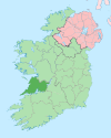
Villages Ardnacrusha · Aughinish · Ballynacally · Ballyvaughan · Barefield · Bodyke · Bridgetown · Broadford · Cahiracon · Carrigaholt · Clarecastle · Clonlara · Cloonanaha · Connolly · Cooraclare · Coore · Corofin · Cratloe · Cree · Cross · Crusheen · Doolin · Doonaha · Doonbeg · Ennistymon · Fanore · Feakle · Hurlers Cross · Inagh · Ivarstown · Kilbaha · Kildysart · Kilfenora · Kilkishen · Killaloe · Killimer · Kilmihil · Kilnamona · Knock · Labasheeda · Lahinch · Liscannor · Lisdoonvarna · Lisseycasey · Meelick · Milltown Malbay · Mountshannon · Mullagh · Murroogh · Newmarket-on-Fergus · O'Brien's Bridge · O'Callaghans Mills · Parteen · Quilty · Quin · Ruan · Scarriff · Sixmilebridge · Spancill Hill · Spanish Point · Tuamgraney · Tulla · WhitegateTownlands Ardsallis · Ballaghline · Burren · Coolmeen · Deer Island · Drumcliff · Inis Cathaig (or Scattery Island) · Ogonnelloe · TulligList of townlands in County Clare · Category:Mountains and hills of County Clare · Category:Rivers of County Clare · Category:Geography of County Clare Categories:- Towns and villages in County Clare


Wikimedia Foundation. 2010.