- Cross, County Clare
-
Cross
An Chrois— Village — Location in Ireland
 Cross
CrossCoordinates: 52°35′55.12″N 9°46′15.67″W / 52.5986444°N 9.7710194°WCoordinates: 52°35′55.12″N 9°46′15.67″W / 52.5986444°N 9.7710194°W Country Ireland Province Munster County County Clare Elevation 45 m (148 ft) Time zone WET (UTC+0) - Summer (DST) IST (WEST) (UTC-1) Irish Grid Reference Q807509 Cross (Irish: An Chrois, meaning "the cross")[1] is a small village in County Clare, Ireland. It is located on the Loop Head Peninsula, east of Carrigaholt on the road to Kilbaha. Cross is part of the parish of Moyarta.[2]
It's name could be derived from a cross related to the old church of Killballyowen. More likely is that the village is named after an once important road crossing as Cross is located in the center of the Loop Head Peninsula.[3]
See also
References
- ^ "An Chrois / Cross". Government of Ireland. http://www.logainm.ie/7274.aspx. Retrieved 27 June 2011.
- ^ County Clare, A History and Topography. - 1995, CLASP Press. Original 1837. ISBN: 1 900545 07 1
- ^ A History of County Clare, Seán Spellissy. - 2003, Gill & Macmillan. ISBN: 0 7171 3460 1. Page 94
Places in County Clare Towns 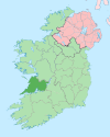
Villages Ardnacrusha · Aughinish · Ballynacally · Ballyvaughan · Barefield · Bodyke · Bridgetown · Broadford · Cahiracon · Carrigaholt · Clarecastle · Clonlara · Cloonanaha · Connolly · Cooraclare · Coore · Corofin · Cratloe · Cree · Cross · Crusheen · Doolin · Doonaha · Doonbeg · Ennistymon · Fanore · Feakle · Hurlers Cross · Inagh · Ivarstown · Kilbaha · Kildysart · Kilfenora · Kilkishen · Killaloe · Killimer · Kilmihil · Kilnamona · Knock · Labasheeda · Lahinch · Liscannor · Lisdoonvarna · Lisseycasey · Meelick · Milltown Malbay · Mountshannon · Mullagh · Murroogh · Newmarket-on-Fergus · O'Brien's Bridge · O'Callaghans Mills · Parteen · Quilty · Quin · Ruan · Scarriff · Sixmilebridge · Spancill Hill · Spanish Point · Tuamgraney · Tulla · WhitegateTownlands Ardsallis · Ballaghline · Burren · Coolmeen · Deer Island · Drumcliff · Inis Cathaig (or Scattery Island) · Ogonnelloe · TulligList of townlands in County Clare · Category:Mountains and hills of County Clare · Category:Rivers of County Clare · Category:Geography of County ClareCategories:- Ireland geography stubs
- Towns and villages in County Clare


Wikimedia Foundation. 2010.