- Tashkurgan, Xinjiang
-
Tashkurgan
تاشقورغان بازىرى
塔什库尔干镇— Town — 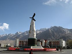 Location in Xinjiang
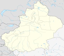
 Tashkurgan
Coordinates: 37°46′22″N 75°13′28″E / 37.77278°N 75.22444°ECoordinates: 37°46′22″N 75°13′28″E / 37.77278°N 75.22444°E Country People's Republic of China Region Xinjiang Prefecture Kashgar County Tashkurgan Elevation 3,094 m (10,151 ft) Time zone China Standard Time (UTC+8) Tashkurgan or Tashiku'ergan (Uyghur: تاشقورغان بازىرى; Sarikoli: [tɔʃqyrʁɔn buzur]; Chinese: 塔什库尔干镇) is the principal town and seat of Tashkurgan Tajik Autonomous County, Xinjiang, People's Republic of China.
Contents
Name
Tashkurgan means Stone Fortress or Stone Tower. The official spelling is Taxkorgan, while Tashkorgan appears occasionally in literature. The town's name is written in Uyghur as تاشقۇرغان, and in Uyghur Latin Yëziqi, Tashqurghan baziri. In Chinese Tashkurgan is written as 塔什库尔干镇 in simplified characters and 塔什庫爾干鎮 in traditional characters; it is pronounced Tǎshíkù'ěrgān Zhèn in pinyin.
Historically the town was also called Sarikol (سريكال) or Sariqol (سرقول).
History
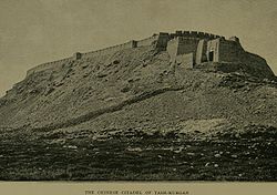 The fortress in 1909.
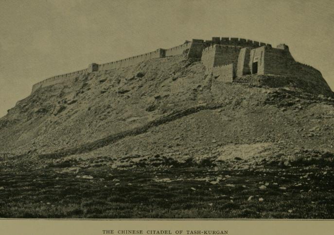
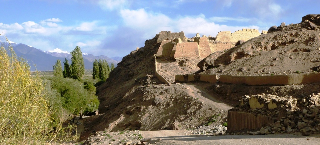
 Ruins of Tashkurgan Fort in 2011.
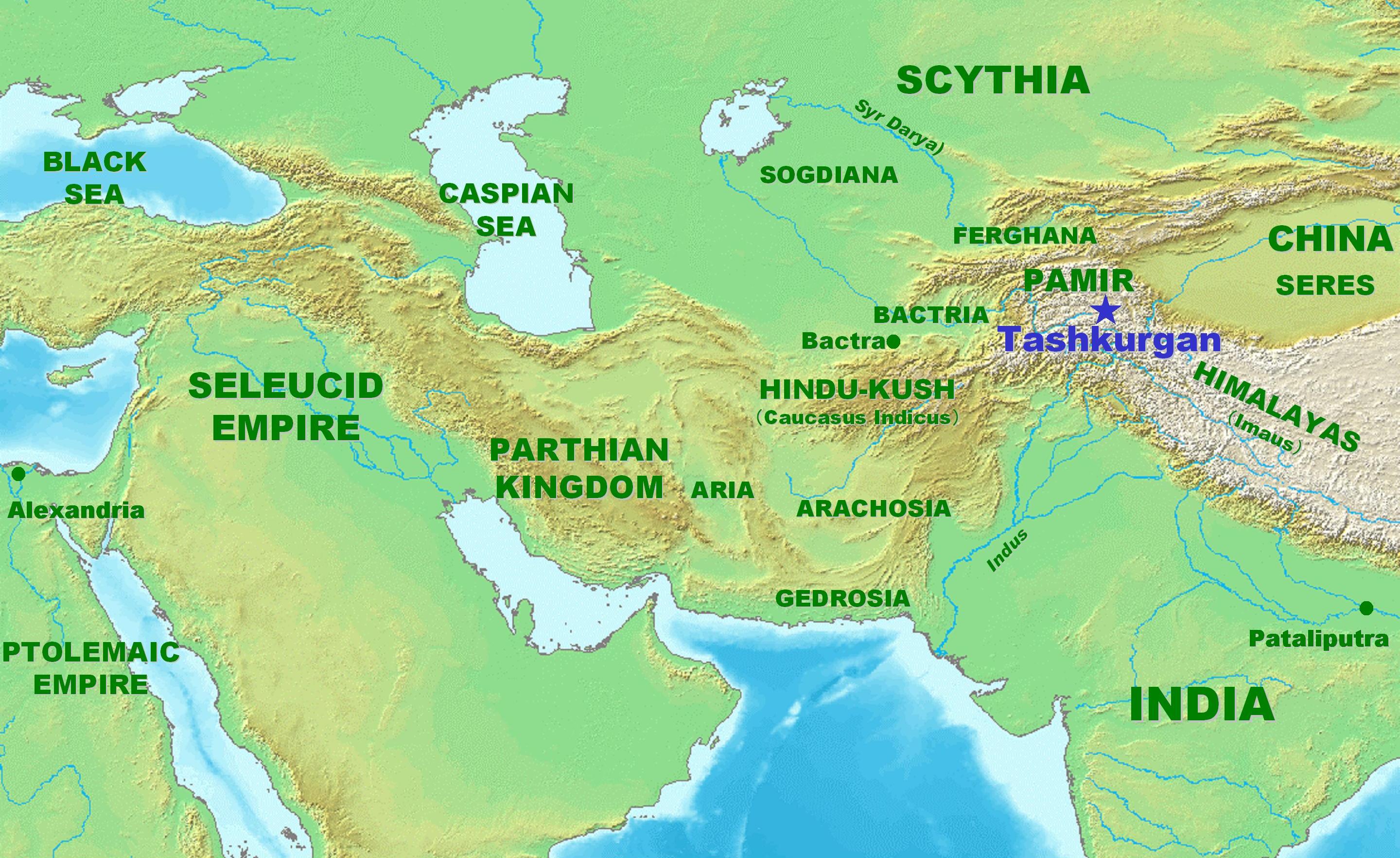
Tashkurgan has a long history as a stop on the Silk Road. Major caravan routes converged here leading to Kashgar in the north, Karghalik to the east, Badakhshan and Wakhan to the west, and Chitral and Hunza to the southwest in Northern Areas of Pakistan.
About 2,000 years ago, during the Han Dynasty Tashkurgan was the main centre of the Kingdom of Puli (蒲犁) and is mentioned in both the Hanshu and the later Hou Hanshu. Later it became known as Varshadeh.[1] Mentions in the Weilüe of the Kingdom of Manli (滿犁) probably also refer to Tashkurgan.[2]
Some scholars believe that a stone tower mentioned in Ptolemy and other early accounts of travel on the Silk Road, refers to this spot. It said by them to have marked the midway point between Europe and China. Other scholars, however, disagree with this identification. The most plausible site is in the Alay Valley.[3]
Many centuries later Tashkurgan became the capital of Sarikol kingdom (色勒库尔), a kingdom of the Pamir Mountains, and later of Qiepantuo (朅盘陀) under the Persians. At the northeast corner of the town is a huge fortress known as the Princess Castle dating from the Yuan Dynasty (1277-1367 CE), and the subject of many colourful local legends. A ruined Zoroastrian temple is located near the fortress.
Museum
In Tashkurgan there is a museum that houses a few local artifacts, a photographic display and, in the basement, two mummies - one of a young woman about 18, and another of a baby about 3 months old which, however, was not hers. They are labelled as dating from the Bronze Age to the Warring States period (475-221 BCE). The mummies were discovered in the nearby Xiabandi Valley on the old caravan route to Yarkand. The valley has now been flooded for a hydro-electric project.
Geography
Tashkurgan is the seat of Taxkorgan Tajik Autonomous County. It is situated at an altitude of 3,090 metres (10,140 ft) on the borders of both Afghanistan and Tajikistan, and close to the border of Kyrgyzstan and Pakistan. Tashkurgan is a market town for sheep, wool and woollen goods, particularly carpets, and is surrounded by orchards. The majority population in the town are ethnic Tajiks. The majority of people in the region speak Sarikoli. There is also a village of Wakhi speakers. Chinese and Uyghur are also spoken.
The Tashkurgan River begins just north of the Khunjerab Pass and flows north along the Karakoram Highway to Tashkurgan. Just north of Tashkurgan it turns east and flows through a gorge to the Tarim Basin where it joins the Yarkand River.
Climate
Tashkurgan has a cold desert climate (Köppen BWk), influenced by the high elevation, with long, very cold winters, and warm summers. Monthly daily average temperatures range from −11.9 °C (10.6 °F) in January to 16.4 °C (61.5 °F) in July, while the annual mean is 3.58 °C (38.4 °F). An average of only 68 millimetres (2.68 in) of precipitation falls per year.
Climate data for Tashkurgan (1971−2000) Month Jan Feb Mar Apr May Jun Jul Aug Sep Oct Nov Dec Year Average high °C (°F) −4.2
(24.4)−1
(30.2)6.0
(42.8)12.8
(55.0)16.7
(62.1)20.5
(68.9)23.7
(74.7)23.3
(73.9)18.6
(65.5)11.6
(52.9)4.8
(40.6)−1.9
(28.6)10.9 Average low °C (°F) −18.6
(−1.5)−15.3
(4.5)−7.3
(18.9)−0.8
(30.6)3.1
(37.6)6.4
(43.5)9.4
(48.9)8.8
(47.8)3.5
(38.3)−3.8
(25.2)−10.8
(12.6)−16.6
(2.1)−3.5 Precipitation mm (inches) 3.2
(0.126)2.6
(0.102)2.4
(0.094)4.8
(0.189)8.0
(0.315)15.5
(0.61)11.3
(0.445)9.6
(0.378)6.0
(0.236)2.1
(0.083).7
(0.028)2.0
(0.079)68.2
(2.685)Avg. precipitation days (≥ 0.1 mm) 2.1 2.4 2.2 2.5 5.1 6.8 6.2 4.6 2.9 1.7 .5 1.6 38.6 Source: Weather.com.cn Karakoram Highway
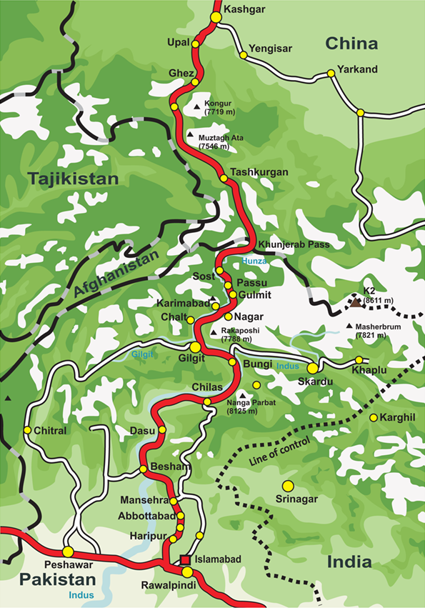
 Overview of the Karakoram Highway
Today Tashkurgan is on the Karakoram Highway which follows the old Silk Road route from China to Pakistan. Accommodation is available and it is a recommended overnight stop for road travellers from China to Pakistan in order to have the best chance of crossing the snow-prone Khunjerab Pass in daylight. Special registration with the police must be made before entering the Tashkurgan, and Chinese citizens must receive written permission from their local police department before entering the region.
Travelling from China, it is about 230 kilometres (140 mi) south of Kashgar and is the last town before the border with Pakistan, and 120 kilometres (75 mi) over the Khunjerab Pass from Sust, which is the Pakistani border crossing town. Passenger road service between Tashkurgan and the Pakistani towns of Sust and Gilgit has existed for many years, and road service between Kashgar and Gilgit (via Tashkurgan and Sust) started in summer 2006. However, the border crossing between China and Pakistan at Khunjerab Pass (the highest border of the world) is open only between May 1 and October 15. During winter, the roads are blocked by snow.
Footnotes
See also
References
- Curzon, George Nathaniel. 1896. The Pamirs and the Source of the Oxus. Royal Geographical Society, London. Reprint: Elibron Classics Series, Adamant Media Corporation. 2005. ISBN 1-4021-5983-8 (pbk); ISBN 1-4021-3090-2 (hbk).
- Hill, John E. (2009). Through the Jade Gate to Rome: A Study of the Silk Routes during the Later Han Dynasty, First to Second Centuries CE. John E. Hill. BookSurge. ISBN 978-1-4392-2134-1.
- 库尔班, 西仁, 马达 力包仑, and 米尔扎 杜斯买买提. 中国塔吉克史料汇编. Urumuqi: 新疆大学出版社, 2003. ISBN 7-5631-1792-X.
External links
- documentary on the Silk Road
- another travel account
- [1] Check out note 20.2. to the translation of the Hou Hanshu by John Hill. http://depts.washington.edu/silkroad/texts/hhshu/hou_han_shu.html
- www.gotravelchina.co.uk
- [2] For a brief description and some photos.
- PIA Northern Areas Page
- www.chinatour.com
Categories:- Populated places in Xinjiang
- Populated places along the Silk Road
- Central Asian Buddhist kingdoms
- Central Asian Buddhist sites
- Ancient peoples of China
- Former countries in Chinese history


Wikimedia Foundation. 2010.