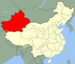
Qitai County

Qitai County

Coordinates: 44°01′N 89°35′E / 44.017°N 89.583°E / 44.017; 89.583

The Qitai County (simplified Chinese: 奇台县; traditional Chinese: 奇台縣; pinyin: Qitai Xian; Uyghur: گۇچۇڭ ناھىيىسى‎, ULY: Guchung Nahiyisi, UPNY: Guqung Nah̡iyisi?), also known as Gucheng (古城), is a county in the Xinjiang Uyghur Autonomous Region of the People's Republic of China and is under the administration of the Changji Hui Autonomous Prefecture. It contains an area of 16,641 km2. According to the 2002 census, it has a population of 230,000.

History

Located on one of the main routes of the Silk Road, the old Gucheng (often referred in the European writing of the past as "Ku Ch'eng-tze" etc., using Wade-Giles or Postal Romanization systems), was the western terminal for one of the caravan routes across the Gobi Desert. Owen Lattimore in The Desert Road to Turkestan leaves an account of his travel along this route in 1926-27.


Wikimedia Foundation. 2010.

Игры ⚽ Поможем сделать НИР

Look at other dictionaries:

  • Qitai — Xian de Qitai Qítái Xiàn (Guçung Nahiyisi) · 奇台县 (گۇچۇڭ ناھىيىسى) …   Wikipédia en Français

  • Qiemo County — Qiemo redirects here. For other uses, see Qiemo (disambiguation). Coordinates: 38°08′09″N 85°31′48″E / 38.13583°N 85.53°E / …   Wikipedia

  • Ruoqiang County — This article is about the county. For other uses, see Ruoqiang (disambiguation). Ruoqiang County 若羌县 چاقىلىق ناھىيىسى   County   …   Wikipedia

  • Qapqal Xibe Autonomous County — Sibo military colonists , picture drawn during Henry Lansdell visit to today s Qapqal County in 1882 Qapqal Xibe Autonomous County (simplified Chinese: 察布查尔锡伯自治县; traditional Chinese: 察布查爾錫伯自治縣; pinyin: Chábùchá ěr Xíbó Zìzhìxiàn …   Wikipedia

  • Manas County — ((simplified Chinese: 玛纳斯县; traditional Chinese: 瑪納斯縣; pinyin: Mǎnàsī Xiàn; Wade–Giles: Ma na szŭ Hsien); Uyghur: ماناس ناھىيىسى‎, ULY: Manas Nahiyisi, UPNY: Manas Nah̡iyisi?) is a county in the Xinjiang Uyghur Autonomous Region and is under the… …   Wikipedia

  • Mori Kazakh Autonomous County — The Mori Kazak Autonomous County (Uyghur: مورى قازاق ئاپتونوم‎, ULY: Mori Qazaq Aptonom Nahiyisi, UPNY: Mori K̡azak̡ Aptonom Nah̡iyisi?, (Kazakh: موري قازاق اۆتونوميالى اۋدانى), Simplified Chinese: 木垒哈萨克自治县) is a county within the Xinjiang Uyghur …   Wikipedia

  • Karakax County — قاراقاش ناھىيىسى 墨玉县   County   Country China Province Xinjiang Prefecture level divisions Hotan Prefecture …   Wikipedia

  • Minfeng County — نىيە ناھىيىسى 民丰县   County   Country China Province Xinjiang Prefecture level divisions Hotan Prefecture …   Wikipedia

  • Qira County — چىرا ناھىيىسى 策勒县   County   Country China Province Xinjiang Prefecture level divisions Hotan Prefecture …   Wikipedia

  • Nilka County — The Nilka County is a county situated within the Xinjiang Uyghur Autonomous Region and is under the administration of the Ili Kazakh Autonomous Prefecture. It contains an area of 10,121 km2. According to the 2002 census, it has a population… …   Wikipedia

Share the article and excerpts

Direct link
Do a right-click on the link above
and select “Copy Link”