- Arundel on the Bay, Maryland
-
Arundel on the Bay — Former village — Location within the state of Maryland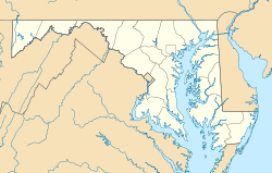
 Arundel on the Bay
Coordinates: 38°55′11″N 76°27′46″W / 38.91972°N 76.46278°WCoordinates: 38°55′11″N 76°27′46″W / 38.91972°N 76.46278°W Country United States State Maryland County Anne Arundel Time zone Eastern (EST) (UTC-5) – Summer (DST) EDT (UTC-4) ZIP codes: 21403 FIPS code GNIS feature ID Arundel on the Bay is a former post village and resort area in Anne Arundel County, Maryland, about 5 miles (8.0 km) southeast of historic Annapolis, Maryland. Arundel on the Bay is located on a peninsula known as the Annapolis Neck and is a peninsula in and of itself, bordered on the east and south by the Chesapeake Bay, and by Fisherman's Creek on the west.
Located near Highland Beach, Arundel on the Bay was formerly an enclave of vacation residences and undeveloped property which attracted affluent African Americans when Jim Crow laws were in effect, when entrance to other resort areas was barred to non-whites.[1] The community now holds approximately 345 homes. Arundel on the Bay is a special tax district; each year a portion of property taxes are reserved by Anne Arundel County for improvements and maintenance of the shoreline.
The community owns a private beach and pier, boat ramp, and boat launch for community use.
Notable residents include Aris T. Allen, Jr., son of Dr. Aris T. Allen, the first African American chair of the Maryland Republican Party and Kurt Schmoke, former and first African American mayor of Baltimore.
References
- ^ The Journal of Negro History, Vol. 84, No. 2 (Spring, 1999), pp. 130-149 doi:10.2307/2649043
Municipalities and communities of Anne Arundel County, Maryland City 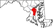
Town CDPs Arden-on-the-Severn | Arnold | Brooklyn Park | Cape St. Claire | Crofton | Crownsville | Deale | Ferndale | Fort Meade | Glen Burnie | Green Haven | Herald Harbor | Hillsmere Shores | Jessup‡ | Lake Shore | Linthicum | Londontowne | Maryland City | Mayo | Naval Academy | Odenton | Parole | Pasadena | Pumphrey | Riva | Riviera Beach | Selby-on-the-Bay | Severn | Severna Park | Shady Side | South Gate
Other
communitiesArundel on the Bay | Beverly Beach | Bristol | Churchton | Davidsonville | Fairhaven | Fairview | Franklin Manor-on-the-Bay | Friendship | Gambrills | Galesville | Germantown | Gibson Island | Hanover | Harmans | Harundale | Harwood | Iglehart | Jacobsville | Jennings | Lothian | Millersville | Orchard Beach | Owensville | Piney Orchard | Riverdale | Rose Haven | Russett | Saunders Point | Seven Oaks | Sherwood Forest | Skidmore | South River | Sudley | Tall Timbers | Tracys Landing | West River | Winchester-on-the-Severn | Woodland Beach | Woodwardville
Footnotes ‡This populated place also has portions in an adjacent county or counties
Categories:- Maryland geography stubs
- Villages in Maryland
- Populated places in Anne Arundel County, Maryland


Wikimedia Foundation. 2010.