- Parole, Maryland
Infobox Settlement
official_name = Parole, Maryland
settlement_type = CDP
nickname =
motto =
imagesize =
image_caption =
image_
imagesize =
image_caption =
image_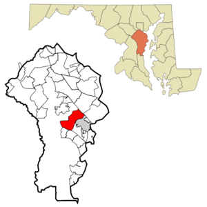
mapsize = 250x200px
map_caption = Location of Parole, Maryland
mapsize1 =
map_caption1 =subdivision_type = Country
subdivision_name =United States
subdivision_type1 = State
subdivision_name1 =Maryland
subdivision_type2 = County
subdivision_name2 = Anne Arundel
government_footnotes =
government_type =
leader_title =
leader_name =
leader_title1 =
leader_name1 =
established_title =
established_date =unit_pref = Imperial
area_footnotes =area_magnitude =
area_total_km2 = 30.7
area_land_km2 = 26.6
area_water_km2 = 4.1
area_total_sq_mi = 11.9
area_land_sq_mi = 10.3
area_water_sq_mi = 1.6population_as_of = 2000
population_footnotes =
population_total = 14031
population_density_km2 = 526.8
population_density_sq_mi = 1364.4timezone = Eastern (EST)
utc_offset = -5
timezone_DST = EDT
utc_offset_DST = -4
elevation_footnotes =
elevation_m = 21
elevation_ft = 69
latd = 38 |latm = 59 |lats = 30 |latNS = N
longd = 76 |longm = 32 |longs = 54 |longEW = Wpostal_code_type =
postal_code =
area_code =
blank_name = FIPS code
blank_info = 24-60325
blank1_name = GNIS feature ID
blank1_info = 0590979
website =
footnotes =Parole is a
census-designated place (CDP) in Anne Arundel County,Maryland ,United States . The population was 14,031 at the 2000 census. It is where several major roads intersect at the edge of the state capital,Annapolis , and adjacent to theAnnapolis Mall shopping center and Anne Arundel General Hospital. The neighborhood was named because it was a site where Union and Confederate prisoners of war were brought for mutual exchange and eventual return to their respective homes. [cite web
url=http://www.hmdb.org/Marker.asp?Marker=2854
title=Camp Parole
last=Fuchs
first=Tom
publisher=Historical Marker Database
date=October 9, 2007] [citation
url=http://www.cem.va.gov/cem/pdf/Annap.pdf
title=Annapolis National Cemetery
publisher=United States Department of Veterans Affairs
accessdate=2008-06-28]Geography
Parole is located at coor dms|38|59|30|N|76|32|54|W|city (38.991657, -76.548450)GR|1.
According to the
United States Census Bureau , the CDP has a total area of 11.9square mile s (30.7km² ), of which, 10.3 square miles (26.6 km²) of it is land and 1.6 square miles (4.1 km²) of it (13.25%) is water.Demographics
As of the
census GR|2 of 2000, there were 14,031 people, 6,645 households, and 3,707 families residing in the CDP. Thepopulation density was 1,364.4 people per square mile (527.0/km²). There were 6,946 housing units at an average density of 675.4/sq mi (260.9/km²). The racial makeup of the CDP was 90.36% White, 6.49% African American, 0.21% Native American, 1.53% Asian, 0.08% Pacific Islander, 0.34% from other races, and 0.98% from two or more races. Hispanic or Latino of any race were 1.56% of the population.There were 6,645 households out of which 14.1% had children under the age of 18 living with them, 48.7% were married couples living together, 5.3% had a female householder with no husband present, and 44.2% were non-families. 37.7% of all households were made up of individuals and 18.4% had someone living alone who was 65 years of age or older. The average household size was 1.96 and the average family size was 2.54.
In the CDP the population was spread out with 12.2% under the age of 18, 5.8% from 18 to 24, 27.4% from 25 to 44, 27.6% from 45 to 64, and 27.0% who were 65 years of age or older. The median age was 48 years. For every 100 females there were 93.7 males. For every 100 females age 18 and over, there were 91.6 males.
The median income for a household in the CDP was $67,479, and the median income for a family was $82,988. Males had a median income of $60,601 versus $43,610 for females. The
per capita income for the CDP was $39,102. About 0.2% of families and 2.7% of the population were below thepoverty line , including 1.0% of those under age 18 and 3.5% of those age 65 or over.References
External links
Wikimedia Foundation. 2010.