- Londontowne, Maryland
Infobox Settlement
official_name = Londontowne, Maryland
settlement_type = CDP
nickname =
motto =
imagesize =
image_caption =
image_
imagesize =
image_caption =
image_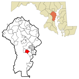
mapsize = 250px
map_caption = Location of Londontowne, Maryland
mapsize1 =
map_caption1 =subdivision_type = Country
subdivision_name =United States
subdivision_type1 = State
subdivision_name1 =Maryland
subdivision_type2 = County
subdivision_name2 = Anne Arundel
government_footnotes =
government_type =
leader_title =
leader_name =
leader_title1 =
leader_name1 =
established_title =
established_date =unit_pref = Imperial
area_footnotes =
area_magnitude =
area_total_km2 = 9.8
area_land_km2 = 7.8
area_water_km2 = 2.0
area_total_sq_mi = 3.8
area_land_sq_mi = 3.0
area_water_sq_mi = 0.8population_as_of = 2000
population_footnotes =
population_total = 7595
population_density_km2 = 971.9
population_density_sq_mi = 2517.3timezone = Eastern (EST)
utc_offset = -5
timezone_DST = EDT
utc_offset_DST = -4
elevation_footnotes =
elevation_m = 8
elevation_ft = 26
latd = 38 |latm = 56 |lats = 10 |latNS = N
longd = 76 |longm = 33 |longs = 15 |longEW = Wpostal_code_type =
postal_code =
area_code =
blank_name = FIPS code
blank_info = 24-47925
blank1_name = GNIS feature ID
blank1_info = 0588901
website =
footnotes =Londontowne is a
census-designated place (CDP) in Anne Arundel County,Maryland ,United States . The population was 7,595 at the 2000 census.History
London Town was a colonial
seaport town founded in 1683 near Annapolis. It was once considered as the site for the capital ofMaryland , a state of the United States of America. It was as prominent acity in trade as Annapolis andWilliamsburg, Virginia . A series of events, including its non-selection as a tobacco inspection station, economic depression, and theRevolutionary War caused it to decline and, by the 19th century, disappear. Today, a public museum and archeology lab and several of its buildings and the grounds have been reconstructed. TheLondon Town Publik House , perhaps also known as Londontowne Public House, is listed on theNational Register of Historic Places and further has been designated aNational Historic Landmark .Geography
Londontowne is located at coor dms|38|56|10|N|76|33|15|W|city (38.936062, -76.554276)GR|1.
According to the
United States Census Bureau , the CDP has a total area of 3.8 square miles (9.8 km²), of which, 3.0 square miles (7.8 km²) of it is land and 0.8 square miles (2.0 km²) of it (20.11%) is water.Demographics
As of the
census GR|2 of 2000, there were 7,595 people, 2,927 households, and 2,040 families residing in the CDP. Thepopulation density was 2,517.3 people per square mile (971.0/km²). There were 3,095 housing units at an average density of 1,025.8/sq mi (395.7/km²). The racial makeup of the CDP was 95.89% White, 1.97% African American, 0.32% Native American, 0.49% Asian, 0.01% Pacific Islander, 0.16% from other races, and 1.16% from two or more races. Hispanic or Latino of any race were 1.95% of the population.There were 2,927 households out of which 31.8% had children under the age of 18 living with them, 55.2% were married couples living together, 10.1% had a female householder with no husband present, and 30.3% were non-families. 22.9% of all households were made up of individuals and 6.6% had someone living alone who was 65 years of age or older. The average household size was 2.56 and the average family size was 3.02.
In the CDP the population was spread out with 23.5% under the age of 18, 6.7% from 18 to 24, 33.3% from 25 to 44, 25.6% from 45 to 64, and 11.0% who were 65 years of age or older. The median age was 38 years. For every 100 females there were 98.7 males. For every 100 females age 18 and over, there were 95.9 males.
The median income for a household in the CDP was $63,021, and the median income for a family was $68,190. Males had a median income of $45,589 versus $34,555 for females. The
per capita income for the CDP was $31,245. About 2.5% of families and 3.3% of the population were below thepoverty line , including 2.6% of those under age 18 and 4.5% of those age 65 or over.Gardens
London Town's woodland gardens (8 acres) began in the late 1960s as naturalized shade gardens. Today they include an
azalea glade with both deciduous and evergreen plantings; acamellia walk with winter blooming camellias; aholly collection; and a winter garden featuring plants of winter interest, with evergreens such as mountain laurel ("Kalmia latifolia").See also
*
List of botanical gardens in the United States References
External links
* [http://www.historiclondontown.com/index.html Historic London Town]
* [http://www.keyschool.org/londontown/Pages/Pages/learnflt.html Archeology of the Lost Towns]
Wikimedia Foundation. 2010.