- Mayo, Maryland
-
Edgewater, Maryland — CDP — Location of Mayo, Maryland
Coordinates: 38°53′36″N 76°30′16″W / 38.89333°N 76.50444°WCoordinates: 38°53′36″N 76°30′16″W / 38.89333°N 76.50444°W Country United States State Maryland County Anne Arundel Area – Total 4.7 sq mi (12.1 km2) – Land 2.5 sq mi (6.6 km2) – Water 2.1 sq mi (5.6 km2) Elevation 13 ft (4 m) Population (2000) – Total 3,153 – Density 1,243.8/sq mi (480.2/km2) Time zone Eastern (EST) (UTC-5) – Summer (DST) EDT (UTC-4) ZIP code 21106 Area code(s) 410 FIPS code 24-51575 GNIS feature ID 0590767 Mayo is a census-designated place (CDP) in Anne Arundel County, Maryland, United States. The population was 3,153 at the 2000 census. Its beach was formerly a popular weekend resort.
Contents
Geography
Mayo is located at 38°53′36″N 76°30′16″W / 38.89333°N 76.50444°W (38.893264, -76.504371)[1].
According to the United States Census Bureau, the CDP has a total area of 4.7 square miles (12 km2), of which, 2.5 square miles (6.5 km2) of it is land and 2.2 square miles (5.7 km2) of it (45.94%) is water.
Saunder's Point, Shoreham Beach, and Beverly Beach are some of the neighborhoods found in Mayo.[citation needed]
Demographics
As of the census[2] of 2000, there were 3,153 people, 1,195 households, and 862 families residing in the CDP. The population density was 1,243.8 people per square mile (479.3/km²). There were 1,303 housing units at an average density of 514.0/sq mi (198.1/km²). The racial makeup of the CDP was 96.32% White, 1.27% African American, 0.51% Native American, 0.67% Asian, 0.03% Pacific Islander, 0.19% from other races, and 1.01% from two or more races. Hispanic or Latino of any race were 1.78% of the population.
There were 1,195 households out of which 33.2% had children under the age of 18 living with them, 61.6% were married couples living together, 6.5% had a female householder with no husband present, and 27.8% were non-families. 20.7% of all households were made up of individuals and 6.5% had someone living alone who was 65 years of age or older. The average household size was 2.64 and the average family size was 3.06.
In the CDP the population was spread out with 25.0% under the age of 18, 5.3% from 18 to 24, 32.0% from 25 to 44, 26.4% from 45 to 64, and 11.3% who were 65 years of age or older. The median age was 38 years. For every 100 females there were 99.2 males. For every 100 females age 18 and over, there were 98.2 males.
The median income for a household in the CDP was $70,909, and the median income for a family was $81,634. Males had a median income of $47,500 versus $36,450 for females. The per capita income for the CDP was $30,552. About 1.8% of families and 2.8% of the population were below the poverty line, including 3.1% of those under age 18 and 3.1% of those age 65 or over.
History
Mayo takes its name from Commodore Isaac Mayo who distinguished himself in the Mexican–American War.[3] Commodore Mayo held a large tract of land on the South River, known in the early 1900s as "Mayo's Neck" that formerly was the home estate of Captain Nicholas Gassaway the son of Maryland politician Colonel Nicholas Gassaway.[3] His home, known as Gresham was listed on the National Register of Historic Places in 1990.[4]
References
- ^ "US Gazetteer files: 2010, 2000, and 1990". United States Census Bureau. 2011-02-12. http://www.census.gov/geo/www/gazetteer/gazette.html. Retrieved 2011-04-23.
- ^ "American FactFinder". United States Census Bureau. http://factfinder.census.gov. Retrieved 2008-01-31.
- ^ a b Warfield, Joshua Dorsey (1905). The founders of Anne Arundel and Howard Counties, Maryland: A genealogical and biographical review from wills, deeds and church records. Baltimore, Maryland: Kohn & Pollock. p. 323. http://books.google.com/books?id=vgINAAAAYAAJ&pg=PA323#v=onepage&q&f=false.
- ^ "National Register Information System". National Register of Historic Places. National Park Service. 2008-04-15. http://nrhp.focus.nps.gov/natreg/docs/All_Data.html.
See also
- Mullins, Caroline L. Britt (1996). The History of Mayo, Maryland. Baltimore, Maryland: Gateway Press. ISBN 978-0966560701.
Municipalities and communities of Anne Arundel County, Maryland City 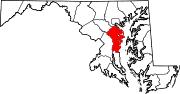
Town CDPs Arden-on-the-Severn | Arnold | Brooklyn Park | Cape St. Claire | Crofton | Crownsville | Deale | Ferndale | Fort Meade | Glen Burnie | Green Haven | Herald Harbor | Hillsmere Shores | Jessup‡ | Lake Shore | Linthicum | Londontowne | Maryland City | Mayo | Naval Academy | Odenton | Parole | Pasadena | Pumphrey | Riva | Riviera Beach | Selby-on-the-Bay | Severn | Severna Park | Shady Side | South Gate
Other
communitiesArundel on the Bay | Beverly Beach | Bristol | Churchton | Davidsonville | Fairhaven | Fairview | Franklin Manor-on-the-Bay | Friendship | Gambrills | Galesville | Germantown | Gibson Island | Hanover | Harmans | Harundale | Harwood | Iglehart | Jacobsville | Jennings | Lothian | Millersville | Orchard Beach | Owensville | Piney Orchard | Riverdale | Rose Haven | Russett | Saunders Point | Seven Oaks | Sherwood Forest | Skidmore | South River | Sudley | Tall Timbers | Tracys Landing | West River | Winchester-on-the-Severn | Woodland Beach | Woodwardville
Footnotes ‡This populated place also has portions in an adjacent county or counties
Categories:- Populated places in Anne Arundel County, Maryland
- Census-designated places in Maryland


Wikimedia Foundation. 2010.