- Minnetonka Beach, Minnesota
-
Minnetonka Beach, Minnesota — City — Location in Hennepin County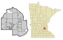
Coordinates: 44°56′22″N 93°35′30″W / 44.93944°N 93.59167°W Country United States State Minnesota County Hennepin Founded Incorporated Government – Mayor Area – Total 0.5 sq mi (1.3 km2) – Land 0.5 sq mi (1.3 km2) – Water 0.0 sq mi (0.0 km2) Elevation 942 ft (287 m) Population (2010)[1] – Total 539 – Density 1,186.5/sq mi (458.1/km2) Time zone Central (CST) (UTC-6) – Summer (DST) CDT (UTC-5) ZIP code 55361 Area code(s) 952 FIPS code 27-43270[2] GNIS feature ID 0647950[3] Minnetonka Beach is a city in Hennepin County, Minnesota, United States. The population was 539 at the 2010 census.[1]
Geography
According to the United States Census Bureau, the city has a total area of 0.5 square miles (1.3 km2), all of it land. County 15 serves as a main route.
Demographics
Historical populations Census Pop. %± 1900 101 — 1910 166 64.4% 1920 94 −43.4% 1930 112 19.1% 1940 229 104.5% 1950 376 64.2% 1960 544 44.7% 1970 586 7.7% 1980 575 −1.9% 1990 573 −0.3% 2000 614 7.2% 2010 539 −12.2% U.S. Decennial Census As of the census[2] of 2000, there were 614 people, 215 households, and 176 families residing in the city. The population density was 1,186.5 people per square mile (455.9/km²). There were 224 housing units at an average density of 432.8 per square mile (166.3/km²). The racial makeup of the city was 97.88% White, 0.16% Native American, 1.30% Asian, and 0.65% from two or more races.
There were 215 households out of which 42.3% had children under the age of 18 living with them, 75.3% were married couples living together, 3.7% had a female householder with no husband present, and 17.7% were non-families. 14.4% of all households were made up of individuals and 5.6% had someone living alone who was 65 years of age or older. The average household size was 2.86 and the average family size was 3.16.
In the city the population was spread out with 29.2% under the age of 18, 5.4% from 18 to 24, 20.7% from 25 to 44, 35.3% from 45 to 64, and 9.4% who were 65 years of age or older. The median age was 42 years. For every 100 females there were 91.9 males. For every 100 females age 18 and over, there were 87.5 males.
The median income for a household in the city was $150,912, and the median income for a family was $168,868. Males had a median income of $100,000 versus $41,875 for females. The per capita income for the city was $91,844. About 1.8% of families and 2.7% of the population were below the poverty line, including 2.5% of those under age 18 and 16.7% of those age 65 or over.
References
- ^ a b "2010 Census Redistricting Data (Public Law 94-171) Summary File". American FactFinder. U.S. Census Bureau, 2010 Census. http://factfinder2.census.gov/faces/tableservices/jsf/pages/productview.xhtml?pid=DEC_10_PL_GCTPL2.ST13&prodType=table. Retrieved 23 April 2011.
- ^ a b "American FactFinder". United States Census Bureau. http://factfinder.census.gov. Retrieved 2008-01-31.
- ^ "US Board on Geographic Names". United States Geological Survey. 2007-10-25. http://geonames.usgs.gov. Retrieved 2008-01-31.
Municipalities and communities of Hennepin County, Minnesota Cities Bloomington | Brooklyn Center | Brooklyn Park | Champlin | Chanhassen‡ | Corcoran | Crystal | Dayton‡ | Deephaven | Eden Prairie | Edina | Excelsior | Golden Valley | Greenfield | Greenwood | Hanover‡ | Hopkins | Independence | Long Lake | Loretto | Maple Grove | Maple Plain | Medicine Lake | Medina | Minneapolis | Minnetonka | Minnetonka Beach | Minnetrista | Mound | New Hope | Orono | Osseo | Plymouth | Richfield | Robbinsdale | Rockford‡ | Rogers | Shorewood | Spring Park | St. Anthony‡ | St. Bonifacius | St. Louis Park | Tonka Bay | Wayzata | Woodland

Township Unorganized
territoryFootnotes ‡This populated place also has portions in an adjacent county or counties
Coordinates: 44°56′23″N 93°34′36″W / 44.93972°N 93.57667°W
Categories:- Cities in Minnesota
- Populated places in Hennepin County, Minnesota


Wikimedia Foundation. 2010.