- Minnetrista, Minnesota
-
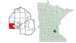
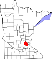
Minnetrista, Minnesota Settlement Location in Hennepin County and the state of MinnesotaCountry United States State Minnesota Region Hennepin County, Carver County Area 30.8 sq mi (80 km2) - land 26.1 sq mi (68 km2) - water 4.7 sq mi (12 km2) Population 6,384 (2010[1]) Minnetrista is a settlement mainly in Hennepin County, Minnesota. A very small part of Minnetrista Extends into Carver County. The name Minnetrista is said to owe its origin to the Dakota language, in which minne means "water" and trista means "crooked."[2] The city is generally rural and still has material agricultural activity, involving corn, beans, hay and horses. It lacks an identifiable downtown, so the nearby city of Mound mostly fills that role, along with the city of Saint Bonifacius. The city can be described as on or near the boundary between the suburbs and rural areas and it faces pressures in favor and against development. Local politics often involve this issue. The population was 6,384 at the 2010 census.[1] Crown College is located along the southern border of Minnetrista.
Contents
Geography
According to the United States Census Bureau, the city has a total area of 30.8 square miles (80 km2), of which, 26.1 square miles (68 km2) of it is land and 4.7 square miles (12 km2) of it (15.31%) is water. County Roads 15, 44, and 110 are three of the main routes.
Lakes in Minnetrista include Whaletail Lake, Little Long Lake, Mud Lake, Ox Yoke Lake, Saunders Lake, as well as several bays of Lake Minnetonka. Six Mile Creek runs through the western part of the city and brings the run off from about 17,000 acres (69 km2) to Lake Minnetonka. In 2005, the City Council of Minnetrista started calling this creek a marsh. One possible reason for them doing so, is that in general, cities can regulate marshes, but not creeks and rivers. At that time, there was also a discussion about limiting docks within the city along Six Mile Creek. Docks with Lake Minnetonka access, can be highly valued.
Demographics
Historical populations Census Pop. %± 1970 2,878 — 1980 3,236 12.4% 1990 3,439 6.3% 2000 4,358 26.7% 2010 6,384 46.5% U.S. Decennial Census As of the census[3] of 2000, there were 4,358 people, 1,505 households, and 1,249 families residing in the city. The population density was 166.9 people per square mile (64.4/km²). There were 1,567 housing units at an average density of 60.0 per square mile (23.2/km²). The racial makeup of the city was 97.06% White, 0.34% African American, 0.21% Native American, 1.47% Asian, 0.50% from other races, and 0.41% from two or more races. Hispanic or Latino of any race were 0.67% of the population. 32.0% were of German, 16.1% Norwegian, 9.9% Swedish, 7.4% Irish and 6.0% English ancestry according to Census 2000.
There were 1,505 households out of which 40.7% had children under the age of 18 living with them, 76.3% were married couples living together, 4.4% had a female householder with no husband present, and 17.0% were non-families. 13.2% of all households were made up of individuals and 2.5% had someone living alone who was 65 years of age or older. The average household size was 2.90 and the average family size was 3.20.
In the city the population was spread out with 29.3% under the age of 18, 5.3% from 18 to 24, 27.8% from 25 to 44, 30.3% from 45 to 64, and 7.4% who were 65 years of age or older. The median age was 39 years. For every 100 females there were 105.5 males. For every 100 females age 18 and over, there were 102.6 males.
The median income for a household in the city was $90,347, and the median income for a family was $93,104. Males had a median income of $65,395 versus $41,645 for females. The per capita income for the city was $40,217. About 2.1% of families and 2.8% of the population were below the poverty line, including 0.9% of those under age 18 and 5.8% of those age 65 or over.
References
- ^ a b "2010 Census Redistricting Data (Public Law 94-171) Summary File". American FactFinder. U.S. Census Bureau, 2010 Census. http://factfinder2.census.gov/faces/tableservices/jsf/pages/productview.xhtml?pid=DEC_10_PL_GCTPL2.ST13&prodType=table. Retrieved 23 April 2011.
- ^ Upham, Warren (2001). Minnesota Place Names. Minnesota Historical Society Press. pp. 231. ISBN 0-87351-396-7. http://shop.mnhs.org/moreinfo.cfm?Product_ID=137.
- ^ "American FactFinder". United States Census Bureau. http://factfinder.census.gov. Retrieved 2008-01-31.
External links
Municipalities and communities of Hennepin County, Minnesota County seat: Minneapolis Cities Bloomington | Brooklyn Center | Brooklyn Park | Champlin | Chanhassen‡ | Corcoran | Crystal | Dayton‡ | Deephaven | Eden Prairie | Edina | Excelsior | Golden Valley | Greenfield | Greenwood | Hanover‡ | Hopkins | Independence | Long Lake | Loretto | Maple Grove | Maple Plain | Medicine Lake | Medina | Minneapolis | Minnetonka | Minnetonka Beach | Minnetrista | Mound | New Hope | Orono | Osseo | Plymouth | Richfield | Robbinsdale | Rockford‡ | Rogers | Shorewood | Spring Park | St. Anthony‡ | St. Bonifacius | St. Louis Park | Tonka Bay | Wayzata | Woodland
Township Unorganized
territoryFootnotes ‡This populated place also has portions in an adjacent county or counties
Coordinates: 44°56′18″N 93°43′04″W / 44.93833°N 93.71778°W
Categories:- Cities in Minnesota
- Populated places in Hennepin County, Minnesota
Wikimedia Foundation. 2010.


