- Maple Plain, Minnesota
-
Maple Plain, Minnesota — City — Location in Hennepin County, Minnesota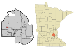
Coordinates: 45°0′30″N 93°39′32″W / 45.00833°N 93.65889°W Country United States State Minnesota County Hennepin Founded Incorporated Government - Mayor John Sweeney Area - City 1.1 sq mi (2.8 km2) - Land 1.1 sq mi (2.8 km2) - Water 0.0 sq mi (0.0 km2) 0% Elevation 1,027 ft (313 m) Population (2010)[1] - City 1,768 - Density 1,875.4/sq mi (724.1/km2) - Metro 3,279,833 Time zone Central (UTC-6) - Summer (DST) Central (UTC-5) Area code(s) 763 FIPS code 27-40256[2] GNIS feature ID 0647497[3] Maple Plain is a city in Hennepin County, Minnesota, United States. It is located about 25 miles west of Minneapolis on U.S. Route 12. It is named for the many sugar maples in its forests.[4] Early settlement of the area started in 1854 and revolved around Lake Independence to its North, and its outflow Pioneer Creek. In 1868 and 1869, the St. Paul, Pacific and Manitoba Railroad was built through Maple Plain. By 1871, Maple Plain had a post office. The city was incorporated as a village in 1912. Village water came to the town in 1939, sewer in about 1950, and blacktop in 1961. The population was 1,768 at the 2010 census.[1]
Contents
Geography
According to the United States Census Bureau, the city has a total area of 1.1 square miles (2.8 km2), all of it land. Pioneer Creek flows through the town's Northwest corner.
Demographics
Historical populations Census Pop. %± 1920 273 — 1930 288 5.5% 1940 360 25.0% 1950 479 33.1% 1960 754 57.4% 1970 1,169 55.0% 1980 1,421 21.6% 1990 2,005 41.1% 2000 2,088 4.1% 2010 1,768 −15.3% U.S. Decennial Census As of the census[2] of 2000, there were 2,088 people, 770 households, and 536 families residing in the city. The population density was 1,875.4 people per square mile (726.3/km²). There were 786 housing units at an average density of 706.0 per square mile (273.4/km²). The racial makeup of the city was 97.65% White, 0.48% African American, 0.24% Native American, 0.62% Asian, 0.38% from other races, and 0.62% from two or more races. Hispanic or Latino of any race were 0.91% of the population.
There were 770 households out of which 41.9% had children under the age of 18 living with them, 54.8% were married couples living together, 10.9% had a female householder with no husband present, and 30.3% were non-families. 25.1% of all households were made up of individuals and 11.0% had someone living alone who was 65 years of age or older. The average household size was 2.61 and the average family size was 3.15.
In the city the population was spread out with 28.9% under the age of 18, 7.5% from 18 to 24, 32.3% from 25 to 44, 20.2% from 45 to 64, and 11.2% who were 65 years of age or older. The median age was 36 years. For every 100 females there were 91.0 males. For every 100 females age 18 and over, there were 88.6 males.
The median income for a household in the city was $50,938, and the median income for a family was $58,977. Males had a median income of $40,114 versus $32,121 for females. The per capita income for the city was $22,218. About 2.6% of families and 4.4% of the population were below the poverty line, including 3.4% of those under age 18 and 10.9% of those age 65 or over.
References
- ^ a b "2010 Census Redistricting Data (Public Law 94-171) Summary File". American FactFinder. U.S. Census Bureau, 2010 Census. http://factfinder2.census.gov/faces/tableservices/jsf/pages/productview.xhtml?pid=DEC_10_PL_GCTPL2.ST13&prodType=table. Retrieved 23 April 2011.
- ^ a b "American FactFinder". United States Census Bureau. http://factfinder.census.gov. Retrieved 2008-01-31.
- ^ "US Board on Geographic Names". United States Geological Survey. 2007-10-25. http://geonames.usgs.gov. Retrieved 2008-01-31.
- ^ Upham, Warren (2001). Minnesota Place Names. Minnesota Historical Society Press. pp. 229. ISBN 0-87351-396-7. http://shop.mnhs.org/moreinfo.cfm?Product_ID=137.
External links
Municipalities and communities of Hennepin County, Minnesota Cities Bloomington | Brooklyn Center | Brooklyn Park | Champlin | Chanhassen‡ | Corcoran | Crystal | Dayton‡ | Deephaven | Eden Prairie | Edina | Excelsior | Golden Valley | Greenfield | Greenwood | Hanover‡ | Hopkins | Independence | Long Lake | Loretto | Maple Grove | Maple Plain | Medicine Lake | Medina | Minneapolis | Minnetonka | Minnetonka Beach | Minnetrista | Mound | New Hope | Orono | Osseo | Plymouth | Richfield | Robbinsdale | Rockford‡ | Rogers | Shorewood | Spring Park | St. Anthony‡ | St. Bonifacius | St. Louis Park | Tonka Bay | Wayzata | Woodland

Township Unorganized
territoryFootnotes ‡This populated place also has portions in an adjacent county or counties
Coordinates: 45°00′26″N 93°39′21″W / 45.00722°N 93.65583°W
Categories:- Cities in Minnesota
- Populated places in Hennepin County, Minnesota
- Populated places established in 1912


Wikimedia Foundation. 2010.