- Nanstallon
-
Coordinates: 50°28′14″N 4°45′57″W / 50.4705°N 4.7659°W
Nanstallon 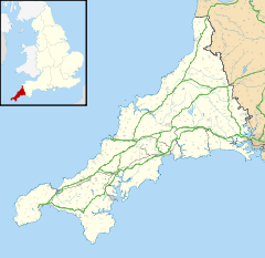
 Nanstallon
Nanstallon shown within CornwallOS grid reference SX038671 Parish Lanivet Unitary authority Cornwall Ceremonial county Cornwall Region South West Country England Sovereign state United Kingdom Post town BODMIN Postcode district PL30 Dialling code 01208 Police Devon and Cornwall Fire Cornwall Ambulance South Western EU Parliament South West England UK Parliament North Cornwall List of places: UK • England • Cornwall Nanstallon is a village in central Cornwall, United Kingdom. It is situated approximately two miles (3 km) west of Bodmin[1].
Nanstallon is in the civil parish of Lanivet[2] overlooking the River Camel valley and the Camel Trail long distance path. The present terminus of the Bodmin and Wenford Railway at Boscarne is half-a-mile (0.8 km) from the village. The site of the former Nanstallon Halt station is an access point to the Camel Trail.
Nanstallon Roman fort
A 1st century Roman fort was excavated at Nanstallon in the early 1970s by Aileen Fox and Professor W. L. D. ‘Bill’ Ravenhill.[3] Until recently (2007) it was the second Roman fort in Cornwall but following a geophysical survey another Roman fort has been found 9 km away near Restormel Castle.[4] Constructed c. AD 55–60, Nanstallon fort is situated in central Cornwall near the Fowey-Camel trade and communication route.
Nanstallon was probably a forward operating base and was strategically well-placed for a Roman presence to be felt. However, the Roman Legion at Exeter was withdrawn c. AD 75 and with no Roman town west of Isca Dumnoniorum Cornwall settled down to four centuries of nominal Roman rule.[5][6]
References
- ^ Ordnance Survey: Landranger map sheet 200 Newquay & Bodmin ISBN 978-0-319-22938-5
- ^ [1] GENUKI website; Lanivet; retrieved April 2010
- ^ The autobiography of Aileen Fox; p. 136 (2000) - The Roman fort at Nanstallon, Cornwall. Aileen Fox & William Ravenhill. Britannia.
- ^ second Roman Fort confirmed in Cornwall Cornish Archaeology news
- ^ Payton, Philip (1996) Cornwall
- ^ [2] Roman military signalling between forts in East Cornwall
External links
 Media related to Nanstallon at Wikimedia Commons
Geography of Cornwall Cornwall Portal Unitary authorities Major settlements Bodmin • Bude • Callington • Camborne • Camelford • Falmouth • Fowey • Hayle • Helston • Launceston • Liskeard • Looe • Lostwithiel • Marazion • Newlyn • Newquay • Padstow • Par • Penryn • Penzance • Porthleven • Redruth • Saltash • St Austell • St Blazey • St Columb Major • St Ives • St Just-in-Penwith • St Mawes • Stratton • Torpoint • Truro • Wadebridge
See also: Civil parishes in CornwallRivers Topics History • Status debate • Flag • Culture • Places • People • The Duchy • Diocese • Politics • Hundreds/shires • Places of interest • full list...Categories:- Villages in Cornwall
- Military history of Cornwall
- History of Cornwall
- Forts in Cornwall
- Cornwall geography stubs

Wikimedia Foundation. 2010.